The left side wins on both ends of the flight: Singapore's skyline and harbor at takeoff, and Seattle's skyline plus Mount Rainier and the Cascades on arrival, while the right side is dominated by open water at both departure and landing.
Flight Path
The great-circle path arcs north across the South China Sea and near Taiwan and Japan before curving over the North Pacific close to the Aleutian Islands and the Alaska Peninsula, then descends along the British Columbia coast past Vancouver Island toward Puget Sound.
Great circle distance and headings ›


Phase by phase

Takeoff from SIN
LEFTDeparting north on runway 02, the initial climb puts Singapore's skyline and harbor on the left side of the aircraft as it banks away from Changi. The right side only offers open South China Sea and the low-lying Riau Islands of Indonesia in the distance.
Landing at SEA
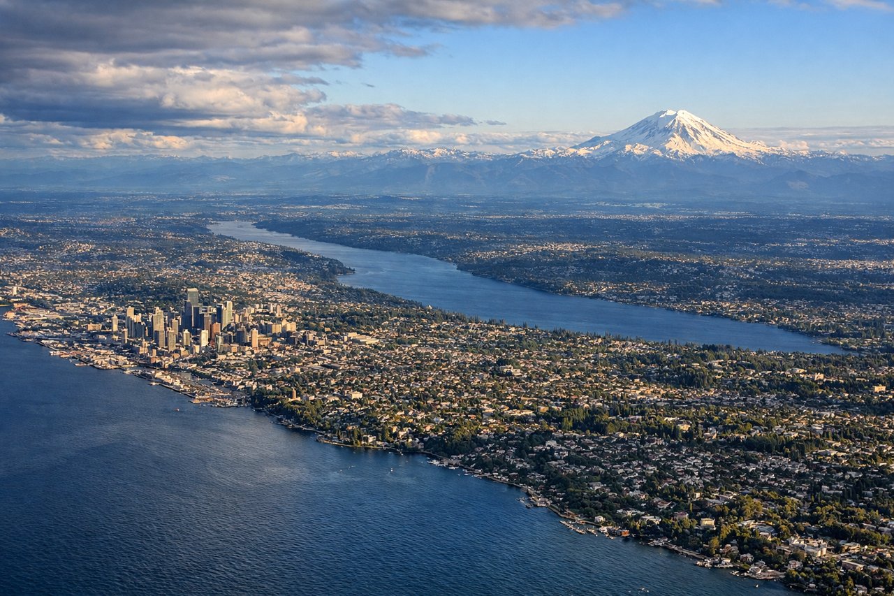
LEFTOn the descent into SEA from the north over Puget Sound, the left side faces east toward downtown Seattle, Lake Washington, and the Cascade foothills, with Mount Rainier's snow-capped summit visible on the southern horizon. The right side only shows the Olympic Mountains and open water of the Sound.
Landmarks on this routeAll landmarks →
Will your flight be in sunlight?
See exactly which side of the plane gets sun and shade at your departure time.
About This Route
Which side of the plane should I sit on flying from Singapore Changi (SIN) to Seattle Tacoma International (SEA)?
Sit on the Left side of the plane for the best views on flights from Singapore to Seattle. The left side wins on both ends of the flight: Singapore's skyline and harbor at takeoff, and Seattle's skyline plus Mount Rainier and the Cascades on arrival, while the right side is dominated by open water at both departure and landing.
What can I see during takeoff from Singapore Changi in Singapore?
During takeoff from Singapore Changi (SIN), sit on the Left side for the best views. Departing north on runway 02, the initial climb puts Singapore's skyline and harbor on the left side of the aircraft as it banks away from Changi. The right side only offers open South China Sea and the low-lying Riau Islands of Indonesia in the distance. Notable sights include: Marina Bay Sands and CBD skyline, Singapore Strait shipping lanes, Sentosa Island, Jurong Port.
What can I see when landing at Seattle Tacoma International in Seattle?
When landing at Seattle Tacoma International (SEA), sit on the Left side for the best views. On the descent into SEA from the north over Puget Sound, the left side faces east toward downtown Seattle, Lake Washington, and the Cascade foothills, with Mount Rainier's snow-capped summit visible on the southern horizon. The right side only shows the Olympic Mountains and open water of the Sound. Notable sights include: Seattle downtown skyline, Lake Washington, Mount Rainier, Cascade foothills.
How long is the flight from Singapore to Seattle?
The flight from Singapore Changi (SIN) to Seattle Tacoma International (SEA) takes 15h 45m.
What does the Singapore to Seattle flight path pass over?
The great-circle path arcs north across the South China Sea and near Taiwan and Japan before curving over the North Pacific close to the Aleutian Islands and the Alaska Peninsula, then descends along the British Columbia coast past Vancouver Island toward Puget Sound.