Right-side seats win overall because the takeoff climb provides superior scenic value with the Santa Cruz Mountains and bay views, and while landing favors the left, the extended eastbound flight path over the Sierra Nevada foothills and central valley offers more dramatic terrain on the right side during cruise.
Flown SJC to DAL? Did we get it right?
Flight Path
San Jose to Dallas is 1,447 miles (2,329 km), a flight of about 4 hours 15 minutes.
The flight path crosses the Sierra Nevada mountains (visible as a major north-south ridge with significant elevation), the Central Valley of California (flat agricultural terrain), and transitions into the Great Plains. Notable features include the Sierra crest around 10,000-11,000 feet elevation, the Kern River drainage system, and the transition from California's mountainous terrain to the flat Texas plains near the New Mexico-Texas border. The Mojave Desert and portions of Arizona and New Mexico are visible during the middle segment, with the landscape gradually flattening as you approach Texas.
Great circle distance and headings ›


Phase by phase
Takeoff from SJC
RIGHTRight-side seats capture the Santa Cruz Mountains and the southern San Francisco Bay as the aircraft climbs eastward. You'll see the bay's distinctive shape and urban sprawl along the peninsula before heading inland.
Landing at DAL
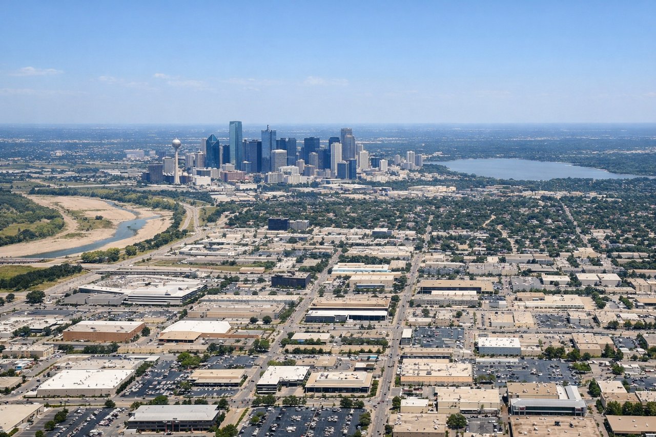
LEFTLeft-side seats offer views of the Trinity River, the Dallas-Fort Worth urban corridor, and downtown Dallas as you descend into Love Field. The city's distinctive skyline and the river's meandering path are clearly visible during final approach.
Will your flight be in sunlight?
Pick a date and time in the Sun Map to watch the sun move across your whole flight.
About This Route
Which side of the plane should I sit on flying from Norman Y Mineta San Jose International (SJC) to Dallas Love Fld (DAL)?
Sit on the Right side of the plane for the best views on flights from San Jose to Dallas. Right-side seats win overall because the takeoff climb provides superior scenic value with the Santa Cruz Mountains and bay views, and while landing favors the left, the extended eastbound flight path over the Sierra Nevada foothills and central valley offers more dramatic terrain on the right side during cruise.
What can I see during takeoff from Norman Y Mineta San Jose International in San Jose?
During takeoff from Norman Y Mineta San Jose International (SJC), sit on the Right side for the best views. Right-side seats capture the Santa Cruz Mountains and the southern San Francisco Bay as the aircraft climbs eastward. You'll see the bay's distinctive shape and urban sprawl along the peninsula before heading inland. Notable sights include: Santa Cruz Mountains, San Francisco Bay (southern portion), San Jose urban grid, Diablo Range foothills.
What can I see when landing at Dallas Love Fld in Dallas?
When landing at Dallas Love Fld (DAL), sit on the Left side for the best views. Left-side seats offer views of the Trinity River, the Dallas-Fort Worth urban corridor, and downtown Dallas as you descend into Love Field. The city's distinctive skyline and the river's meandering path are clearly visible during final approach. Notable sights include: Trinity River, Dallas downtown skyline, White Rock Lake, Fort Worth urban area.
How long is the flight from San Jose to Dallas?
The flight from Norman Y Mineta San Jose International (SJC) to Dallas Love Fld (DAL) takes about 4 hours 15 minutes. The shortest flight path between them is 1,447 miles (2,329 km); winds and air traffic control usually add a few percent.
What does the San Jose to Dallas flight path pass over?
The flight path crosses the Sierra Nevada mountains (visible as a major north-south ridge with significant elevation), the Central Valley of California (flat agricultural terrain), and transitions into the Great Plains. Notable features include the Sierra crest around 10,000-11,000 feet elevation, the Kern River drainage system, and the transition from California's mountainous terrain to the flat Texas plains near the New Mexico-Texas border. The Mojave Desert and portions of Arizona and New Mexico are visible during the middle segment, with the landscape gradually flattening as you approach Texas.