Both sides score equally at 2.5 due to the flight's fundamental geography: the route crosses 2,000 miles of relatively flat terrain (Great Plains, Mississippi Valley, and central Florida) with minimal dramatic elevation change. However, the left side edges ahead for takeoff drama from the San Francisco Bay Area and Santa Cruz Mountains, which provides the flight's most visually distinctive segment. The landing approach to Orlando is equally unremarkable on both sides, as central Florida's landscape is uniformly flat and lake-dotted. Left is the marginally better choice for the overall experience.
Flown SJC to MCO? Did we get it right?
Flight Path
San Jose to Orlando is 2,416 miles (3,889 km), a flight of about 5 hours 15 minutes.
The flight path crosses the Sierra Nevada's eastern escarpment (visible from altitude as a dramatic elevation boundary), then descends into the Great Basin and Great Plains. Notable midpoint landmarks include the Rocky Mountains (southern Colorado/northern New Mexico region, typically visible as a distant ridge line), the Mississippi River valley (broad, flat, with visible meanders), and the transition into the Gulf Coastal Plain. Most of the cruise phase occurs over featureless plains and open terrain at 35,000+ feet, where individual landmarks are difficult to distinguish. The most visually interesting segment occurs during the first 45 minutes (Bay Area departure and Sierra crossing) and the final 30 minutes (central Florida descent and approach).
Great circle distance and headings ›


Phase by phase
Takeoff from SJC
LEFTLeft side captures the San Francisco Bay Area geography during initial climb. Departing runway 30 (northwest), the left wing shows the South Bay urban sprawl, the southern reaches of San Francisco Bay, and the Santa Cruz Mountains rising to the southwest—a more dramatic departure than the right side's inland valley view.
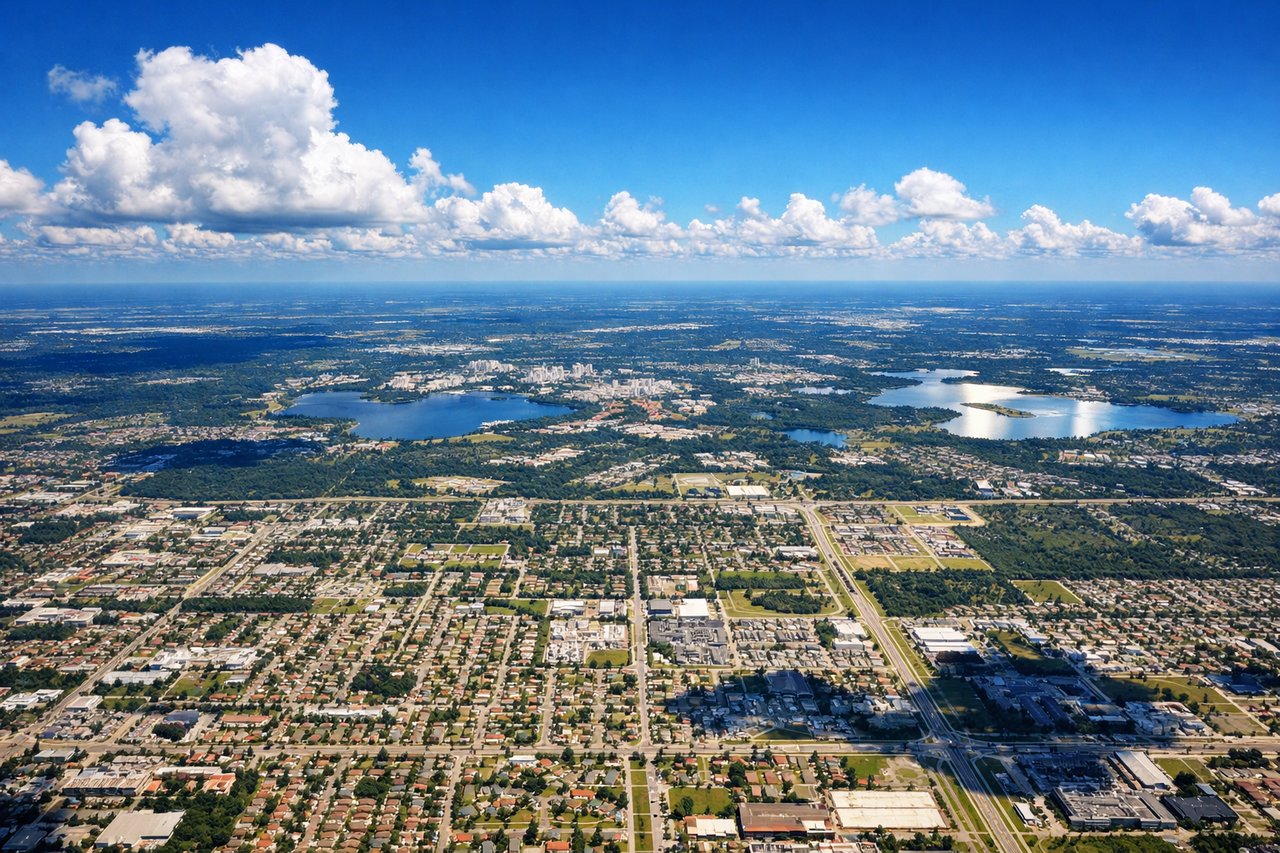
Landing at MCO
RIGHTRight side during approach to MCO captures the central Florida landscape and the approach corridor. Descending into Orlando on typical south-flow operations (runway 17), the right wing reveals the transition from rural central Florida's lakes and pine forests to the urban core of Orlando, including downtown and the theme park corridor—more visually interesting than the left side's swampy wetlands.
Will your flight be in sunlight?
Pick a date and time in the Sun Map to watch the sun move across your whole flight.
About This Route
Which side of the plane should I sit on flying from Norman Y Mineta San Jose International (SJC) to Orlando International (MCO)?
Sit on the Left side of the plane for the best views on flights from San Jose to Orlando. Both sides score equally at 2.5 due to the flight's fundamental geography: the route crosses 2,000 miles of relatively flat terrain (Great Plains, Mississippi Valley, and central Florida) with minimal dramatic elevation change. However, the left side edges ahead for takeoff drama from the San Francisco Bay Area and Santa Cruz Mountains, which provides the flight's most visually distinctive segment. The landing approach to Orlando is equally unremarkable on both sides, as central Florida's landscape is uniformly flat and lake-dotted. Left is the marginally better choice for the overall experience.
What can I see during takeoff from Norman Y Mineta San Jose International in San Jose?
During takeoff from Norman Y Mineta San Jose International (SJC), sit on the Left side for the best views. Left side captures the San Francisco Bay Area geography during initial climb. Departing runway 30 (northwest), the left wing shows the South Bay urban sprawl, the southern reaches of San Francisco Bay, and the Santa Cruz Mountains rising to the southwest—a more dramatic departure than the right side's inland valley view. Notable sights include: San Francisco Bay (southern arm), Santa Cruz Mountains, San Jose urban grid, Diablo Range foothills.
What can I see when landing at Orlando International in Orlando?
When landing at Orlando International (MCO), sit on the Right side for the best views. Right side during approach to MCO captures the central Florida landscape and the approach corridor. Descending into Orlando on typical south-flow operations (runway 17), the right wing reveals the transition from rural central Florida's lakes and pine forests to the urban core of Orlando, including downtown and the theme park corridor—more visually interesting than the left side's swampy wetlands. Notable sights include: Lake Apopka, Orlando downtown skyline, Central Florida lakes network, theme park development corridor.
How long is the flight from San Jose to Orlando?
The flight from Norman Y Mineta San Jose International (SJC) to Orlando International (MCO) takes about 5 hours 15 minutes. The shortest flight path between them is 2,416 miles (3,889 km); winds and air traffic control usually add a few percent.
What does the San Jose to Orlando flight path pass over?
The flight path crosses the Sierra Nevada's eastern escarpment (visible from altitude as a dramatic elevation boundary), then descends into the Great Basin and Great Plains. Notable midpoint landmarks include the Rocky Mountains (southern Colorado/northern New Mexico region, typically visible as a distant ridge line), the Mississippi River valley (broad, flat, with visible meanders), and the transition into the Gulf Coastal Plain. Most of the cruise phase occurs over featureless plains and open terrain at 35,000+ feet, where individual landmarks are difficult to distinguish. The most visually interesting segment occurs during the first 45 minutes (Bay Area departure and Sierra crossing) and the final 30 minutes (central Florida descent and approach).