Left side wins both ends of the flight. During climb-out you get the Central Valley and Costa Rican volcanoes; during cruise over the Gulf of Honduras and Yucatán you have a slight advantage seeing the Gulf of Mexico coastline; and on arrival the Houston Ship Channel and Galveston Bay are on the left. Consistent payoff throughout.
Flown SJO to IAH? Did we get it right?
Flight Path
San Jose to Houston is 1,556 miles (2,505 km), a flight of about 4 hours 30 minutes.
The flight tracks northwest over Nicaragua's Lake Nicaragua (the largest lake in Central America, clearly visible as a large dark blue body of water), then over Honduras and the Gulf of Honduras, across the Yucatán Peninsula of Mexico with its flat limestone karst terrain and occasional cenote clusters, then out over the southern Gulf of Mexico before crossing the Texas coast near Corpus Christi or Galveston and tracking north to Houston
Great circle distance and headings ›Phase by phase
Takeoff from SJO
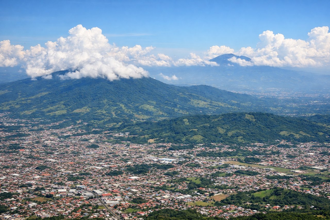
LEFTSJO's primary departure runway is 07, meaning aircraft climb out heading northeast. A left (north-facing) window gives you a clear view of the Central Valley and the Cordillera Central volcanoes — Poás, Barva, and Irazú — rising above the plateau. The right side faces south toward the Talamanca range but the volcanic cones are the more dramatic and distinctive feature.
Landing at IAH
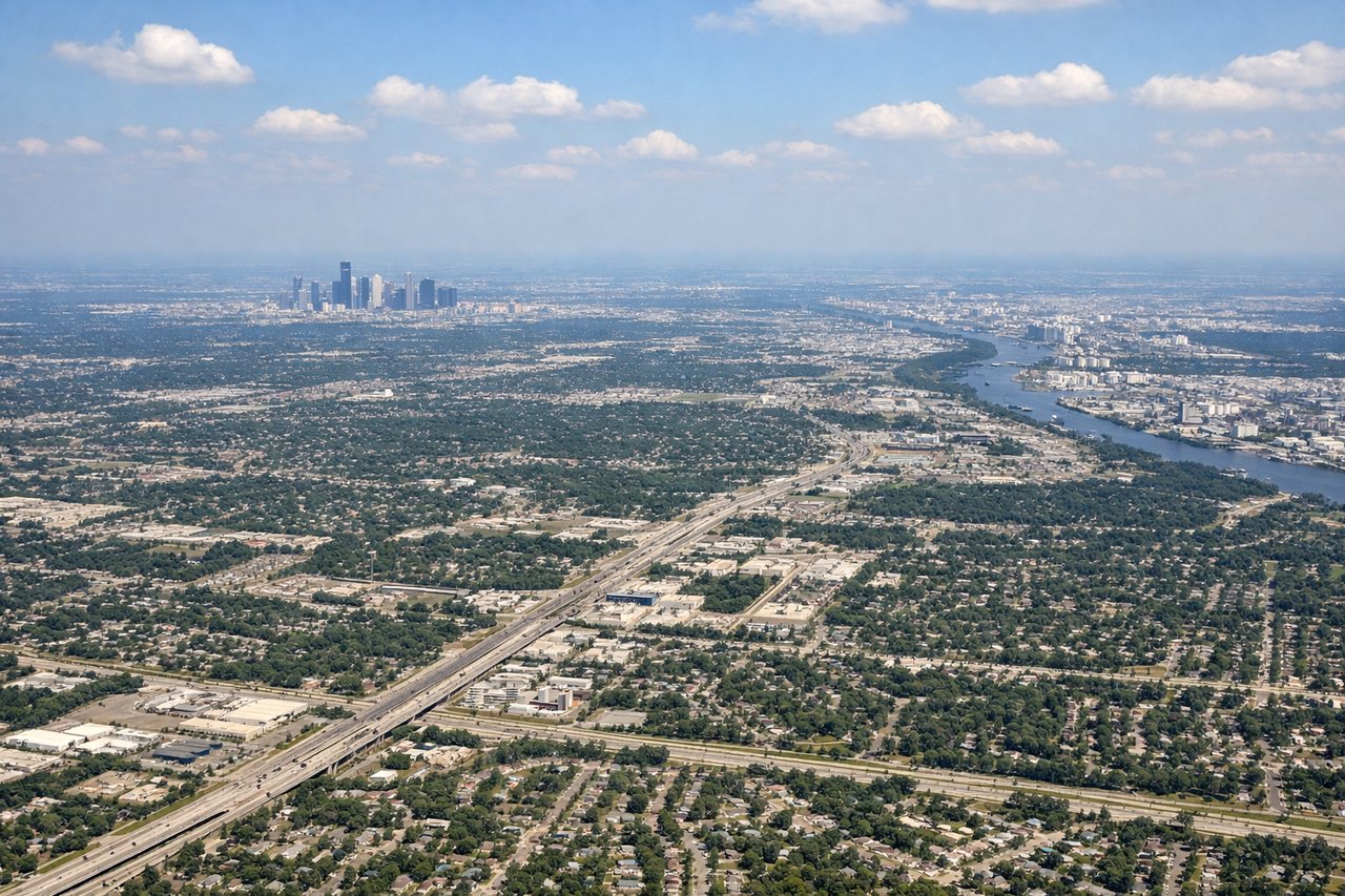
LEFTArrivals into IAH typically come from the south on runways 26L/26R or 27, meaning the aircraft approaches from the southeast heading northwest. A left (south-facing) window gives you the Houston Ship Channel, Galveston Bay, and the sprawling refinery and petrochemical complex along the channel — one of the most visually striking industrial landscapes in North America. The right side faces north toward suburban sprawl with fewer distinctive features.
Will your flight be in sunlight?
Pick a date and time in the Sun Map to watch the sun move across your whole flight.
About This Route
Which side of the plane should I sit on flying from Juan Santamaria International (SJO) to George Bush Intcntl Houston (IAH)?
Sit on the Left side of the plane for the best views on flights from San Jose to Houston. Left side wins both ends of the flight. During climb-out you get the Central Valley and Costa Rican volcanoes; during cruise over the Gulf of Honduras and Yucatán you have a slight advantage seeing the Gulf of Mexico coastline; and on arrival the Houston Ship Channel and Galveston Bay are on the left. Consistent payoff throughout.
What can I see during takeoff from Juan Santamaria International in San Jose?
During takeoff from Juan Santamaria International (SJO), sit on the Left side for the best views. SJO's primary departure runway is 07, meaning aircraft climb out heading northeast. A left (north-facing) window gives you a clear view of the Central Valley and the Cordillera Central volcanoes — Poás, Barva, and Irazú — rising above the plateau. The right side faces south toward the Talamanca range but the volcanic cones are the more dramatic and distinctive feature. Notable sights include: Irazú Volcano (3,432m, directly northeast), Barva Volcano (2,906m), the urban sprawl of San José and Heredia in the Central Valley below, Poás Volcano visible further northwest on the horizon.
What can I see when landing at George Bush Intcntl Houston in Houston?
When landing at George Bush Intcntl Houston (IAH), sit on the Left side for the best views. Arrivals into IAH typically come from the south on runways 26L/26R or 27, meaning the aircraft approaches from the southeast heading northwest. A left (south-facing) window gives you the Houston Ship Channel, Galveston Bay, and the sprawling refinery and petrochemical complex along the channel — one of the most visually striking industrial landscapes in North America. The right side faces north toward suburban sprawl with fewer distinctive features. Notable sights include: Galveston Bay and the upper bay visible to the southeast, Houston Ship Channel with its dense refinery and tank farm corridor, downtown Houston skyline visible to the southwest during the approach turn, Lake Houston to the east of the airport.
How long is the flight from San Jose to Houston?
The flight from Juan Santamaria International (SJO) to George Bush Intcntl Houston (IAH) takes about 4 hours 30 minutes. The shortest flight path between them is 1,556 miles (2,505 km); winds and air traffic control usually add a few percent.
What does the San Jose to Houston flight path pass over?
The flight tracks northwest over Nicaragua's Lake Nicaragua (the largest lake in Central America, clearly visible as a large dark blue body of water), then over Honduras and the Gulf of Honduras, across the Yucatán Peninsula of Mexico with its flat limestone karst terrain and occasional cenote clusters, then out over the southern Gulf of Mexico before crossing the Texas coast near Corpus Christi or Galveston and tracking north to Houston