Left side wins at both ends of the flight. During the climb out of San José you face the Cordillera Central volcanoes, and on descent into Toronto you get Lake Ontario and the city skyline. Over the mid-flight cruise the views are less decisive, but the left side also offers better angles over the Yucatán Peninsula and Gulf of Mexico coastline.
Flown SJO to YYZ? Did we get it right?
Flight Path
San Jose to Toronto is 2,343 miles (3,771 km), a flight of about 5 hours 5 minutes.
The flight tracks northwest over Nicaragua and Honduras, then across the Yucatán Peninsula where the flat limestone shelf and Caribbean coastline are visible. It crosses the Gulf of Mexico, enters the US over the Florida panhandle or Louisiana coast, then tracks northeast over the Appalachian ridgelines of Tennessee and Kentucky before crossing into Ontario. The Great Lakes — particularly Lake Erie — appear in the final hour of flight.
Great circle distance and headings ›


Phase by phase
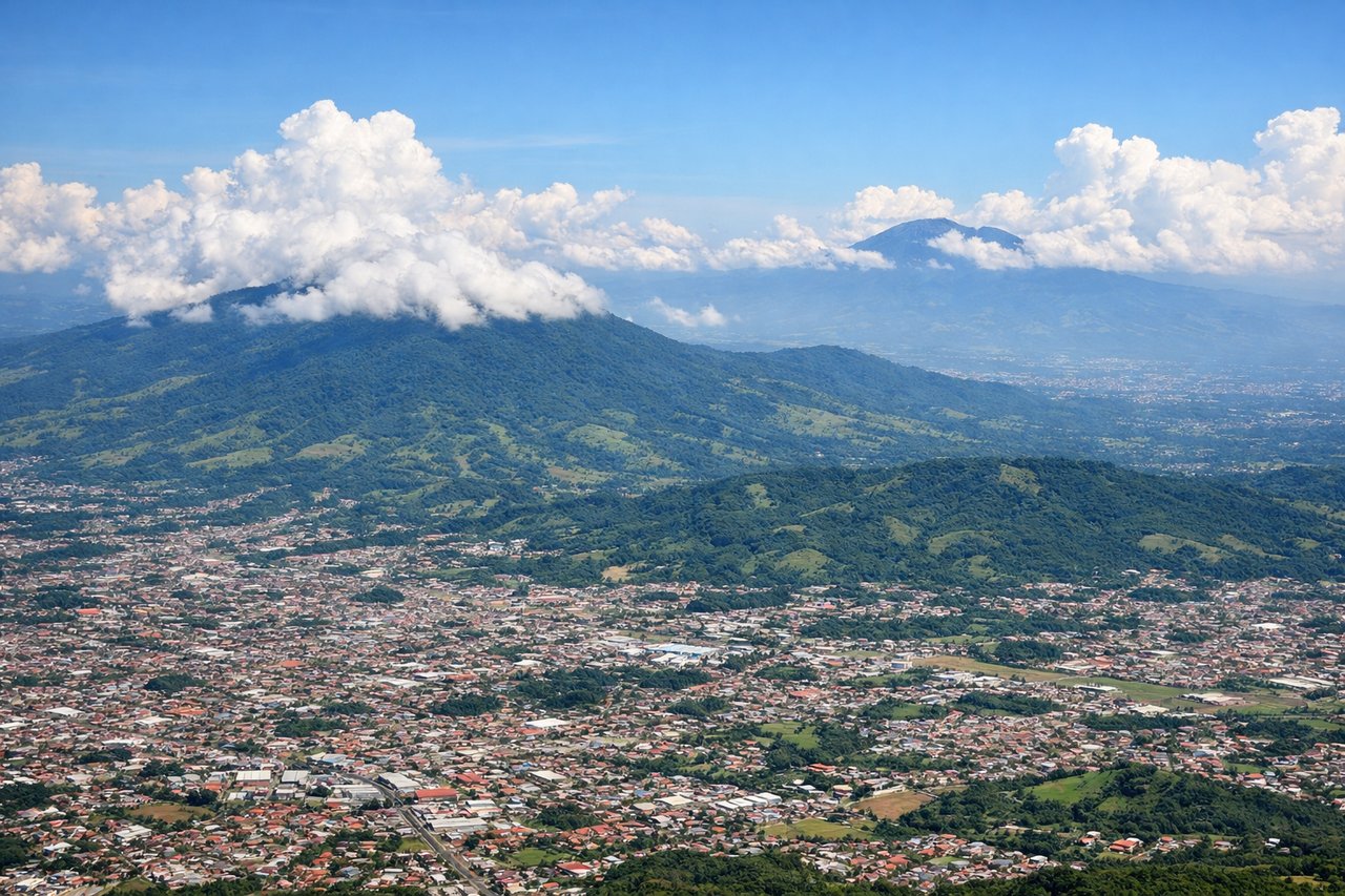
Takeoff from SJO
LEFTJuan Santamaría airport's primary departure runway (07) heads east, putting the left (north) side facing the Poás and Barva volcanoes of the Cordillera Central. You get a clear look at the volcanic peaks and the Central Valley sprawl of San José below. The right side faces south toward lower terrain with less dramatic relief.
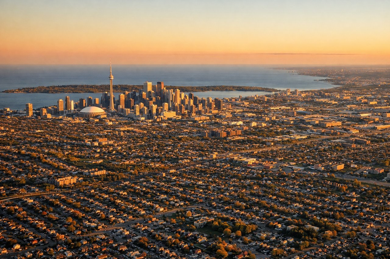
Landing at YYZ
LEFTPearson's dominant arrival runway 06L/06R brings aircraft in from the southwest heading northeast, placing Lake Ontario and the Toronto downtown skyline on the left side. You get a clear view of the CN Tower, the waterfront, and the lake as you descend over Mississauga. The right side faces north toward suburban sprawl with no comparable landmarks.
Will your flight be in sunlight?
Pick a date and time in the Sun Map to watch the sun move across your whole flight.
About This Route
Which side of the plane should I sit on flying from Juan Santamaria International (SJO) to Lester B Pearson International (YYZ)?
Sit on the Left side of the plane for the best views on flights from San Jose to Toronto. Left side wins at both ends of the flight. During the climb out of San José you face the Cordillera Central volcanoes, and on descent into Toronto you get Lake Ontario and the city skyline. Over the mid-flight cruise the views are less decisive, but the left side also offers better angles over the Yucatán Peninsula and Gulf of Mexico coastline.
What can I see during takeoff from Juan Santamaria International in San Jose?
During takeoff from Juan Santamaria International (SJO), sit on the Left side for the best views. Juan Santamaría airport's primary departure runway (07) heads east, putting the left (north) side facing the Poás and Barva volcanoes of the Cordillera Central. You get a clear look at the volcanic peaks and the Central Valley sprawl of San José below. The right side faces south toward lower terrain with less dramatic relief. Notable sights include: Volcán Poás (2,708m), Volcán Barva, Central Valley urban spread of San José, Cordillera Central ridgeline.
What can I see when landing at Lester B Pearson International in Toronto?
When landing at Lester B Pearson International (YYZ), sit on the Left side for the best views. Pearson's dominant arrival runway 06L/06R brings aircraft in from the southwest heading northeast, placing Lake Ontario and the Toronto downtown skyline on the left side. You get a clear view of the CN Tower, the waterfront, and the lake as you descend over Mississauga. The right side faces north toward suburban sprawl with no comparable landmarks. Notable sights include: Lake Ontario, CN Tower and Toronto downtown skyline, Mississauga suburban grid, Toronto Islands.
How long is the flight from San Jose to Toronto?
The flight from Juan Santamaria International (SJO) to Lester B Pearson International (YYZ) takes about 5 hours 5 minutes. The shortest flight path between them is 2,343 miles (3,771 km); winds and air traffic control usually add a few percent.
What does the San Jose to Toronto flight path pass over?
The flight tracks northwest over Nicaragua and Honduras, then across the Yucatán Peninsula where the flat limestone shelf and Caribbean coastline are visible. It crosses the Gulf of Mexico, enters the US over the Florida panhandle or Louisiana coast, then tracks northeast over the Appalachian ridgelines of Tennessee and Kentucky before crossing into Ontario. The Great Lakes — particularly Lake Erie — appear in the final hour of flight.