Sacramento to Santiago is 5,950 miles (9,576 km), a flight of about 10 hours.
While the takeoff offers Sierra Nevada views on the left, the landing descent provides more dramatic and extended mountain scenery on the right as you approach the Andes. The Andes are more visually striking at landing altitude and occupy more of the visual frame during the final approach.
Flight Path
The flight path crosses the southwestern United States (Arizona, New Mexico, parts of Mexico), then over the Pacific Ocean for roughly 5-6 hours. Notable midpoint landmarks include the Colorado Plateau region visible early in the flight, the Sierra Madre Occidental in Mexico during the southern portion of the US crossing, and the Pacific coastline of Mexico near Baja California before heading out over open ocean. The Pacific crossing offers minimal landmarks; the Andes become visible again approximately 2-3 hours before landing as you approach the South American continent.
Great circle distance and headings ›


Phase by phase
Takeoff from SMF
LEFTLeft side offers views of the Sierra Nevada mountain range during the initial climb-out heading south. The western slope of the Sierra is clearly visible from Sacramento's southbound departure corridor, with snow-capped peaks visible on clear days.
Landing at SCL
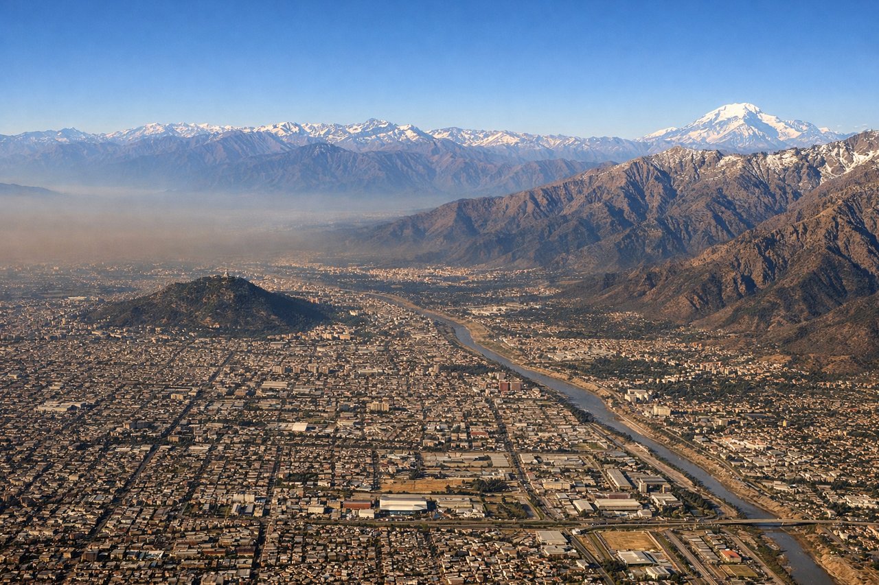
RIGHTRight side provides excellent views of the Andes Mountains during descent into Santiago. The approach path from the north brings the eastern cordillera into view on the right, with the snow-capped peaks of the central Chilean Andes dominating the landscape as you descend toward the valley floor.
Landmarks on this routeAll landmarks →
Will your flight be in sunlight?
Pick a date and time in the Sun Map to watch the sun move across your whole flight.
About This Route
Which side of the plane should I sit on flying from Sacramento International (SMF) to Arturo Merino Benitez International (SCL)?
Sit on the Right side of the plane for the best views on flights from Sacramento to Santiago. While the takeoff offers Sierra Nevada views on the left, the landing descent provides more dramatic and extended mountain scenery on the right as you approach the Andes. The Andes are more visually striking at landing altitude and occupy more of the visual frame during the final approach.
What can I see during takeoff from Sacramento International in Sacramento?
During takeoff from Sacramento International (SMF), sit on the Left side for the best views. Left side offers views of the Sierra Nevada mountain range during the initial climb-out heading south. The western slope of the Sierra is clearly visible from Sacramento's southbound departure corridor, with snow-capped peaks visible on clear days. Notable sights include: Sierra Nevada range, Sacramento Valley floor, Folsom Lake (if visible during climb), American River valley.
What can I see when landing at Arturo Merino Benitez International in Santiago?
When landing at Arturo Merino Benitez International (SCL), sit on the Right side for the best views. Right side provides excellent views of the Andes Mountains during descent into Santiago. The approach path from the north brings the eastern cordillera into view on the right, with the snow-capped peaks of the central Chilean Andes dominating the landscape as you descend toward the valley floor. Notable sights include: Central Chilean Andes (Cordillera Principal), Santiago metropolitan area in the valley, Maipo River valley, Aconcagua massif region (distant).
How long is the flight from Sacramento to Santiago?
The flight from Sacramento International (SMF) to Arturo Merino Benitez International (SCL) takes about 10 hours. The shortest flight path between them is 5,950 miles (9,576 km); winds and air traffic control usually add a few percent.
What does the Sacramento to Santiago flight path pass over?
The flight path crosses the southwestern United States (Arizona, New Mexico, parts of Mexico), then over the Pacific Ocean for roughly 5-6 hours. Notable midpoint landmarks include the Colorado Plateau region visible early in the flight, the Sierra Madre Occidental in Mexico during the southern portion of the US crossing, and the Pacific coastline of Mexico near Baja California before heading out over open ocean. The Pacific crossing offers minimal landmarks; the Andes become visible again approximately 2-3 hours before landing as you approach the South American continent.