Santiago to Sacramento is 5,950 miles (9,576 km), a flight of about 11 hours 35 minutes.
The takeoff view of the Andes is more dramatic and geographically distinctive than the landing approach. While the Sierra Nevada is visible on descent, the Andes departure offers sharper relief and more striking visual contrast.
Flight Path
The flight path crosses the Pacific Ocean for roughly 4-5 hours. Notable geographic features along the route include the Atacama Desert region (visible during initial westbound climb from SCL), the Pacific coastline of Peru and Ecuador (if flying a northern corridor), and the approach to North America via the California coast near Monterey or Big Sur before turning inland toward Sacramento. The Sierra Nevada becomes visible roughly 200 miles east of Sacramento during descent.
Great circle distance and headings ›


Phase by phase
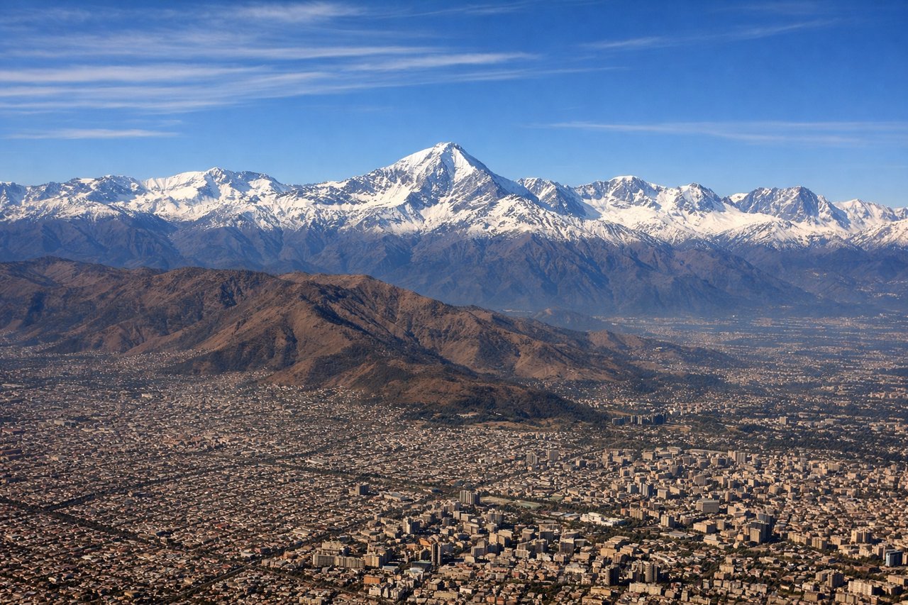
Takeoff from SCL
LEFTSCL typically departs runway 07 (westbound) or 25 (southbound). Left seats offer the best view of the Andes cordillera immediately west and northwest of Santiago during climb-out, with the snow-capped peaks rising dramatically as you gain altitude.
Landing at SMF
RIGHTSMF typically lands runway 16 (northbound) or 34 (southbound). Right seats provide excellent views during descent into the Sacramento Valley, showing the Sierra Nevada range to the east and the transition from the Central Valley's agricultural grid to the airport approach.
Landmarks on this routeAll landmarks →
Will your flight be in sunlight?
Pick a date and time in the Sun Map to watch the sun move across your whole flight.
About This Route
Which side of the plane should I sit on flying from Arturo Merino Benitez International (SCL) to Sacramento International (SMF)?
Sit on the Left side of the plane for the best views on flights from Santiago to Sacramento. The takeoff view of the Andes is more dramatic and geographically distinctive than the landing approach. While the Sierra Nevada is visible on descent, the Andes departure offers sharper relief and more striking visual contrast.
What can I see during takeoff from Arturo Merino Benitez International in Santiago?
During takeoff from Arturo Merino Benitez International (SCL), sit on the Left side for the best views. SCL typically departs runway 07 (westbound) or 25 (southbound). Left seats offer the best view of the Andes cordillera immediately west and northwest of Santiago during climb-out, with the snow-capped peaks rising dramatically as you gain altitude. Notable sights include: Andes Mountains (western cordillera), Maipo River valley, San Cristóbal Hill (Cerro San Cristóbal), Aconcagua massif (distant, on horizon).
What can I see when landing at Sacramento International in Sacramento?
When landing at Sacramento International (SMF), sit on the Right side for the best views. SMF typically lands runway 16 (northbound) or 34 (southbound). Right seats provide excellent views during descent into the Sacramento Valley, showing the Sierra Nevada range to the east and the transition from the Central Valley's agricultural grid to the airport approach. Notable sights include: Sierra Nevada range (eastern horizon), Sacramento River, Central Valley agricultural patchwork, Folsom Lake (if visible on approach).
How long is the flight from Santiago to Sacramento?
The flight from Arturo Merino Benitez International (SCL) to Sacramento International (SMF) takes about 11 hours 35 minutes. The shortest flight path between them is 5,950 miles (9,576 km); winds and air traffic control usually add a few percent.
What does the Santiago to Sacramento flight path pass over?
The flight path crosses the Pacific Ocean for roughly 4-5 hours. Notable geographic features along the route include the Atacama Desert region (visible during initial westbound climb from SCL), the Pacific coastline of Peru and Ecuador (if flying a northern corridor), and the approach to North America via the California coast near Monterey or Big Sur before turning inland toward Sacramento. The Sierra Nevada becomes visible roughly 200 miles east of Sacramento during descent.