Surabaya to Hong Kong is 2,053 miles (3,304 km), a flight of about 4 hours 15 minutes.
While the right side offers good views during takeoff from Surabaya, the left side provides superior scenery during the critical landing phase into Hong Kong, where Victoria Harbour and the iconic skyline are major visual highlights. The approach into Hong Kong is the more memorable segment of this route.
Flight Path
The flight path crosses the South China Sea heading northwest. Notable features include the Java Sea transition to open ocean, the Natuna Islands (small, scattered low islands visible around 2 hours into flight), and the approach to the South China Sea proper. The coastline of southern Vietnam and Cambodia may be visible on the horizon to the left (west) during the latter portion of the flight, though these remain distant. The flight maintains cruising altitude over open water for most of the journey, with limited ground features visible until the final descent into Hong Kong approaches the Pearl River Delta region.
Great circle distance and headings ›Phase by phase
Takeoff from SUB
RIGHTRight-side seats offer views of the Madura Strait and the northern coast of East Java as the aircraft climbs northwestward. You'll see the transition from Surabaya's urban sprawl to open water and the volcanic landscape inland.
Landing at HKG
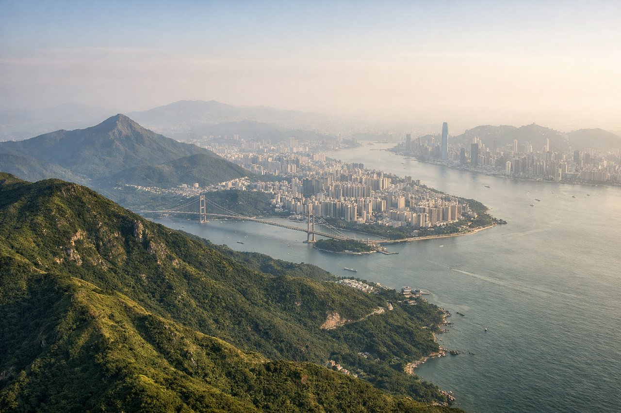
LEFTLeft-side seats provide excellent views during the descent approach into Hong Kong. You'll see Victoria Harbour, Hong Kong Island's skyline, and Kowloon Peninsula as the aircraft descends from the northwest toward the runway.
Landmarks on this routeAll landmarks →
Will your flight be in sunlight?
Pick a date and time in the Sun Map to watch the sun move across your whole flight.
About This Route
Which side of the plane should I sit on flying from Juanda International Airport (SUB) to Hong Kong International (HKG)?
Sit on the Left side of the plane for the best views on flights from Surabaya to Hong Kong. While the right side offers good views during takeoff from Surabaya, the left side provides superior scenery during the critical landing phase into Hong Kong, where Victoria Harbour and the iconic skyline are major visual highlights. The approach into Hong Kong is the more memorable segment of this route.
What can I see during takeoff from Juanda International Airport in Surabaya?
During takeoff from Juanda International Airport (SUB), sit on the Right side for the best views. Right-side seats offer views of the Madura Strait and the northern coast of East Java as the aircraft climbs northwestward. You'll see the transition from Surabaya's urban sprawl to open water and the volcanic landscape inland. Notable sights include: Madura Strait, Mount Bromo (distant, inland to the south), Surabaya city grid, Java's northern coastline.
What can I see when landing at Hong Kong International in Hong Kong?
When landing at Hong Kong International (HKG), sit on the Left side for the best views. Left-side seats provide excellent views during the descent approach into Hong Kong. You'll see Victoria Harbour, Hong Kong Island's skyline, and Kowloon Peninsula as the aircraft descends from the northwest toward the runway. Notable sights include: Victoria Harbour, Hong Kong Island skyline, Kowloon Peninsula, New Territories.
How long is the flight from Surabaya to Hong Kong?
The flight from Juanda International Airport (SUB) to Hong Kong International (HKG) takes about 4 hours 15 minutes. The shortest flight path between them is 2,053 miles (3,304 km); winds and air traffic control usually add a few percent.
What does the Surabaya to Hong Kong flight path pass over?
The flight path crosses the South China Sea heading northwest. Notable features include the Java Sea transition to open ocean, the Natuna Islands (small, scattered low islands visible around 2 hours into flight), and the approach to the South China Sea proper. The coastline of southern Vietnam and Cambodia may be visible on the horizon to the left (west) during the latter portion of the flight, though these remain distant. The flight maintains cruising altitude over open water for most of the journey, with limited ground features visible until the final descent into Hong Kong approaches the Pearl River Delta region.