Surabaya to Singapore is 855 miles (1,376 km), a flight of about 2 hours 20 minutes.
While takeoff on the right offers good initial views of Java's coast, the landing approach on the left provides more sustained and dramatic scenery—the Riau Islands and Johor Strait are visually distinctive and occupy more of the descent phase. The left side captures the most geographically interesting portion of this short route.
Flight Path
Java Sea (open water with minimal landmarks), transition zone between Java's volcanic highlands and the low-lying island geography of Singapore and the Riau archipelago. The flight path crosses relatively open water for most of the journey, with the most notable midpoint feature being the gradual shift from Java's mountainous interior (visible to the left during climb) to the flat, island-dotted seascape approaching Singapore.
Great circle distance and headings ›Phase by phase
Takeoff from SUB
RIGHTRight side offers views of the Madura Strait and the northern coast of Java as the aircraft climbs southwestward. You'll see the transition from urban Surabaya to coastal waters and the volcanic landscape inland.
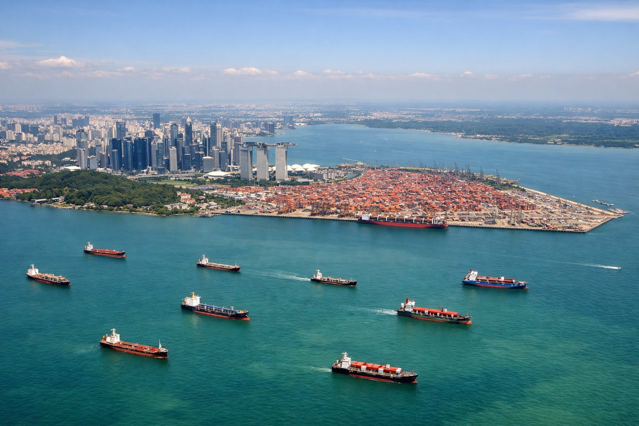
Landing at SIN
LEFTLeft side provides views of the Johor Strait, the Riau Islands archipelago, and Singapore's northern coastline as you descend toward Changi. You'll see the transition from open water to the island nation's urban and industrial zones.
Landmarks on this routeAll landmarks →
Will your flight be in sunlight?
Pick a date and time in the Sun Map to watch the sun move across your whole flight.
About This Route
Which side of the plane should I sit on flying from Juanda International Airport (SUB) to Singapore Changi (SIN)?
Sit on the Left side of the plane for the best views on flights from Surabaya to Singapore. While takeoff on the right offers good initial views of Java's coast, the landing approach on the left provides more sustained and dramatic scenery—the Riau Islands and Johor Strait are visually distinctive and occupy more of the descent phase. The left side captures the most geographically interesting portion of this short route.
What can I see during takeoff from Juanda International Airport in Surabaya?
During takeoff from Juanda International Airport (SUB), sit on the Right side for the best views. Right side offers views of the Madura Strait and the northern coast of Java as the aircraft climbs southwestward. You'll see the transition from urban Surabaya to coastal waters and the volcanic landscape inland. Notable sights include: Madura Strait, northern Java coastline, Mount Bromo volcanic region (distant), Surabaya urban sprawl.
What can I see when landing at Singapore Changi in Singapore?
When landing at Singapore Changi (SIN), sit on the Left side for the best views. Left side provides views of the Johor Strait, the Riau Islands archipelago, and Singapore's northern coastline as you descend toward Changi. You'll see the transition from open water to the island nation's urban and industrial zones. Notable sights include: Johor Strait, Riau Islands (Batam and Bintan), Singapore's northern coast and Straits of Malacca approach.
How long is the flight from Surabaya to Singapore?
The flight from Juanda International Airport (SUB) to Singapore Changi (SIN) takes about 2 hours 20 minutes. The shortest flight path between them is 855 miles (1,376 km); winds and air traffic control usually add a few percent.
What does the Surabaya to Singapore flight path pass over?
Java Sea (open water with minimal landmarks), transition zone between Java's volcanic highlands and the low-lying island geography of Singapore and the Riau archipelago. The flight path crosses relatively open water for most of the journey, with the most notable midpoint feature being the gradual shift from Java's mountainous interior (visible to the left during climb) to the flat, island-dotted seascape approaching Singapore.