Tashkent to Kuala Lumpur is 3,336 miles (5,369 km), a flight of about 5 hours 50 minutes.
The right side scores higher due to the landing approach's superior scenic variety: the Strait of Malacca crossing, river delta complexity, and Kuala Lumpur's urban landmarks provide more visual interest than Tashkent's relatively flat departure. The takeoff from Tashkent is modest (distant mountains, urban grid), while the approach to KUL combines water, wetlands, and dense cityscape. The midpoint cruise over Afghanistan and Pakistan offers minimal window views on either side (high altitude, sparse terrain), so the landing experience dominates the overall score.
Flight Path
Hindu Kush mountain range (Afghanistan, visible at altitude as distant peaks), Indus River valley (Pakistan, visible as a green ribbon in arid terrain), Balochistan plateau (sparse, desert-like terrain with minimal landmarks), Arabian Sea approach (open water with no notable features)
Great circle distance and headings ›
.jpg?width=600)


.jpg?width=600)


Phase by phase
Takeoff from TAS
LEFTTashkent's urban sprawl and the Chirchik River valley are visible during climb-out on the left side. The city itself provides moderate landmark density, though the surrounding terrain flattens quickly into the Fergana Valley.
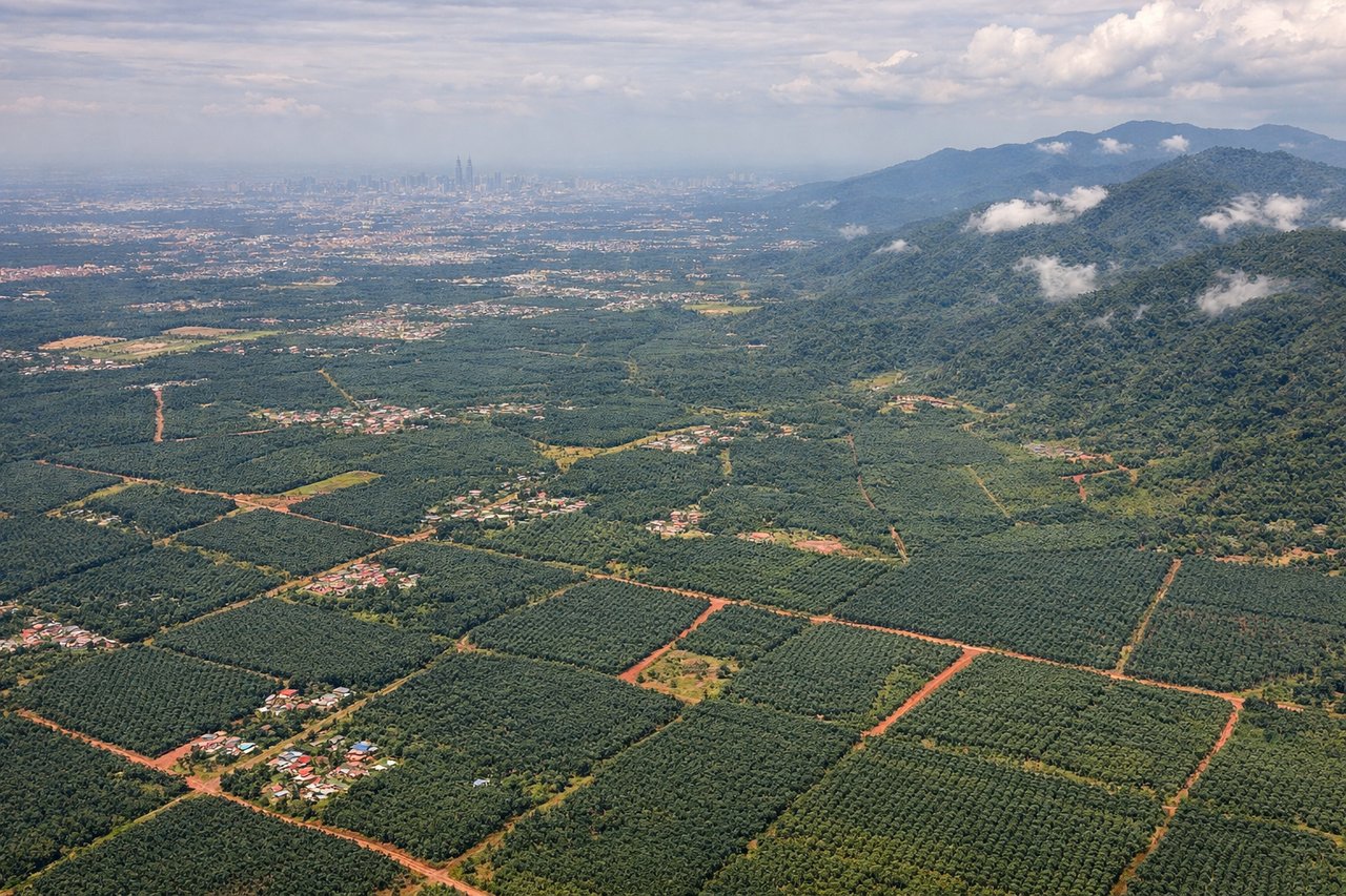
Landing at KUL
RIGHTThe approach to Kuala Lumpur crosses the Strait of Malacca and the Selangor coast, offering water views and the Klang Valley's urban density. The landing path provides views of the Petronas Twin Towers area and the convergence of the Klang and Selangor rivers into the strait.
Landmarks on this routeAll landmarks →
Will your flight be in sunlight?
Pick a date and time in the Sun Map to watch the sun move across your whole flight.
About This Route
Which side of the plane should I sit on flying from Tashkent International Airport (TAS) to Kuala Lumpur International (KUL)?
Sit on the Right side of the plane for the best views on flights from Tashkent to Kuala Lumpur. The right side scores higher due to the landing approach's superior scenic variety: the Strait of Malacca crossing, river delta complexity, and Kuala Lumpur's urban landmarks provide more visual interest than Tashkent's relatively flat departure. The takeoff from Tashkent is modest (distant mountains, urban grid), while the approach to KUL combines water, wetlands, and dense cityscape. The midpoint cruise over Afghanistan and Pakistan offers minimal window views on either side (high altitude, sparse terrain), so the landing experience dominates the overall score.
What can I see during takeoff from Tashkent International Airport in Tashkent?
During takeoff from Tashkent International Airport (TAS), sit on the Left side for the best views. Tashkent's urban sprawl and the Chirchik River valley are visible during climb-out on the left side. The city itself provides moderate landmark density, though the surrounding terrain flattens quickly into the Fergana Valley. Notable sights include: Tashkent city center, Chirchik River, Tian Shan foothills (distant northeast), Fergana Valley plains.
What can I see when landing at Kuala Lumpur International in Kuala Lumpur?
When landing at Kuala Lumpur International (KUL), sit on the Right side for the best views. The approach to Kuala Lumpur crosses the Strait of Malacca and the Selangor coast, offering water views and the Klang Valley's urban density. The landing path provides views of the Petronas Twin Towers area and the convergence of the Klang and Selangor rivers into the strait. Notable sights include: Strait of Malacca, Selangor River delta, Klang Valley urban sprawl, Petronas Twin Towers district.
How long is the flight from Tashkent to Kuala Lumpur?
The flight from Tashkent International Airport (TAS) to Kuala Lumpur International (KUL) takes about 5 hours 50 minutes. The shortest flight path between them is 3,336 miles (5,369 km); winds and air traffic control usually add a few percent.
What does the Tashkent to Kuala Lumpur flight path pass over?
Hindu Kush mountain range (Afghanistan, visible at altitude as distant peaks), Indus River valley (Pakistan, visible as a green ribbon in arid terrain), Balochistan plateau (sparse, desert-like terrain with minimal landmarks), Arabian Sea approach (open water with no notable features)