Right side scores higher (3.5 vs 2.5) due to superior landing approach scenery into Lisbon. While takeoff from Tenerife is comparable on both sides, the approach into Lisbon on the right side provides dramatic urban and estuary views—the Tagus River, 25 de Abril Bridge, and city skyline—that significantly outweigh the left side's open ocean and distant mountain views. The landing sequence dominates the overall flight experience on this short route.
Flown TFS to LIS? Did we get it right?
Flight Path
Tenerife to Lisbon is 856 miles (1,378 km), a flight of about 2 hours 20 minutes.
Open Atlantic Ocean between the Canary Islands and Iberian Peninsula; no significant landmarks visible during cruise phase. The flight path crosses approximately 1,200 km of open water at altitude 35,000 feet, with no islands or notable geographic features. Descent begins roughly 200 km west of Portugal, where the Portuguese coastline and Sintra mountains become visible on approach.
Great circle distance and headings ›


Phase by phase
Takeoff from TFS
RIGHTRight side captures the dramatic volcanic terrain of southern Tenerife during climb-out. The Teno and Anaga mountain ranges frame the island's northern edge, while the southern volcanic plateau and coastal cliffs are visible as the aircraft climbs northeast on runway 07.
Landing at LIS
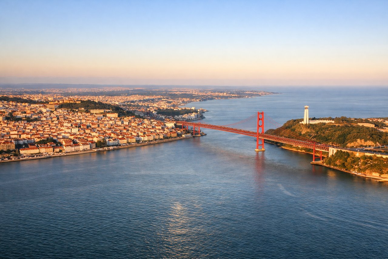
RIGHTRight side offers superior approach scenery into Lisbon. Aircraft descending on runway 20 approach from the north over the Tagus River estuary, providing views of Lisbon's urban sprawl, the 25 de Abril Bridge, and the Sintra-Cascais coastal range. The right side faces west toward the city and its landmarks.
Will your flight be in sunlight?
Pick a date and time in the Sun Map to watch the sun move across your whole flight.
About This Route
Which side of the plane should I sit on flying from Tenerife Sur (TFS) to Lisboa (LIS)?
Sit on the Right side of the plane for the best views on flights from Tenerife to Lisbon. Right side scores higher (3.5 vs 2.5) due to superior landing approach scenery into Lisbon. While takeoff from Tenerife is comparable on both sides, the approach into Lisbon on the right side provides dramatic urban and estuary views—the Tagus River, 25 de Abril Bridge, and city skyline—that significantly outweigh the left side's open ocean and distant mountain views. The landing sequence dominates the overall flight experience on this short route.
What can I see during takeoff from Tenerife Sur in Tenerife?
During takeoff from Tenerife Sur (TFS), sit on the Right side for the best views. Right side captures the dramatic volcanic terrain of southern Tenerife during climb-out. The Teno and Anaga mountain ranges frame the island's northern edge, while the southern volcanic plateau and coastal cliffs are visible as the aircraft climbs northeast on runway 07. Notable sights include: Mount Teide (visible in distance on clear days), southern volcanic plateau, Tenerife's southern coastline, Atlantic Ocean to the east.
What can I see when landing at Lisboa in Lisbon?
When landing at Lisboa (LIS), sit on the Right side for the best views. Right side offers superior approach scenery into Lisbon. Aircraft descending on runway 20 approach from the north over the Tagus River estuary, providing views of Lisbon's urban sprawl, the 25 de Abril Bridge, and the Sintra-Cascais coastal range. The right side faces west toward the city and its landmarks. Notable sights include: Tagus River estuary, 25 de Abril Bridge, Lisbon city center and harbor, Sintra mountain range to the northwest.
How long is the flight from Tenerife to Lisbon?
The flight from Tenerife Sur (TFS) to Lisboa (LIS) takes about 2 hours 20 minutes. The shortest flight path between them is 856 miles (1,378 km); winds and air traffic control usually add a few percent.
What does the Tenerife to Lisbon flight path pass over?
Open Atlantic Ocean between the Canary Islands and Iberian Peninsula; no significant landmarks visible during cruise phase. The flight path crosses approximately 1,200 km of open water at altitude 35,000 feet, with no islands or notable geographic features. Descent begins roughly 200 km west of Portugal, where the Portuguese coastline and Sintra mountains become visible on approach.