Tallinn to Copenhagen is 521 miles (839 km), a flight of about 1 hour 15 minutes.
The left side captures the most geographically significant features: the Gulf of Finland on departure and the Øresund Strait on arrival. Both are major water bodies that define the route's geographic character and provide clear visual orientation.
Flight Path
The flight path crosses the Baltic Sea southwestward, passing over open water with scattered Swedish islands (Gotland region) visible to the left during cruise. The route maintains a consistent heading over the Baltic with no major landmasses in the direct path until the approach to Copenhagen. The Øresund Strait becomes visible approximately 20 minutes before landing, marking the transition from open water to the Danish-Swedish coastal zone.
Great circle distance and headings ›Phase by phase
Takeoff from TLL
RIGHTRight side captures the Gulf of Finland immediately after departure, with Tallinn's Old Town and harbor visible on the left bank. The water body dominates the early climb-out and provides clear geographic context for the southwestward routing.
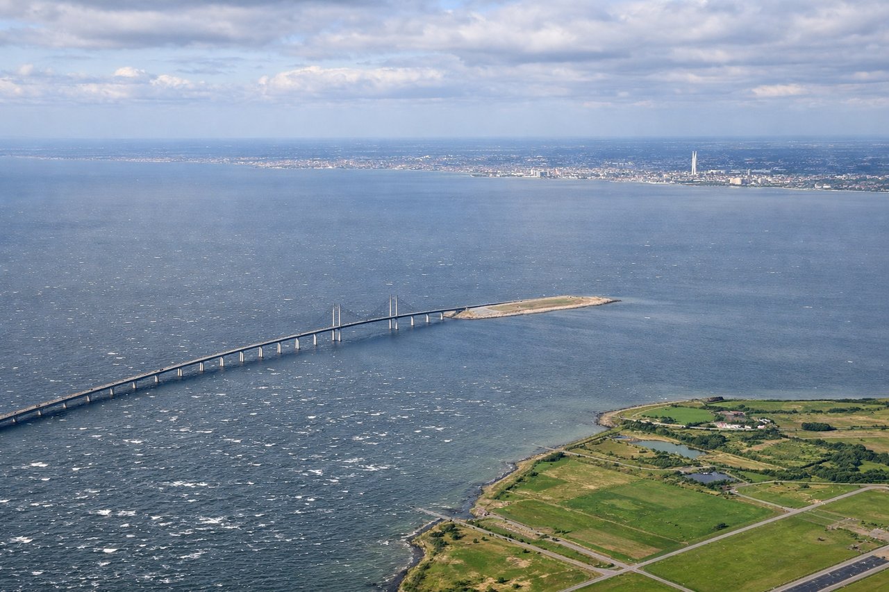
Landing at CPH
LEFTLeft side provides views of the Øresund Strait and the Swedish coast near Malmö during descent into Copenhagen. This geographic landmark clearly marks the final approach corridor and offers distinctive water-and-coastline contrast.
Will your flight be in sunlight?
Pick a date and time in the Sun Map to watch the sun move across your whole flight.
About This Route
Which side of the plane should I sit on flying from Tallinn (TLL) to Kastrup (CPH)?
Sit on the Left side of the plane for the best views on flights from Tallinn to Copenhagen. The left side captures the most geographically significant features: the Gulf of Finland on departure and the Øresund Strait on arrival. Both are major water bodies that define the route's geographic character and provide clear visual orientation.
What can I see during takeoff from Tallinn in Tallinn?
During takeoff from Tallinn (TLL), sit on the Right side for the best views. Right side captures the Gulf of Finland immediately after departure, with Tallinn's Old Town and harbor visible on the left bank. The water body dominates the early climb-out and provides clear geographic context for the southwestward routing. Notable sights include: Gulf of Finland, Tallinn Old Town and medieval spires, Pirita River estuary, Lasnamäe district elevated terrain to the southeast.
What can I see when landing at Kastrup in Copenhagen?
When landing at Kastrup (CPH), sit on the Left side for the best views. Left side provides views of the Øresund Strait and the Swedish coast near Malmö during descent into Copenhagen. This geographic landmark clearly marks the final approach corridor and offers distinctive water-and-coastline contrast. Notable sights include: Øresund Strait, Swedish coast and Malmö region, Amager Island (Copenhagen's southern district), Kastrup airport runways and surrounding flat terrain.
How long is the flight from Tallinn to Copenhagen?
The flight from Tallinn (TLL) to Kastrup (CPH) takes about 1 hour 15 minutes. The shortest flight path between them is 521 miles (839 km); winds and air traffic control usually add a few percent.
What does the Tallinn to Copenhagen flight path pass over?
The flight path crosses the Baltic Sea southwestward, passing over open water with scattered Swedish islands (Gotland region) visible to the left during cruise. The route maintains a consistent heading over the Baltic with no major landmasses in the direct path until the approach to Copenhagen. The Øresund Strait becomes visible approximately 20 minutes before landing, marking the transition from open water to the Danish-Swedish coastal zone.