While the Tampa Bay departure adds a nice coastal moment on the left, the right side wins overall because the Rocky Mountain approach into Denver is the most visually striking part of this flight, offering the Front Range and Pikes Peak as a dramatic close to an otherwise flat cruise.
Flight Path
The cruise track crosses the Florida Panhandle, southern Alabama and Mississippi, the Mississippi River near the Arkansas border, and the flat farmland of Oklahoma and Kansas before the terrain begins rising into the High Plains approaching Colorado.
Great circle distance and headings ›
.jpg?width=600)
Phase by phase
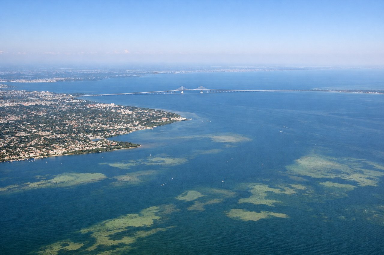
Takeoff from TPA
LEFTDeparting TPA typically sends aircraft out over Tampa Bay before the turn toward the northwest, giving left-side passengers a brief but clear view of the bay, St. Petersburg's skyline, and the Gulf coastline. The right side mostly shows suburban Tampa and flat inland terrain.

Landing at DEN
RIGHTOn approach into DEN from the southeast, the descent and final turn typically expose the Front Range of the Rocky Mountains to the west, giving right-side passengers a dramatic mountain backdrop as the flat plains give way to foothills. The left side mostly faces empty prairie during this phase.
Landmarks on this routeAll landmarks →
Will your flight be in sunlight?
See exactly which side of the plane gets sun and shade at your departure time.
About This Route
Which side of the plane should I sit on flying from Tampa International (TPA) to Denver International (DEN)?
Sit on the Right side of the plane for the best views on flights from Tampa to Denver. While the Tampa Bay departure adds a nice coastal moment on the left, the right side wins overall because the Rocky Mountain approach into Denver is the most visually striking part of this flight, offering the Front Range and Pikes Peak as a dramatic close to an otherwise flat cruise.
What can I see during takeoff from Tampa International in Tampa?
During takeoff from Tampa International (TPA), sit on the Left side for the best views. Departing TPA typically sends aircraft out over Tampa Bay before the turn toward the northwest, giving left-side passengers a brief but clear view of the bay, St. Petersburg's skyline, and the Gulf coastline. The right side mostly shows suburban Tampa and flat inland terrain. Notable sights include: Tampa Bay, St. Petersburg skyline, Sunshine Skyway Bridge, Gulf of Mexico coastline.
What can I see when landing at Denver International in Denver?
When landing at Denver International (DEN), sit on the Right side for the best views. On approach into DEN from the southeast, the descent and final turn typically expose the Front Range of the Rocky Mountains to the west, giving right-side passengers a dramatic mountain backdrop as the flat plains give way to foothills. The left side mostly faces empty prairie during this phase. Notable sights include: Rocky Mountains Front Range, Pikes Peak, Denver skyline, High Plains foothills.
How long is the flight from Tampa to Denver?
The flight from Tampa International (TPA) to Denver International (DEN) takes 3h 40m.
What does the Tampa to Denver flight path pass over?
The cruise track crosses the Florida Panhandle, southern Alabama and Mississippi, the Mississippi River near the Arkansas border, and the flat farmland of Oklahoma and Kansas before the terrain begins rising into the High Plains approaching Colorado.