The Tampa Bay departure offers a genuinely scenic coastal water view, while the rest of the flight over Georgia, Tennessee, and Ohio is flat and unremarkable on both sides, making the left side's takeoff advantage the deciding factor.
Flown TPA to DTW? Did we get it right?
Flight Path
Tampa to Detroit is 985 miles (1,585 km), a flight of about 2 hours 25 minutes.
Flat agricultural land of central Georgia, the Appalachian foothills near eastern Tennessee/Kentucky border seen faintly on the horizon, and the Ohio River valley before crossing into Michigan farmland.
Great circle distance and headings ›Phase by phase
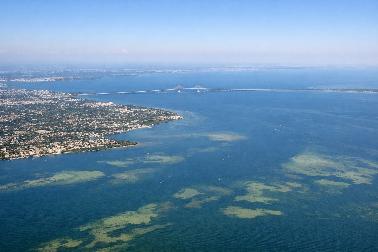
Takeoff from TPA
LEFTDeparting TPA northbound, Tampa Bay and its barrier islands spread out to the west, giving a nice water and shoreline view during the initial climb. The east side mostly shows Tampa's low-rise suburbs and interstate grid.
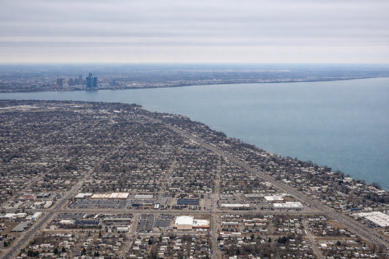
Landing at DTW
RIGHTOn approach into DTW from the south, the descent path curves such that downtown Detroit's skyline and the Detroit River separating the U.S. from Windsor, Ontario become visible on the east side. The west side during final approach shows mostly flat farmland and suburban grids.
Will your flight be in sunlight?
Pick a date and time in the Sun Map to watch the sun move across your whole flight.
About This Route
Which side of the plane should I sit on flying from Tampa International (TPA) to Detroit Metro Wayne Co (DTW)?
Sit on the Left side of the plane for the best views on flights from Tampa to Detroit. The Tampa Bay departure offers a genuinely scenic coastal water view, while the rest of the flight over Georgia, Tennessee, and Ohio is flat and unremarkable on both sides, making the left side's takeoff advantage the deciding factor.
What can I see during takeoff from Tampa International in Tampa?
During takeoff from Tampa International (TPA), sit on the Left side for the best views. Departing TPA northbound, Tampa Bay and its barrier islands spread out to the west, giving a nice water and shoreline view during the initial climb. The east side mostly shows Tampa's low-rise suburbs and interstate grid. Notable sights include: Tampa Bay, Davis Islands, MacDill Peninsula, Gulf of Mexico coastline in the distance.
What can I see when landing at Detroit Metro Wayne Co in Detroit?
When landing at Detroit Metro Wayne Co (DTW), sit on the Right side for the best views. On approach into DTW from the south, the descent path curves such that downtown Detroit's skyline and the Detroit River separating the U.S. from Windsor, Ontario become visible on the east side. The west side during final approach shows mostly flat farmland and suburban grids. Notable sights include: Detroit River, Downtown Detroit skyline, Windsor, Ontario across the river, Lake St. Clair in the distance.
How long is the flight from Tampa to Detroit?
The flight from Tampa International (TPA) to Detroit Metro Wayne Co (DTW) takes about 2 hours 25 minutes. The shortest flight path between them is 985 miles (1,585 km); winds and air traffic control usually add a few percent.
What does the Tampa to Detroit flight path pass over?
Flat agricultural land of central Georgia, the Appalachian foothills near eastern Tennessee/Kentucky border seen faintly on the horizon, and the Ohio River valley before crossing into Michigan farmland.