While takeoff favors the right, the landing approach over Buenos Aires and the Río de la Plata is more visually rewarding and geographically distinctive. The estuary and city grid provide superior views compared to the relatively flat, featureless terrain of central Florida.
Flight Path
Flight path crosses the Caribbean Sea, then the northern coast of South America (visible: Orinoco Delta region, Venezuelan coast if routed north), descends over the Amazon Basin and central Brazil (limited visibility due to cloud cover typical of equatorial regions), crosses the Brazilian plateau, and approaches the Paraná River system before reaching the Río de la Plata basin. Most of the midpoint journey occurs over sparsely populated interior Brazil with few distinctive landmarks visible from cruise altitude due to persistent cloud cover.
Great circle distance and headings ›


_(cropped).jpg?width=600)
Phase by phase
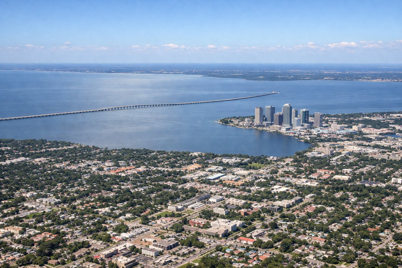
Takeoff from TPA
RIGHTTPA typically departs runways 18L/R or 1L/R depending on wind. Right-side seats offer views of Tampa Bay's eastern shoreline and the city's downtown skyline during initial climb. Left side faces inland terrain with fewer distinctive features.

Landing at EZE
LEFTApproaching EZE typically uses runways 09/27 depending on wind. Left-side seats during descent offer views of the Río de la Plata's western shore, the city of Buenos Aires proper, and the approach path over suburban areas. Right side faces the open estuary with fewer ground features.
Landmarks on this routeAll landmarks →
Will your flight be in sunlight?
See exactly which side of the plane gets sun and shade at your departure time.
About This Route
Which side of the plane should I sit on flying from Tampa International (TPA) to Ezeiza Ministro Pistarini (EZE)?
Sit on the Left side of the plane for the best views on flights from Tampa to Buenos Aires. While takeoff favors the right, the landing approach over Buenos Aires and the Río de la Plata is more visually rewarding and geographically distinctive. The estuary and city grid provide superior views compared to the relatively flat, featureless terrain of central Florida.
What can I see during takeoff from Tampa International in Tampa?
During takeoff from Tampa International (TPA), sit on the Right side for the best views. TPA typically departs runways 18L/R or 1L/R depending on wind. Right-side seats offer views of Tampa Bay's eastern shoreline and the city's downtown skyline during initial climb. Left side faces inland terrain with fewer distinctive features. Notable sights include: Tampa Bay (body of water to the east), Downtown Tampa skyline, Hillsborough River, Gulf of Mexico horizon.
What can I see when landing at Ezeiza Ministro Pistarini in Buenos Aires?
When landing at Ezeiza Ministro Pistarini (EZE), sit on the Left side for the best views. Approaching EZE typically uses runways 09/27 depending on wind. Left-side seats during descent offer views of the Río de la Plata's western shore, the city of Buenos Aires proper, and the approach path over suburban areas. Right side faces the open estuary with fewer ground features. Notable sights include: Río de la Plata (wide estuary), Buenos Aires urban grid, Suburban sprawl south of city, Approach corridor over flat pampas.
How long is the flight from Tampa to Buenos Aires?
The flight from Tampa International (TPA) to Ezeiza Ministro Pistarini (EZE) takes Approximately 8 hours 45 minutes to 9 hours 30 minutes.
What does the Tampa to Buenos Aires flight path pass over?
Flight path crosses the Caribbean Sea, then the northern coast of South America (visible: Orinoco Delta region, Venezuelan coast if routed north), descends over the Amazon Basin and central Brazil (limited visibility due to cloud cover typical of equatorial regions), crosses the Brazilian plateau, and approaches the Paraná River system before reaching the Río de la Plata basin. Most of the midpoint journey occurs over sparsely populated interior Brazil with few distinctive landmarks visible from cruise altitude due to persistent cloud cover.