While the Tampa Bay departure gives the left side a scenic edge at takeoff, the right side wins overall because the southeastern approach into MSP delivers a rare domestic-flight bonus: both downtown skylines and the Mississippi-Minnesota river confluence in one continuous view.
Flown TPA to MSP? Did we get it right?
Flight Path
Tampa to Minneapolis is 1,308 miles (2,105 km), a flight of about 2 hours 55 minutes.
Tennessee River valley near Chattanooga, Land Between the Lakes (Kentucky Lake and Lake Barkley) in western Kentucky, the Ohio River crossing, and the Mississippi River bluff country near La Crosse, Wisconsin as the route nears Minnesota
Great circle distance and headings ›

Phase by phase
Takeoff from TPA
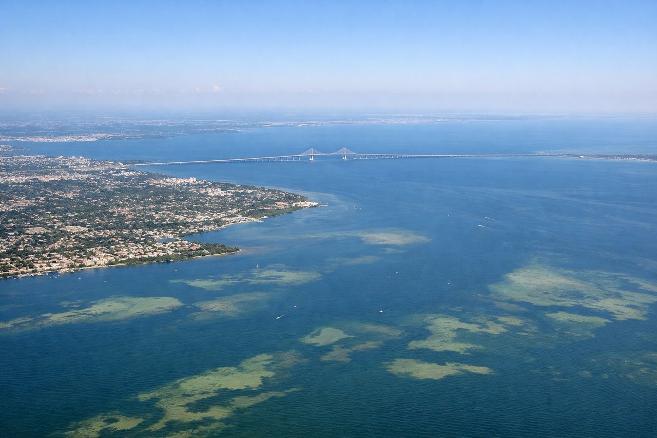
LEFTTPA sits on a peninsula with Old Tampa Bay directly west of the runways, so departing aircraft show the bay, barrier islands, and St. Petersburg skyline across the water on the left, while the right side only offers flat Hillsborough County suburbs.

Landing at MSP
RIGHTArrivals from the south typically approach MSP's parallel runways from the southeast, passing just south of the Twin Cities core, which puts downtown Minneapolis and St. Paul along with the Mississippi-Minnesota river confluence on the right side of the aircraft.
Will your flight be in sunlight?
Pick a date and time in the Sun Map to watch the sun move across your whole flight.
About This Route
Which side of the plane should I sit on flying from Tampa International (TPA) to Minneapolis St Paul International (MSP)?
Sit on the Right side of the plane for the best views on flights from Tampa to Minneapolis. While the Tampa Bay departure gives the left side a scenic edge at takeoff, the right side wins overall because the southeastern approach into MSP delivers a rare domestic-flight bonus: both downtown skylines and the Mississippi-Minnesota river confluence in one continuous view.
What can I see during takeoff from Tampa International in Tampa?
During takeoff from Tampa International (TPA), sit on the Left side for the best views. TPA sits on a peninsula with Old Tampa Bay directly west of the runways, so departing aircraft show the bay, barrier islands, and St. Petersburg skyline across the water on the left, while the right side only offers flat Hillsborough County suburbs. Notable sights include: Old Tampa Bay, St. Petersburg skyline, Gulf of Mexico horizon, Courtney Campbell Causeway.
What can I see when landing at Minneapolis St Paul International in Minneapolis?
When landing at Minneapolis St Paul International (MSP), sit on the Right side for the best views. Arrivals from the south typically approach MSP's parallel runways from the southeast, passing just south of the Twin Cities core, which puts downtown Minneapolis and St. Paul along with the Mississippi-Minnesota river confluence on the right side of the aircraft. Notable sights include: Downtown Minneapolis skyline, downtown St. Paul skyline, Mississippi and Minnesota River confluence, Fort Snelling State Park.
How long is the flight from Tampa to Minneapolis?
The flight from Tampa International (TPA) to Minneapolis St Paul International (MSP) takes about 2 hours 55 minutes. The shortest flight path between them is 1,308 miles (2,105 km); winds and air traffic control usually add a few percent.
What does the Tampa to Minneapolis flight path pass over?
Tennessee River valley near Chattanooga, Land Between the Lakes (Kentucky Lake and Lake Barkley) in western Kentucky, the Ohio River crossing, and the Mississippi River bluff country near La Crosse, Wisconsin as the route nears Minnesota