While takeoff offers good Gulf views, the landing approach into Maui provides more dramatic and distinctive scenery—the volcanic landscape, island topography, and the contrast between ocean and land are more visually compelling than the relatively flat Tampa Bay departure.
Flown TPA to OGG? Did we get it right?
Flight Path
Tampa to Kahului is 4,606 miles (7,413 km), a flight of about 9 hours 10 minutes.
The flight crosses the entire Gulf of Mexico, passing over the Yucatan Peninsula's northern coast (visible as a low, forested landmass), then continues over open ocean. The Yucatan's shallow shelf creates visible color gradations in the water. No major landmarks are visible during the mid-Pacific portion of the flight; the route crosses approximately 1,200 miles of open ocean between the Yucatan and Hawaii.
Great circle distance and headings ›

Phase by phase
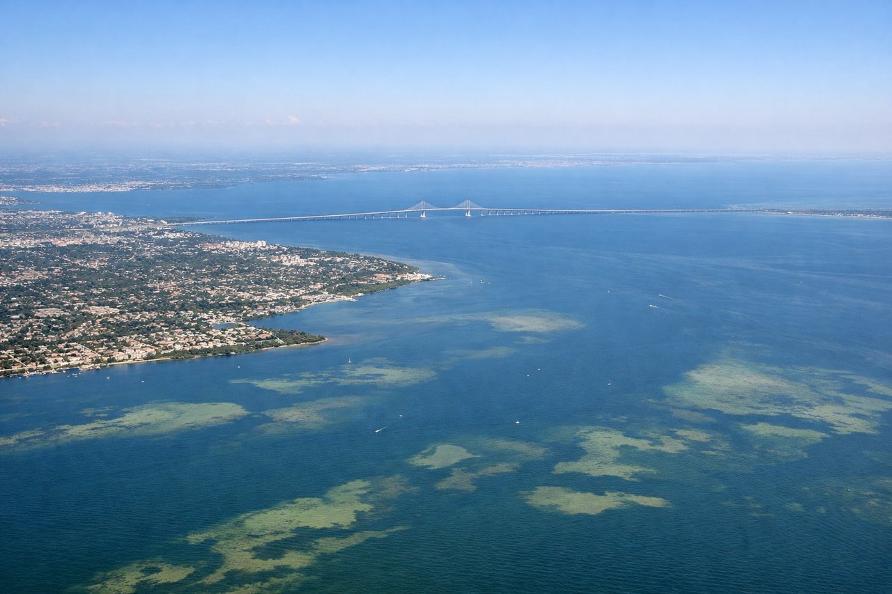
Takeoff from TPA
LEFTLeft side offers views of Tampa Bay and the Gulf of Mexico coastline as the aircraft climbs westward. You'll see the bay's distinctive shape, barrier islands, and the transition from urban Tampa to open water.
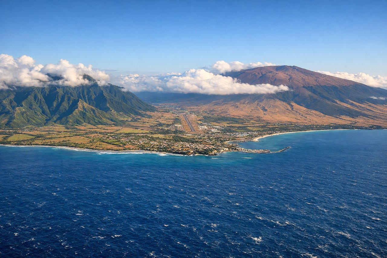
Landing at OGG
RIGHTRight side provides views of the Big Island's windward coast and the West Maui mountains during descent into Kahului. You'll see the dramatic volcanic landscape and the transition from ocean to the island's leeward side where the airport sits.
Will your flight be in sunlight?
Pick a date and time in the Sun Map to watch the sun move across your whole flight.
About This Route
Which side of the plane should I sit on flying from Tampa International (TPA) to Kahului (OGG)?
Sit on the Right side of the plane for the best views on flights from Tampa to Kahului. While takeoff offers good Gulf views, the landing approach into Maui provides more dramatic and distinctive scenery—the volcanic landscape, island topography, and the contrast between ocean and land are more visually compelling than the relatively flat Tampa Bay departure.
What can I see during takeoff from Tampa International in Tampa?
During takeoff from Tampa International (TPA), sit on the Left side for the best views. Left side offers views of Tampa Bay and the Gulf of Mexico coastline as the aircraft climbs westward. You'll see the bay's distinctive shape, barrier islands, and the transition from urban Tampa to open water. Notable sights include: Tampa Bay, Hillsborough Bay, Gulf of Mexico, Pinellas County barrier islands.
What can I see when landing at Kahului in Kahului?
When landing at Kahului (OGG), sit on the Right side for the best views. Right side provides views of the Big Island's windward coast and the West Maui mountains during descent into Kahului. You'll see the dramatic volcanic landscape and the transition from ocean to the island's leeward side where the airport sits. Notable sights include: West Maui mountains (Pu'u Kukui), Kahului Bay, Big Island's Haleakalā volcano, Pacific Ocean.
How long is the flight from Tampa to Kahului?
The flight from Tampa International (TPA) to Kahului (OGG) takes about 9 hours 10 minutes. The shortest flight path between them is 4,606 miles (7,413 km); winds and air traffic control usually add a few percent.
What does the Tampa to Kahului flight path pass over?
The flight crosses the entire Gulf of Mexico, passing over the Yucatan Peninsula's northern coast (visible as a low, forested landmass), then continues over open ocean. The Yucatan's shallow shelf creates visible color gradations in the water. No major landmarks are visible during the mid-Pacific portion of the flight; the route crosses approximately 1,200 miles of open ocean between the Yucatan and Hawaii.