Right-side seats capture the most dramatic scenery: the full Tampa Bay departure over water and the Caribbean Sea crossing. While left seats offer canal views on descent, the right side provides more continuous scenic interest across the entire flight path.
Flown TPA to PAC? Did we get it right?
Flight Path
Tampa to Panama City is 1,327 miles (2,136 km), a flight of about 3 hours 15 minutes.
The flight path crosses the Yucatan Channel between Cuba and Mexico's Yucatan Peninsula, then continues southeast over the Caribbean Sea. At cruise altitude (around 30,000 feet), the Yucatan Peninsula's flat limestone platform and the Caribbean's deep blue waters dominate the midpoint. The Cayman Islands may be visible on clear days as small dark specks in the turquoise water. As the aircraft approaches Central America, the mountainous spine of Honduras and Nicaragua becomes visible on the horizon, followed by the Costa Rican highlands before descending into Panama.
Great circle distance and headings ›Phase by phase
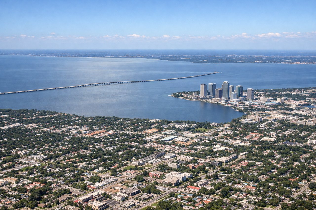
Takeoff from TPA
RIGHTRight-side seats offer views of Tampa Bay and the Gulf of Mexico as the aircraft climbs out over water. The bay's distinctive shape and coastal geography are clearly visible during the initial climb phase.
Landing at PAC
LEFTLeft-side seats provide views of the Panama Canal approach and the Gatun Lake system during descent. The canal's locks and the surrounding tropical landscape are visible on approach to Marcos A Gelabert, which lies west of the canal.
Will your flight be in sunlight?
Pick a date and time in the Sun Map to watch the sun move across your whole flight.
About This Route
Which side of the plane should I sit on flying from Tampa International (TPA) to Marcos A Gelabert International (PAC)?
Sit on the Right side of the plane for the best views on flights from Tampa to Panama City. Right-side seats capture the most dramatic scenery: the full Tampa Bay departure over water and the Caribbean Sea crossing. While left seats offer canal views on descent, the right side provides more continuous scenic interest across the entire flight path.
What can I see during takeoff from Tampa International in Tampa?
During takeoff from Tampa International (TPA), sit on the Right side for the best views. Right-side seats offer views of Tampa Bay and the Gulf of Mexico as the aircraft climbs out over water. The bay's distinctive shape and coastal geography are clearly visible during the initial climb phase. Notable sights include: Tampa Bay, Hillsborough Bay, Gulf of Mexico, Clearwater Beach barrier islands.
What can I see when landing at Marcos A Gelabert International in Panama City?
When landing at Marcos A Gelabert International (PAC), sit on the Left side for the best views. Left-side seats provide views of the Panama Canal approach and the Gatun Lake system during descent. The canal's locks and the surrounding tropical landscape are visible on approach to Marcos A Gelabert, which lies west of the canal. Notable sights include: Gatun Lake, Panama Canal locks, Chagres River valley, Darien Gap forest canopy.
How long is the flight from Tampa to Panama City?
The flight from Tampa International (TPA) to Marcos A Gelabert International (PAC) takes about 3 hours 15 minutes. The shortest flight path between them is 1,327 miles (2,136 km); winds and air traffic control usually add a few percent.
What does the Tampa to Panama City flight path pass over?
The flight path crosses the Yucatan Channel between Cuba and Mexico's Yucatan Peninsula, then continues southeast over the Caribbean Sea. At cruise altitude (around 30,000 feet), the Yucatan Peninsula's flat limestone platform and the Caribbean's deep blue waters dominate the midpoint. The Cayman Islands may be visible on clear days as small dark specks in the turquoise water. As the aircraft approaches Central America, the mountainous spine of Honduras and Nicaragua becomes visible on the horizon, followed by the Costa Rican highlands before descending into Panama.