The left side captures Taiwan's mountainous departure, occasional glimpses of the North Pacific coastal terrain (Aleutians, Gulf of Alaska, Pacific Northwest coastline) as the great-circle route curves down toward California, and a mountain- and skyline-rich approach into LAX. The right side is dominated by open ocean for nearly the entire flight with little landmark variety.
Flight Path
The great-circle routing arcs north from Taiwan past southern Japan, then across the North Pacific near the Aleutian Islands and Gulf of Alaska before descending along the British Columbia, Washington, and Oregon coastlines toward California — mostly open ocean with occasional distant coastal mountains visible on the left in clear conditions.
Great circle distance and headings ›
.jpg?width=600)
Phase by phase
Takeoff from TPE
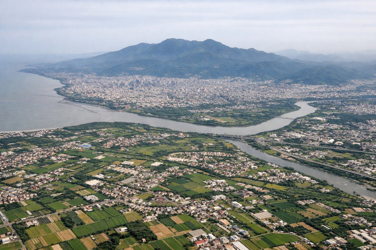
LEFTTPE's favored takeoff runway sends departures climbing southwest down Taiwan's western coastal plain, putting the island's interior on the left. Passengers see the green foothills of the Xueshan (Snow Mountain) range and the patchwork of rice paddies and tea terraces around Taoyuan and Hsinchu, while the right side only shows the flat Taiwan Strait.
Landing at LAX
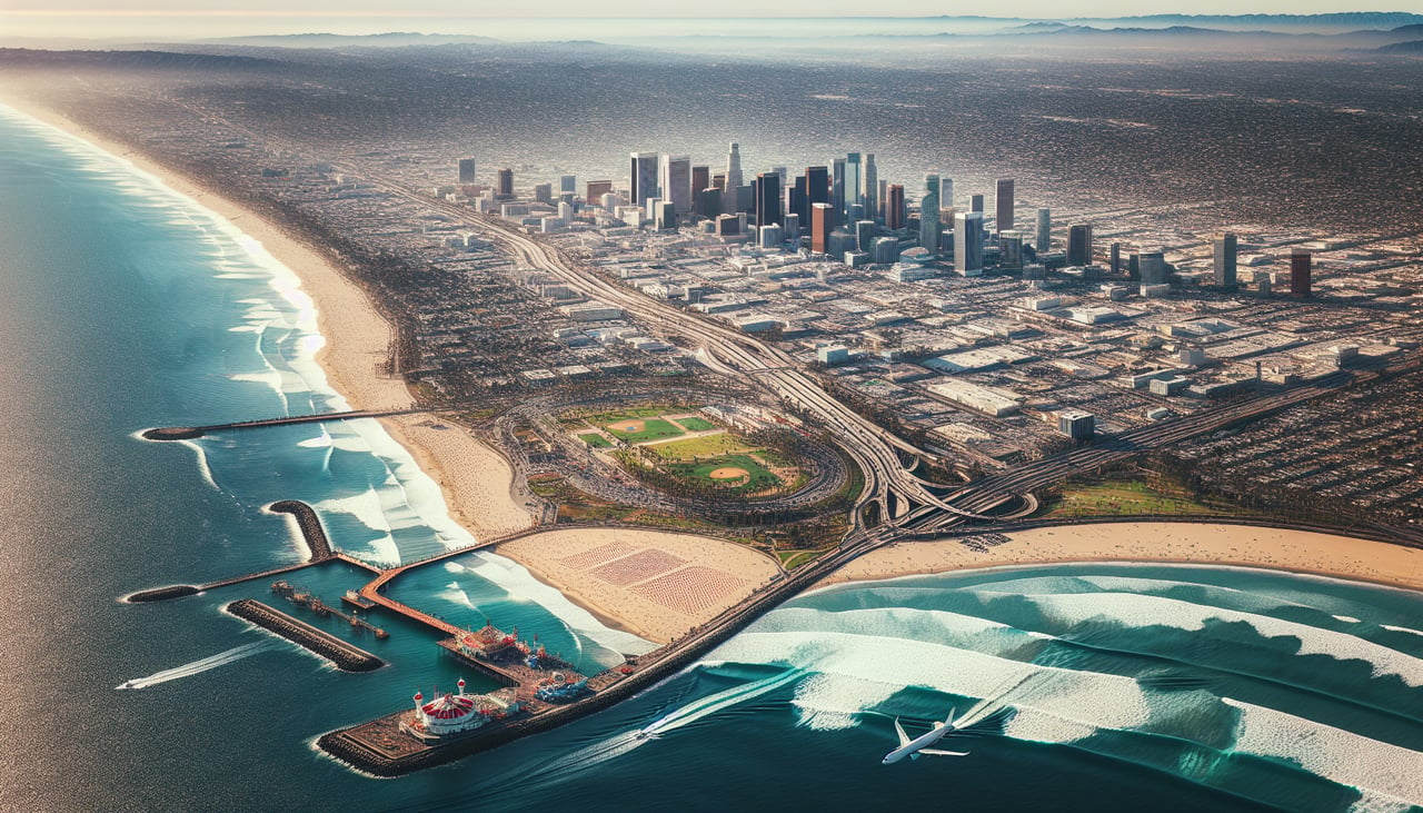
LEFTArriving into LAX from the north along the West Coast, the aircraft typically swings over the Los Angeles basin before turning onto final approach, putting the San Gabriel Mountains and the Downtown LA skyline on the left. The right side mostly faces open ocean and the flat South Bay coastline with fewer distinct landmarks.
Landmarks on this routeAll landmarks →
Will your flight be in sunlight?
See exactly which side of the plane gets sun and shade at your departure time.
About This Route
Which side of the plane should I sit on flying from Chiang Kai Shek International (TPE) to Los Angeles International (LAX)?
Sit on the Left side of the plane for the best views on flights from Taipei to Los Angeles. The left side captures Taiwan's mountainous departure, occasional glimpses of the North Pacific coastal terrain (Aleutians, Gulf of Alaska, Pacific Northwest coastline) as the great-circle route curves down toward California, and a mountain- and skyline-rich approach into LAX. The right side is dominated by open ocean for nearly the entire flight with little landmark variety.
What can I see during takeoff from Chiang Kai Shek International in Taipei?
During takeoff from Chiang Kai Shek International (TPE), sit on the Left side for the best views. TPE's favored takeoff runway sends departures climbing southwest down Taiwan's western coastal plain, putting the island's interior on the left. Passengers see the green foothills of the Xueshan (Snow Mountain) range and the patchwork of rice paddies and tea terraces around Taoyuan and Hsinchu, while the right side only shows the flat Taiwan Strait. Notable sights include: Xueshan (Snow Mountain) foothills, Taoyuan farmland and wetlands, Hsinchu hills, Taiwan Strait coastline visible in the distance.
What can I see when landing at Los Angeles International in Los Angeles?
When landing at Los Angeles International (LAX), sit on the Left side for the best views. Arriving into LAX from the north along the West Coast, the aircraft typically swings over the Los Angeles basin before turning onto final approach, putting the San Gabriel Mountains and the Downtown LA skyline on the left. The right side mostly faces open ocean and the flat South Bay coastline with fewer distinct landmarks. Notable sights include: San Gabriel Mountains, Downtown Los Angeles skyline, Hollywood Hills/Griffith Park, Santa Monica Bay coastline in the distance.
How long is the flight from Taipei to Los Angeles?
The flight from Chiang Kai Shek International (TPE) to Los Angeles International (LAX) takes 11h 50m.
What does the Taipei to Los Angeles flight path pass over?
The great-circle routing arcs north from Taiwan past southern Japan, then across the North Pacific near the Aleutian Islands and Gulf of Alaska before descending along the British Columbia, Washington, and Oregon coastlines toward California — mostly open ocean with occasional distant coastal mountains visible on the left in clear conditions.