Although the right side wins both the Taipei departure and Phoenix arrival, the long transpacific cruise phase favors the left side, which faces the string of Japanese islands, the volcanic Alaska Peninsula and Aleutian arc, and the snow-capped coastal ranges of British Columbia and the northern Rockies before the descent into Arizona. The right side, by contrast, faces almost uninterrupted open Pacific for most of the roughly 12-hour cruise.
Flown TPE to PHX? Did we get it right?
Flight Path
Taipei to Phoenix is 7,092 miles (11,413 km), a flight of about 12 hours 15 minutes.
Southern Japan (Kyushu/Shikoku coastline), the North Pacific Ocean, the Alaska Peninsula and Aleutian Islands, and the coastal mountains of British Columbia before the route curves south over the Rockies and Great Basin toward Arizona
Great circle distance and headings ›


Phase by phase

Takeoff from TPE
RIGHTDeparting TPE on the northeast-facing runway, the right side looks out over the Taipei Basin, catching the city skyline, the volcanic cones of Yangmingshan National Park, and the Keelung coastline before the aircraft heads out over open water. The left side mostly shows the flatter Taoyuan coastal plain and the Taiwan Strait.
Landing at PHX
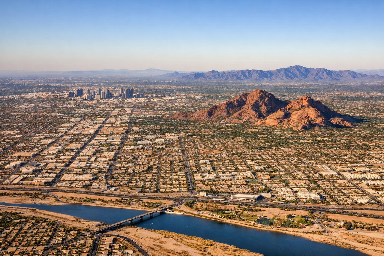
RIGHTOn approach into PHX from the north, the right side faces the jagged Superstition Mountains during the turn onto final, then sweeps past Camelback Mountain and the downtown Phoenix skyline as the aircraft lines up on the westbound runway. The left side mostly shows the flatter southern desert and South Mountain Park with less contrast.
Will your flight be in sunlight?
Pick a date and time in the Sun Map to watch the sun move across your whole flight.
About This Route
Which side of the plane should I sit on flying from Chiang Kai Shek International (TPE) to Phoenix Sky Harbor International (PHX)?
Sit on the Left side of the plane for the best views on flights from Taipei to Phoenix. Although the right side wins both the Taipei departure and Phoenix arrival, the long transpacific cruise phase favors the left side, which faces the string of Japanese islands, the volcanic Alaska Peninsula and Aleutian arc, and the snow-capped coastal ranges of British Columbia and the northern Rockies before the descent into Arizona. The right side, by contrast, faces almost uninterrupted open Pacific for most of the roughly 12-hour cruise.
What can I see during takeoff from Chiang Kai Shek International in Taipei?
During takeoff from Chiang Kai Shek International (TPE), sit on the Right side for the best views. Departing TPE on the northeast-facing runway, the right side looks out over the Taipei Basin, catching the city skyline, the volcanic cones of Yangmingshan National Park, and the Keelung coastline before the aircraft heads out over open water. The left side mostly shows the flatter Taoyuan coastal plain and the Taiwan Strait. Notable sights include: Taipei skyline, Yangmingshan volcanic peaks, Keelung coastline, East China Sea.
What can I see when landing at Phoenix Sky Harbor International in Phoenix?
When landing at Phoenix Sky Harbor International (PHX), sit on the Right side for the best views. On approach into PHX from the north, the right side faces the jagged Superstition Mountains during the turn onto final, then sweeps past Camelback Mountain and the downtown Phoenix skyline as the aircraft lines up on the westbound runway. The left side mostly shows the flatter southern desert and South Mountain Park with less contrast. Notable sights include: Superstition Mountains, Camelback Mountain, Piestewa Peak, Phoenix downtown skyline.
How long is the flight from Taipei to Phoenix?
The flight from Chiang Kai Shek International (TPE) to Phoenix Sky Harbor International (PHX) takes about 12 hours 15 minutes. The shortest flight path between them is 7,092 miles (11,413 km); winds and air traffic control usually add a few percent.
What does the Taipei to Phoenix flight path pass over?
Southern Japan (Kyushu/Shikoku coastline), the North Pacific Ocean, the Alaska Peninsula and Aleutian Islands, and the coastal mountains of British Columbia before the route curves south over the Rockies and Great Basin toward Arizona