The right side offers a more consistent narrative: the flight path crosses central Vietnam's coastline near the Annamite foothills mid-route, and the Bangkok approach reveals the Chao Phraya delta's river bends and suburban texture, while the left side is dominated by long stretches of open South China Sea with little variation.
Flown TSA to BKK? Did we get it right?
Flight Path
Taipei to Bangkok is 1,564 miles (2,518 km), a flight of about 3 hours 35 minutes.
South China Sea, the central Vietnamese coastline near the Annamite Range foothills, and the Mekong lowlands of Cambodia before descending into Thailand's central plain
Great circle distance and headings ›Phase by phase
Takeoff from TSA
LEFTDeparting Sungshan, the initial climb passes directly over the Keelung River and Taipei's Xinyi district, with Taipei 101 briefly visible below. As the aircraft turns south, Taiwan's Central Mountain Range rises into view on the left, giving a quick but genuine mountain backdrop before heading out over water.
Landing at BKK
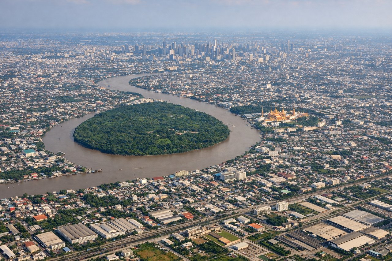
RIGHTOn approach into Suvarnabhumi from the north, the descent path crosses the Chao Phraya River delta, with its winding brown channel and dense grid of Bangkok's outer suburbs visible on the right side as the aircraft lines up for a north-south runway. The flat, water-laced landscape is more visually structured on this side than the featureless paddies to the left.
Will your flight be in sunlight?
Pick a date and time in the Sun Map to watch the sun move across your whole flight.
About This Route
Which side of the plane should I sit on flying from Sungshan (TSA) to Suvarnabhumi Airport (BKK)?
Sit on the Right side of the plane for the best views on flights from Taipei to Bangkok. The right side offers a more consistent narrative: the flight path crosses central Vietnam's coastline near the Annamite foothills mid-route, and the Bangkok approach reveals the Chao Phraya delta's river bends and suburban texture, while the left side is dominated by long stretches of open South China Sea with little variation.
What can I see during takeoff from Sungshan in Taipei?
During takeoff from Sungshan (TSA), sit on the Left side for the best views. Departing Sungshan, the initial climb passes directly over the Keelung River and Taipei's Xinyi district, with Taipei 101 briefly visible below. As the aircraft turns south, Taiwan's Central Mountain Range rises into view on the left, giving a quick but genuine mountain backdrop before heading out over water. Notable sights include: Taipei 101 and Xinyi skyline, Keelung River, Central Mountain Range peaks, Taiwan Strait coastline.
What can I see when landing at Suvarnabhumi Airport in Bangkok?
When landing at Suvarnabhumi Airport (BKK), sit on the Right side for the best views. On approach into Suvarnabhumi from the north, the descent path crosses the Chao Phraya River delta, with its winding brown channel and dense grid of Bangkok's outer suburbs visible on the right side as the aircraft lines up for a north-south runway. The flat, water-laced landscape is more visually structured on this side than the featureless paddies to the left. Notable sights include: Chao Phraya River bends, Bangkok's eastern suburbs, aquaculture ponds and canals, distant Bangkok skyline.
How long is the flight from Taipei to Bangkok?
The flight from Sungshan (TSA) to Suvarnabhumi Airport (BKK) takes about 3 hours 35 minutes. The shortest flight path between them is 1,564 miles (2,518 km); winds and air traffic control usually add a few percent.
What does the Taipei to Bangkok flight path pass over?
South China Sea, the central Vietnamese coastline near the Annamite Range foothills, and the Mekong lowlands of Cambodia before descending into Thailand's central plain