Left side wins both ends of the flight. The Andes volcanic scenery on departure is the highlight of the entire route, and the Atlanta skyline approach on the same side seals it. During the cruise over Colombia, Venezuela, and the Caribbean, the left side also tracks closer to the Colombian Andes and the Caribbean coastline.
Flight Path
The route tracks northeast over the Colombian Andes (left side views of the Cordillera Oriental), then crosses the Venezuelan llanos flatlands, exits South America near the Caribbean coast of Venezuela or Trinidad, crosses the Caribbean Sea, enters the Gulf of Mexico or passes over Cuba and the Florida Straits, then tracks northwest over Florida and Georgia toward Atlanta. The Caribbean crossing offers open blue water views on both sides mid-flight.
Great circle distance and headings ›


.jpeg?width=600)
Phase by phase

Takeoff from UIO
LEFTQuito's runway 18 departure (southbound) puts the left side facing east toward the Andes volcanic chain. You get a direct broadside view of Cotopaxi and the Avenue of the Volcanoes as the aircraft climbs and turns northeast. The right side faces west toward the lower coastal plain with far less drama.
Landing at ATL
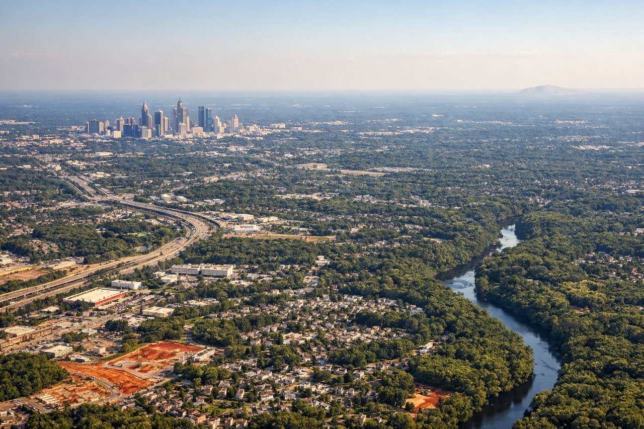
LEFTAtlanta's primary arrival from the south on runways 26L/26R or 27L/27R puts the left side facing south over the Atlanta metro sprawl and downtown skyline. The left seat gets the clearest view of the downtown cluster of skyscrapers and the dense urban grid on final approach. Right side faces north toward suburban sprawl with less visual interest.
Landmarks on this routeAll landmarks →
Will your flight be in sunlight?
See exactly which side of the plane gets sun and shade at your departure time.
About This Route
Which side of the plane should I sit on flying from Mariscal Sucre International Airport (UIO) to The William B Hartsfield Atlanta International (ATL)?
Sit on the Left side of the plane for the best views on flights from Quito to Atlanta. Left side wins both ends of the flight. The Andes volcanic scenery on departure is the highlight of the entire route, and the Atlanta skyline approach on the same side seals it. During the cruise over Colombia, Venezuela, and the Caribbean, the left side also tracks closer to the Colombian Andes and the Caribbean coastline.
What can I see during takeoff from Mariscal Sucre International Airport in Quito?
During takeoff from Mariscal Sucre International Airport (UIO), sit on the Left side for the best views. Quito's runway 18 departure (southbound) puts the left side facing east toward the Andes volcanic chain. You get a direct broadside view of Cotopaxi and the Avenue of the Volcanoes as the aircraft climbs and turns northeast. The right side faces west toward the lower coastal plain with far less drama. Notable sights include: Cotopaxi volcano (18,405 ft, snow-capped cone), Pichincha volcano directly west of Quito, the Avenue of the Volcanoes corridor stretching south, Quito's urban grid in the valley below during initial climb.
What can I see when landing at The William B Hartsfield Atlanta International in Atlanta?
When landing at The William B Hartsfield Atlanta International (ATL), sit on the Left side for the best views. Atlanta's primary arrival from the south on runways 26L/26R or 27L/27R puts the left side facing south over the Atlanta metro sprawl and downtown skyline. The left seat gets the clearest view of the downtown cluster of skyscrapers and the dense urban grid on final approach. Right side faces north toward suburban sprawl with less visual interest. Notable sights include: Atlanta downtown skyline cluster (Peachtree Street corridor), Stone Mountain visible to the northeast on clear days, Lake Lanier to the north, the dense I-285 perimeter highway ring visible as a concrete loop around the metro.
How long is the flight from Quito to Atlanta?
The flight from Mariscal Sucre International Airport (UIO) to The William B Hartsfield Atlanta International (ATL) takes Approximately 5 hours 30 minutes to 6 hours.
What does the Quito to Atlanta flight path pass over?
The route tracks northeast over the Colombian Andes (left side views of the Cordillera Oriental), then crosses the Venezuelan llanos flatlands, exits South America near the Caribbean coast of Venezuela or Trinidad, crosses the Caribbean Sea, enters the Gulf of Mexico or passes over Cuba and the Florida Straits, then tracks northwest over Florida and Georgia toward Atlanta. The Caribbean crossing offers open blue water views on both sides mid-flight.