Left side wins both ends of the flight. During the Andean departure you get Pichincha and the dramatic valley scenery, and on approach into Houston you get the Ship Channel industrial complex and downtown skyline. The right side offers less distinctive terrain at both ends.
Flown UIO to IAH? Did we get it right?
Flight Path
Quito to Houston is 2,362 miles (3,801 km), a flight of about 5 hours 45 minutes.
After leaving the Andes, the flight crosses the Colombian and Venezuelan llanos (vast flat grasslands), then the Caribbean Sea near the Venezuelan or Colombian coast. Over the Gulf of Mexico the view is open water for roughly 90 minutes. The Yucatán Peninsula may be visible below depending on routing, and the Texas coastline and Galveston Bay signal the final descent into Houston.
Great circle distance and headings ›

Phase by phase

Takeoff from UIO
LEFTMariscal Sucre typically departs on runway 18 heading south, then turns north. Left-side passengers get the Pichincha volcano complex directly off the wing as the aircraft climbs out of the valley. The Quito city bowl and the dramatic western Andean escarpment dropping toward the Pacific lowlands are clearly visible on the left.
Landing at IAH
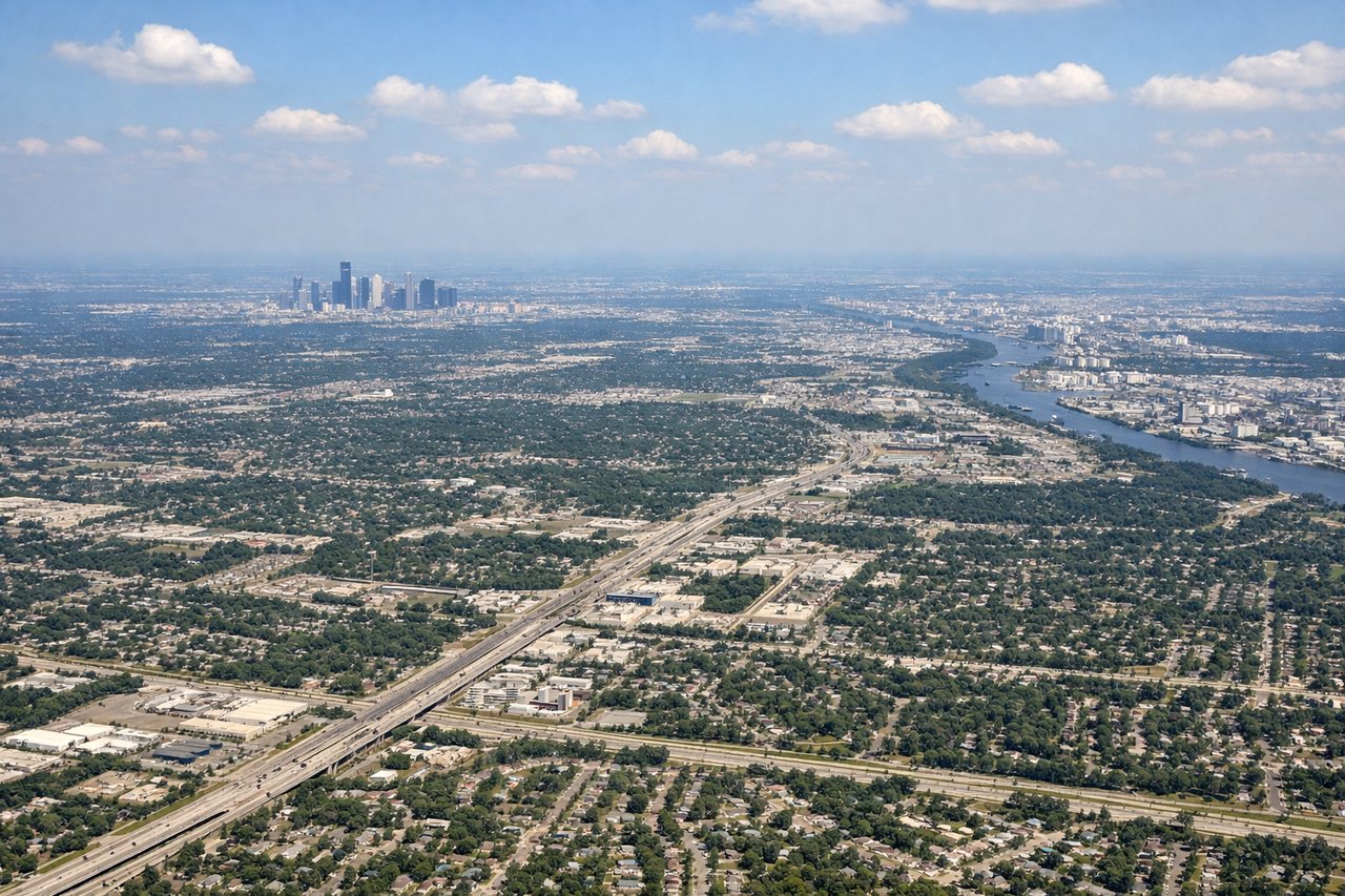
LEFTIAH typically lands on runways 26L/26R or 27 heading west, meaning the approach comes from the east over the Houston metro. Left-side passengers look south over downtown Houston, the Ship Channel, and the sprawling refinery complex along the Houston Ship Channel — some of the most visually distinctive industrial geography in the US.
Will your flight be in sunlight?
Pick a date and time in the Sun Map to watch the sun move across your whole flight.
About This Route
Which side of the plane should I sit on flying from Mariscal Sucre International Airport (UIO) to George Bush Intcntl Houston (IAH)?
Sit on the Left side of the plane for the best views on flights from Quito to Houston. Left side wins both ends of the flight. During the Andean departure you get Pichincha and the dramatic valley scenery, and on approach into Houston you get the Ship Channel industrial complex and downtown skyline. The right side offers less distinctive terrain at both ends.
What can I see during takeoff from Mariscal Sucre International Airport in Quito?
During takeoff from Mariscal Sucre International Airport (UIO), sit on the Left side for the best views. Mariscal Sucre typically departs on runway 18 heading south, then turns north. Left-side passengers get the Pichincha volcano complex directly off the wing as the aircraft climbs out of the valley. The Quito city bowl and the dramatic western Andean escarpment dropping toward the Pacific lowlands are clearly visible on the left. Notable sights include: Volcán Pichincha (4,784m) with its twin peaks Guagua and Rucu, the Quito urban valley stretching south, the western Andean cordillera dropping sharply toward the coastal plain, Cayambe volcano visible to the northeast as the aircraft turns.
What can I see when landing at George Bush Intcntl Houston in Houston?
When landing at George Bush Intcntl Houston (IAH), sit on the Left side for the best views. IAH typically lands on runways 26L/26R or 27 heading west, meaning the approach comes from the east over the Houston metro. Left-side passengers look south over downtown Houston, the Ship Channel, and the sprawling refinery complex along the Houston Ship Channel — some of the most visually distinctive industrial geography in the US. Notable sights include: Downtown Houston skyline, Houston Ship Channel and refinery row, Galveston Bay visible to the south, Lake Houston to the northeast.
How long is the flight from Quito to Houston?
The flight from Mariscal Sucre International Airport (UIO) to George Bush Intcntl Houston (IAH) takes about 5 hours 45 minutes. The shortest flight path between them is 2,362 miles (3,801 km); winds and air traffic control usually add a few percent.
What does the Quito to Houston flight path pass over?
After leaving the Andes, the flight crosses the Colombian and Venezuelan llanos (vast flat grasslands), then the Caribbean Sea near the Venezuelan or Colombian coast. Over the Gulf of Mexico the view is open water for roughly 90 minutes. The Yucatán Peninsula may be visible below depending on routing, and the Texas coastline and Galveston Bay signal the final descent into Houston.