Ulan Bator to Tokyo is 1,902 miles (3,061 km), a flight of about 4 hours 15 minutes.
Right-side seats capture the most dramatic scenery during takeoff from Ulan Bator (Khangai Mountains and river valleys), while left-side seats dominate the landing approach into Tokyo (Mount Fuji and Tokyo Bay). However, the takeoff segment offers more sustained and varied terrain viewing, making right the overall preference for this route.
Flight Path
The flight path crosses the Korea Strait and passes over the Japanese island of Honshu. Notable midpoint features include the Sea of Japan (visible on both sides depending on exact routing), the Korean Peninsula's eastern coastline (if visible during the southern leg), and the transition from Mongolian steppe to Japanese mountainous terrain. The aircraft typically cruises at 33,000–35,000 feet over open water, limiting landmark visibility in the middle segment, but the descent into Japanese airspace reveals the Izu Peninsula, Sagami Bay, and the Kanto Plain's dense urban development.
Great circle distance and headings ›Phase by phase
Takeoff from ULN
RIGHTRight-side seats offer views of the Khangai Mountains and Tuul River valley as the aircraft climbs southeastward from Ulan Bator. The terrain transitions from urban sprawl to rolling steppe with visible river systems.
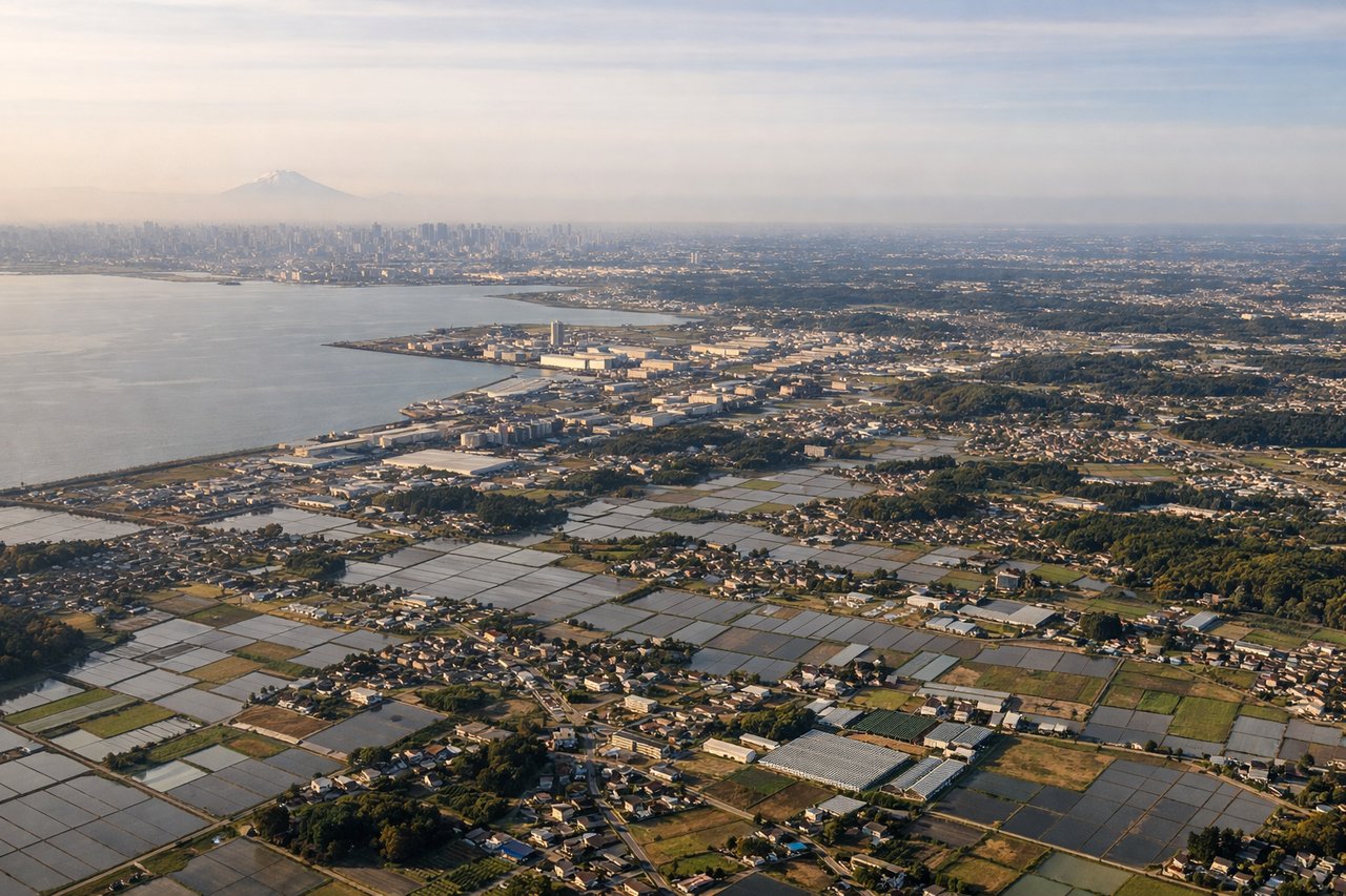
Landing at NRT
LEFTLeft-side seats provide views of Tokyo Bay, the Kanto Plain, and Mount Fuji during descent into Narita. The approach from the northeast offers clear sightlines to Japan's most iconic geography and the sprawling Tokyo metropolitan area.
Landmarks on this routeAll landmarks →
Will your flight be in sunlight?
Pick a date and time in the Sun Map to watch the sun move across your whole flight.
About This Route
Which side of the plane should I sit on flying from Buyant Ukhaa (ULN) to New Tokyo International (NRT)?
Sit on the Right side of the plane for the best views on flights from Ulan Bator to Tokyo. Right-side seats capture the most dramatic scenery during takeoff from Ulan Bator (Khangai Mountains and river valleys), while left-side seats dominate the landing approach into Tokyo (Mount Fuji and Tokyo Bay). However, the takeoff segment offers more sustained and varied terrain viewing, making right the overall preference for this route.
What can I see during takeoff from Buyant Ukhaa in Ulan Bator?
During takeoff from Buyant Ukhaa (ULN), sit on the Right side for the best views. Right-side seats offer views of the Khangai Mountains and Tuul River valley as the aircraft climbs southeastward from Ulan Bator. The terrain transitions from urban sprawl to rolling steppe with visible river systems. Notable sights include: Khangai Mountains (southwest), Tuul River valley (south), Ulan Bator urban grid (north), steppe grasslands extending east.
What can I see when landing at New Tokyo International in Tokyo?
When landing at New Tokyo International (NRT), sit on the Left side for the best views. Left-side seats provide views of Tokyo Bay, the Kanto Plain, and Mount Fuji during descent into Narita. The approach from the northeast offers clear sightlines to Japan's most iconic geography and the sprawling Tokyo metropolitan area. Notable sights include: Mount Fuji (southwest, visible on clear days), Tokyo Bay (south), Kanto Plain urban grid (west), Boso Peninsula (southeast).
How long is the flight from Ulan Bator to Tokyo?
The flight from Buyant Ukhaa (ULN) to New Tokyo International (NRT) takes about 4 hours 15 minutes. The shortest flight path between them is 1,902 miles (3,061 km); winds and air traffic control usually add a few percent.
What does the Ulan Bator to Tokyo flight path pass over?
The flight path crosses the Korea Strait and passes over the Japanese island of Honshu. Notable midpoint features include the Sea of Japan (visible on both sides depending on exact routing), the Korean Peninsula's eastern coastline (if visible during the southern leg), and the transition from Mongolian steppe to Japanese mountainous terrain. The aircraft typically cruises at 33,000–35,000 feet over open water, limiting landmark visibility in the middle segment, but the descent into Japanese airspace reveals the Izu Peninsula, Sagami Bay, and the Kanto Plain's dense urban development.