Tokyo to Ulan Bator is 1,902 miles (3,061 km), a flight of about 4 hours 30 minutes.
The right seat wins overall because the Bogd Khan Uul on approach to Ulaanbaatar is one of the more dramatic arrival views in the region, and during the cruise the right side tracks closer to the Mongolian steppe and the southern edge of the Gobi transition zone. The takeoff left-side advantage is real but modest — Tokyo Bay is impressive but the city is quickly left behind.
Flight Path
The route crosses the Yellow Sea shortly after departure, then tracks over northeastern China through Liaoning and Inner Mongolia provinces. The landscape transitions from the densely populated North China Plain to the increasingly arid Mongolian Plateau. The Gobi Desert's southern fringe becomes visible as the terrain turns from brown agricultural land to open sandy steppe. The Khangai mountain foothills appear on the right side in the final hour before descent into Ulaanbaatar.
Great circle distance and headings ›Phase by phase
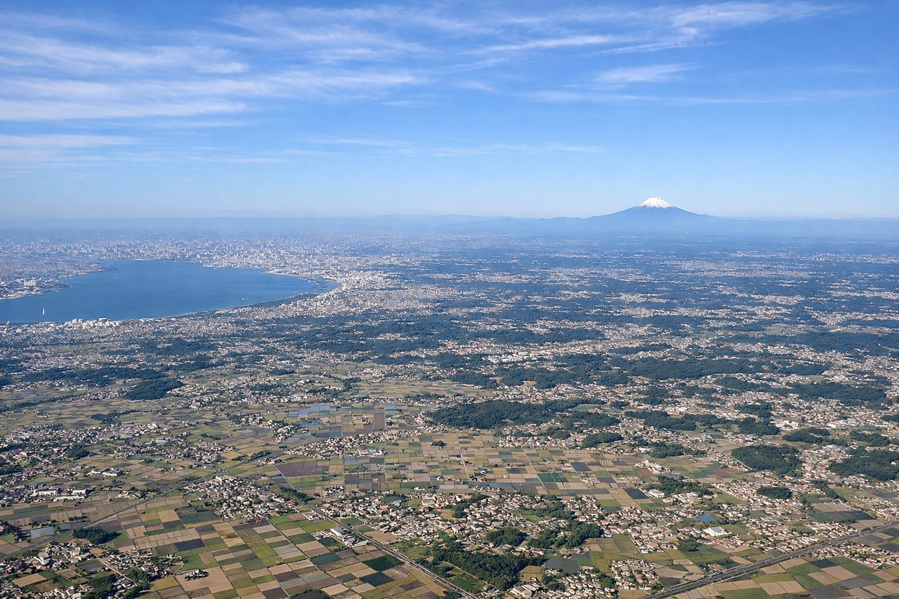
Takeoff from NRT
LEFTNRT typically departs on runways 16R/16L heading south, then aircraft turn westward toward the route. A left seat gives you views over Tokyo Bay and the urban sprawl of Greater Tokyo as you climb out and bank right. You can pick out the bay's distinctive shape and the dense grid of the Kanto Plain before heading northwest.
Landing at ULN
RIGHTBuyant Ukhaa Airport typically lands on runway 32, approaching from the southeast over the Tuul River valley. A right seat on approach gives you a clear view of the Bogd Khan Uul mountain range rising sharply south of Ulaanbaatar, a distinctive forested ridge that frames the city. The Tuul River's meandering course through the valley is also visible on the right side.
Landmarks on this routeAll landmarks →
Will your flight be in sunlight?
Pick a date and time in the Sun Map to watch the sun move across your whole flight.
About This Route
Which side of the plane should I sit on flying from New Tokyo International (NRT) to Buyant Ukhaa (ULN)?
Sit on the Right side of the plane for the best views on flights from Tokyo to Ulan Bator. The right seat wins overall because the Bogd Khan Uul on approach to Ulaanbaatar is one of the more dramatic arrival views in the region, and during the cruise the right side tracks closer to the Mongolian steppe and the southern edge of the Gobi transition zone. The takeoff left-side advantage is real but modest — Tokyo Bay is impressive but the city is quickly left behind.
What can I see during takeoff from New Tokyo International in Tokyo?
During takeoff from New Tokyo International (NRT), sit on the Left side for the best views. NRT typically departs on runways 16R/16L heading south, then aircraft turn westward toward the route. A left seat gives you views over Tokyo Bay and the urban sprawl of Greater Tokyo as you climb out and bank right. You can pick out the bay's distinctive shape and the dense grid of the Kanto Plain before heading northwest. Notable sights include: Tokyo Bay, Kanto Plain urban grid, Chiba coastline, distant Boso Peninsula.
What can I see when landing at Buyant Ukhaa in Ulan Bator?
When landing at Buyant Ukhaa (ULN), sit on the Right side for the best views. Buyant Ukhaa Airport typically lands on runway 32, approaching from the southeast over the Tuul River valley. A right seat on approach gives you a clear view of the Bogd Khan Uul mountain range rising sharply south of Ulaanbaatar, a distinctive forested ridge that frames the city. The Tuul River's meandering course through the valley is also visible on the right side. Notable sights include: Bogd Khan Uul mountain range, Tuul River valley, Ulaanbaatar city center, surrounding steppe.
How long is the flight from Tokyo to Ulan Bator?
The flight from New Tokyo International (NRT) to Buyant Ukhaa (ULN) takes about 4 hours 30 minutes. The shortest flight path between them is 1,902 miles (3,061 km); winds and air traffic control usually add a few percent.
What does the Tokyo to Ulan Bator flight path pass over?
The route crosses the Yellow Sea shortly after departure, then tracks over northeastern China through Liaoning and Inner Mongolia provinces. The landscape transitions from the densely populated North China Plain to the increasingly arid Mongolian Plateau. The Gobi Desert's southern fringe becomes visible as the terrain turns from brown agricultural land to open sandy steppe. The Khangai mountain foothills appear on the right side in the final hour before descent into Ulaanbaatar.