Hewandorra to Toronto is 2,346 miles (3,775 km), a flight of about 5 hours 45 minutes.
Left side wins both ends of the flight — the volcanic peaks and Caribbean coastline of St. Lucia on departure, and the Toronto skyline with Lake Ontario on arrival. During the cruise, the left side also faces generally east and south, giving occasional views over the eastern Caribbean islands early in the flight and the US eastern seaboard as you cross into North American airspace.
Flight Path
After departing St. Lucia, the route passes over or near Martinique and Dominica in the Lesser Antilles, then crosses Puerto Rico and Hispaniola airspace at cruise altitude. Over the open Atlantic and then the US eastern seaboard, the Appalachian Mountains appear as a broad corrugated ridge running northeast through Pennsylvania and New York state. Lake Ontario becomes visible well before descent into Toronto.
Great circle distance and headings ›
.jpeg?width=600)

Phase by phase
Takeoff from UVF
LEFTHewanorra's runway 10/28 means departures typically head eastward over the sea before turning north. A left (north-facing) seat gives you the best view back over St. Lucia's mountainous interior, including the Pitons and the central ridge, as the aircraft climbs and banks. The right side faces open Atlantic.
Landing at YYZ
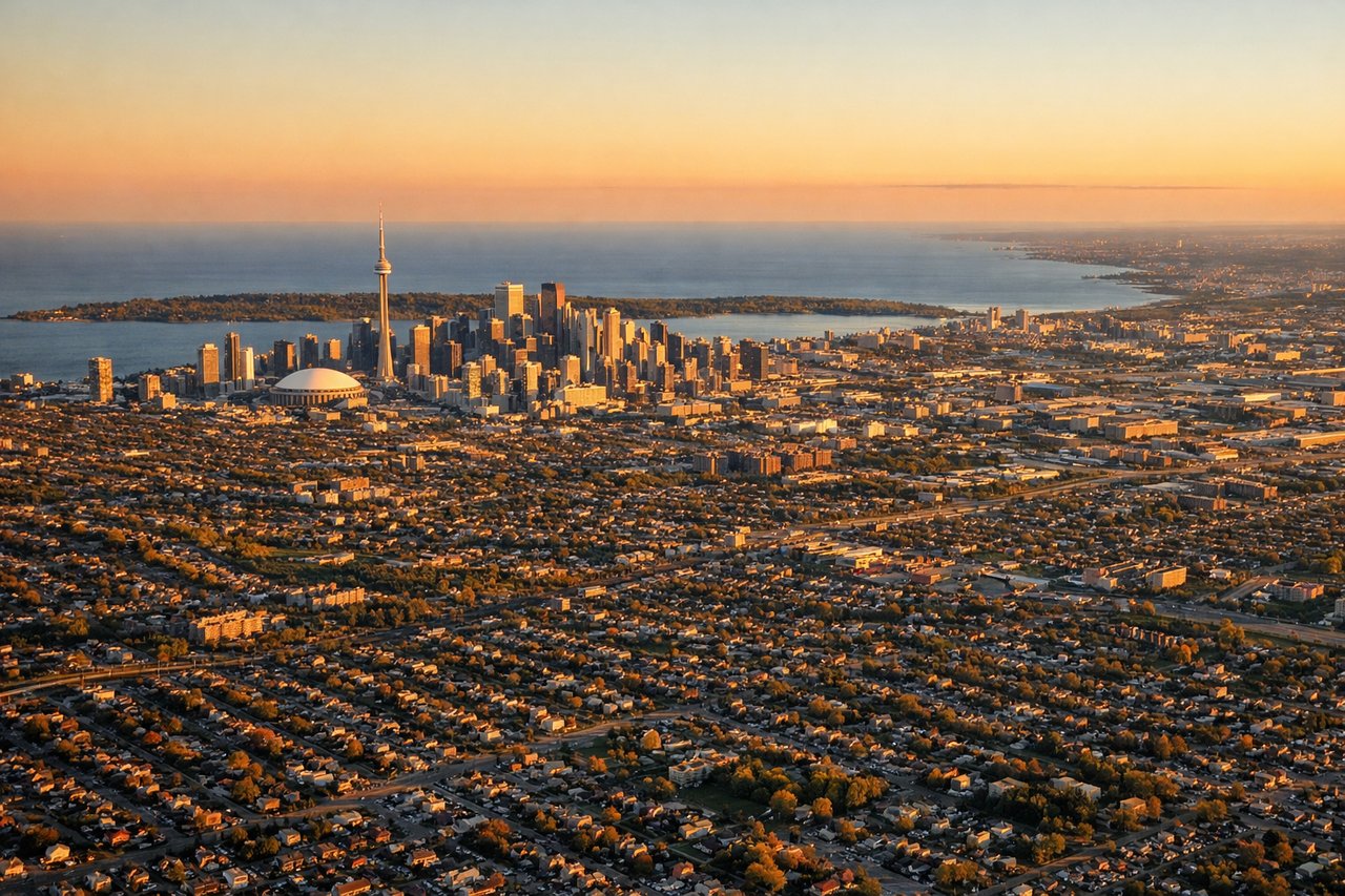
LEFTApproaching Toronto from the south-southeast on runway 23/24L at Pearson, a left-side seat faces east and southeast, giving a clear view over downtown Toronto's skyline including the CN Tower, Lake Ontario's northern shoreline, and the city grid. The right side looks northwest over suburban sprawl with little of interest.
Landmarks on this routeAll landmarks →
Will your flight be in sunlight?
Pick a date and time in the Sun Map to watch the sun move across your whole flight.
About This Route
Which side of the plane should I sit on flying from Hewanorra International (UVF) to Lester B Pearson International (YYZ)?
Sit on the Left side of the plane for the best views on flights from Hewandorra to Toronto. Left side wins both ends of the flight — the volcanic peaks and Caribbean coastline of St. Lucia on departure, and the Toronto skyline with Lake Ontario on arrival. During the cruise, the left side also faces generally east and south, giving occasional views over the eastern Caribbean islands early in the flight and the US eastern seaboard as you cross into North American airspace.
What can I see during takeoff from Hewanorra International in Hewandorra?
During takeoff from Hewanorra International (UVF), sit on the Left side for the best views. Hewanorra's runway 10/28 means departures typically head eastward over the sea before turning north. A left (north-facing) seat gives you the best view back over St. Lucia's mountainous interior, including the Pitons and the central ridge, as the aircraft climbs and banks. The right side faces open Atlantic. Notable sights include: The Pitons (Gros Piton and Petit Piton) near Soufrière on the west coast, the Quilesse Forest Reserve ridgeline, Vieux Fort town and Maria Islands just off the southern tip, the Caribbean Sea coastline curving northwest.
What can I see when landing at Lester B Pearson International in Toronto?
When landing at Lester B Pearson International (YYZ), sit on the Left side for the best views. Approaching Toronto from the south-southeast on runway 23/24L at Pearson, a left-side seat faces east and southeast, giving a clear view over downtown Toronto's skyline including the CN Tower, Lake Ontario's northern shoreline, and the city grid. The right side looks northwest over suburban sprawl with little of interest. Notable sights include: CN Tower and downtown Toronto skyline, Lake Ontario's north shore and Toronto Islands, the Don Valley and ravine system visible as a green corridor cutting through the urban grid, Hamilton and the western end of Lake Ontario in the far distance.
How long is the flight from Hewandorra to Toronto?
The flight from Hewanorra International (UVF) to Lester B Pearson International (YYZ) takes about 5 hours 45 minutes. The shortest flight path between them is 2,346 miles (3,775 km); winds and air traffic control usually add a few percent.
What does the Hewandorra to Toronto flight path pass over?
After departing St. Lucia, the route passes over or near Martinique and Dominica in the Lesser Antilles, then crosses Puerto Rico and Hispaniola airspace at cruise altitude. Over the open Atlantic and then the US eastern seaboard, the Appalachian Mountains appear as a broad corrugated ridge running northeast through Pennsylvania and New York state. Lake Ontario becomes visible well before descent into Toronto.