Warsaw to Kosice is 242 miles (390 km), a flight of about 1 hour 15 minutes.
Takeoff views of Warsaw's Vistula meanders and city structure are more visually distinctive than landing views. The right side captures the most geographically significant feature of the departure phase.
Flight Path
The flight path crosses the Masovian Lowlands (flat, agricultural), then enters the Lublin Upland region with gentle rolling terrain. The Vistula River valley remains visible for the first 30 minutes. Around midpoint, the landscape transitions from Polish plains to Slovak foothills. The Bug River valley may be visible on the left during the first half. As the aircraft approaches Kosice, the Low Tatras become increasingly prominent on the northern horizon, with the Hornád River valley becoming the dominant geographical feature in the final descent phase.
Great circle distance and headings ›Phase by phase
Takeoff from WAW
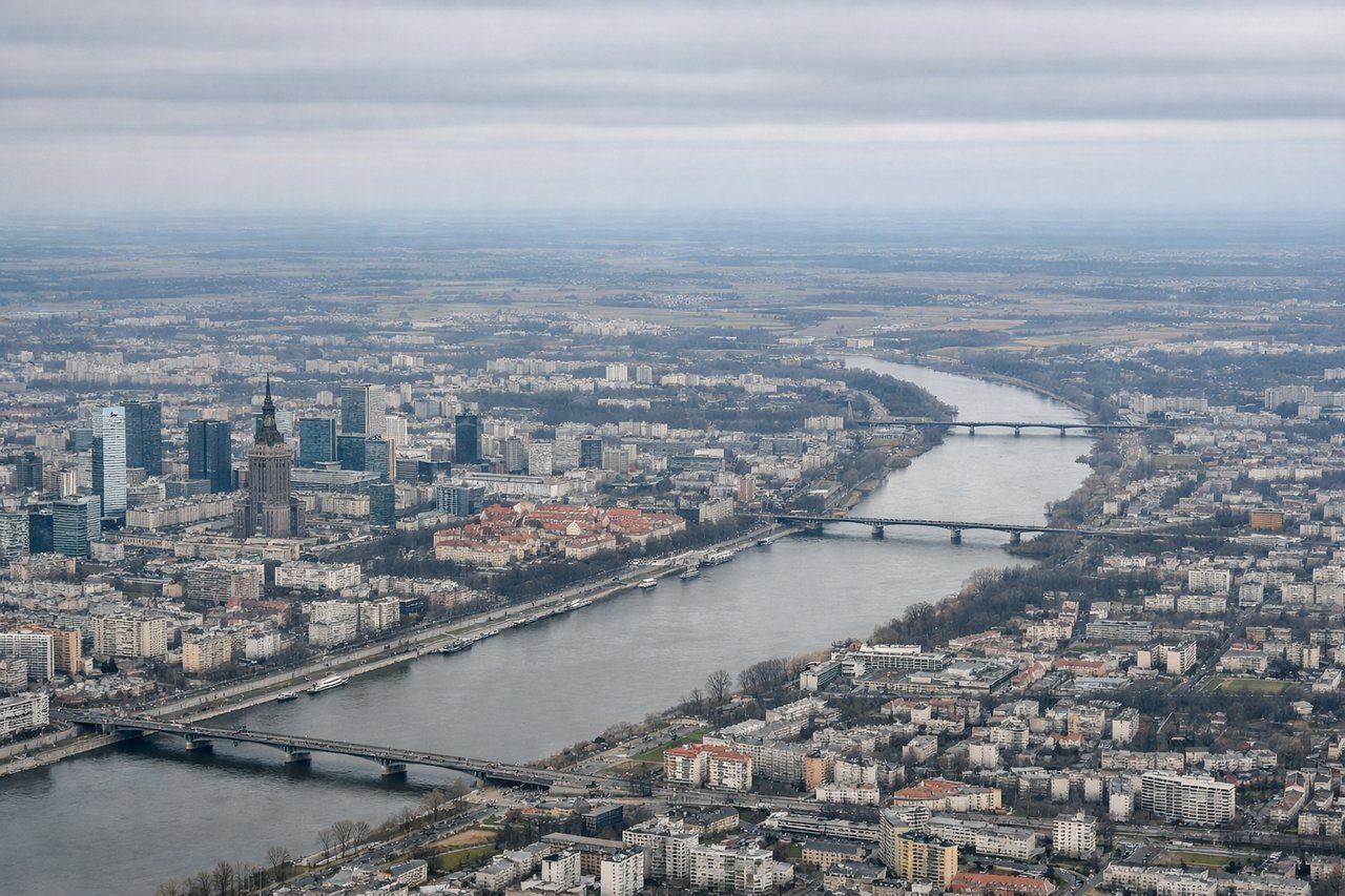
RIGHTWarsaw typically departs eastbound (runways 33L/33R). Right-side seats face south initially, offering views of the Vistula River's distinctive meanders through Warsaw's city center and the suburban sprawl expanding toward the Masovian Lowlands. Left seats see only the industrial northern suburbs and flat terrain.
Landing at KSC
LEFTKosice approaches from the west (typically runway 04). Left-side seats face north during descent, providing views of the Low Tatras' northern foothills and the Hornád River valley that frames the airport approach. Right seats see only flat terrain to the south.
Will your flight be in sunlight?
Pick a date and time in the Sun Map to watch the sun move across your whole flight.
About This Route
Which side of the plane should I sit on flying from Okecie (WAW) to Kosice (KSC)?
Sit on the Right side of the plane for the best views on flights from Warsaw to Kosice. Takeoff views of Warsaw's Vistula meanders and city structure are more visually distinctive than landing views. The right side captures the most geographically significant feature of the departure phase.
What can I see during takeoff from Okecie in Warsaw?
During takeoff from Okecie (WAW), sit on the Right side for the best views. Warsaw typically departs eastbound (runways 33L/33R). Right-side seats face south initially, offering views of the Vistula River's distinctive meanders through Warsaw's city center and the suburban sprawl expanding toward the Masovian Lowlands. Left seats see only the industrial northern suburbs and flat terrain. Notable sights include: Vistula River (multiple bends through central Warsaw), Warsaw Old Town district, Masovian Lowlands extending southeast, Narew River confluence.
What can I see when landing at Kosice in Kosice?
When landing at Kosice (KSC), sit on the Left side for the best views. Kosice approaches from the west (typically runway 04). Left-side seats face north during descent, providing views of the Low Tatras' northern foothills and the Hornád River valley that frames the airport approach. Right seats see only flat terrain to the south. Notable sights include: Low Tatras (Nízke Tatry) northern slopes, Hornád River valley, Kosice city center, Slovak Ore Mountains (Slovenské rudohorie) to the east.
How long is the flight from Warsaw to Kosice?
The flight from Okecie (WAW) to Kosice (KSC) takes about 1 hour 15 minutes. The shortest flight path between them is 242 miles (390 km); winds and air traffic control usually add a few percent.
What does the Warsaw to Kosice flight path pass over?
The flight path crosses the Masovian Lowlands (flat, agricultural), then enters the Lublin Upland region with gentle rolling terrain. The Vistula River valley remains visible for the first 30 minutes. Around midpoint, the landscape transitions from Polish plains to Slovak foothills. The Bug River valley may be visible on the left during the first half. As the aircraft approaches Kosice, the Low Tatras become increasingly prominent on the northern horizon, with the Hornád River valley becoming the dominant geographical feature in the final descent phase.