The right side wins for the full flight: it shows the Qinling Mountains dramatically during takeoff and the transitional hill country of northern Guangdong during descent, while the left side spends most of the flight over flatter agricultural plains with fewer distinctive features.
Flown XIY to CAN? Did we get it right?
Flight Path
Xi'an to Guangzhou is 811 miles (1,305 km), a flight of about 2 hours 40 minutes.
Qinling and Daba mountain ranges, Yangtze River basin near the Hubei-Hunan border, Dongting Lake region, and the hilly transition zone of northern Guangdong before the Pearl River Delta
Great circle distance and headings ›Phase by phase
Takeoff from XIY
RIGHTDeparting XIY southbound, the right (west-facing) side catches the Qinling Mountains rising sharply just south of the Guanzhong Plain, giving a dramatic wall of peaks during initial climb. The left side mostly shows the flat, hazy farmland of the Wei River valley.
Landing at CAN
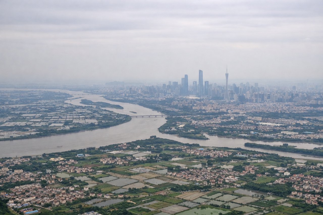
RIGHTOn approach into CAN from the north, the right side offers views of the low hills and reservoirs of northern Guangdong before the terrain flattens into the Pearl River Delta, giving more topographic variety than the flatter eastern approach. Passengers also get a better angle on the Pearl River's tributaries threading through the delta as the plane turns for final approach.
Will your flight be in sunlight?
Pick a date and time in the Sun Map to watch the sun move across your whole flight.
About This Route
Which side of the plane should I sit on flying from Xianyang (XIY) to Guangzhou Baiyun International Airport (CAN)?
Sit on the Right side of the plane for the best views on flights from Xi'an to Guangzhou. The right side wins for the full flight: it shows the Qinling Mountains dramatically during takeoff and the transitional hill country of northern Guangdong during descent, while the left side spends most of the flight over flatter agricultural plains with fewer distinctive features.
What can I see during takeoff from Xianyang in Xi'an?
During takeoff from Xianyang (XIY), sit on the Right side for the best views. Departing XIY southbound, the right (west-facing) side catches the Qinling Mountains rising sharply just south of the Guanzhong Plain, giving a dramatic wall of peaks during initial climb. The left side mostly shows the flat, hazy farmland of the Wei River valley. Notable sights include: Qinling Mountains, Wei River valley, Guanzhong Plain farmland.
What can I see when landing at Guangzhou Baiyun International Airport in Guangzhou?
When landing at Guangzhou Baiyun International Airport (CAN), sit on the Right side for the best views. On approach into CAN from the north, the right side offers views of the low hills and reservoirs of northern Guangdong before the terrain flattens into the Pearl River Delta, giving more topographic variety than the flatter eastern approach. Passengers also get a better angle on the Pearl River's tributaries threading through the delta as the plane turns for final approach. Notable sights include: Northern Guangdong hills, Pearl River tributaries, Pearl River Delta farmland, Baiyun District outskirts.
How long is the flight from Xi'an to Guangzhou?
The flight from Xianyang (XIY) to Guangzhou Baiyun International Airport (CAN) takes about 2 hours 40 minutes. The shortest flight path between them is 811 miles (1,305 km); winds and air traffic control usually add a few percent.
What does the Xi'an to Guangzhou flight path pass over?
Qinling and Daba mountain ranges, Yangtze River basin near the Hubei-Hunan border, Dongting Lake region, and the hilly transition zone of northern Guangdong before the Pearl River Delta