Left side delivers the best views at both ends of this short flight — Ottawa's river and Parliament Hill on departure, and Lake Ontario with the Toronto skyline on approach. The flight is too brief and low-drama in the middle for the right side to compensate.
Flown YOW to YYZ? Did we get it right?
Flight Path
Ottawa to Toronto is 226 miles (363 km), a flight of about 1 hour.
The flight tracks roughly southwest across the flat agricultural lowlands of eastern Ontario — the St. Lawrence Lowlands plain. You pass over or near Kingston and the northern end of Lake Ontario around the midpoint. The Thousand Islands region of the St. Lawrence River may be visible to the south on a clear day. The terrain is predominantly flat to gently rolling farmland with scattered small lakes and the occasional small city. No significant elevation changes — this is one of the flattest flight corridors in Canada.
Great circle distance and headings ›Phase by phase
Takeoff from YOW
LEFTOttawa's dominant runway is 07/25, with westbound departures toward Toronto typically using runway 25 (heading roughly southwest). A left-side seat gives you a view back over the Ottawa River and downtown Ottawa as you climb out, including Parliament Hill and the Rideau Canal corridor. Right side faces south toward suburban sprawl.
Landing at YYZ
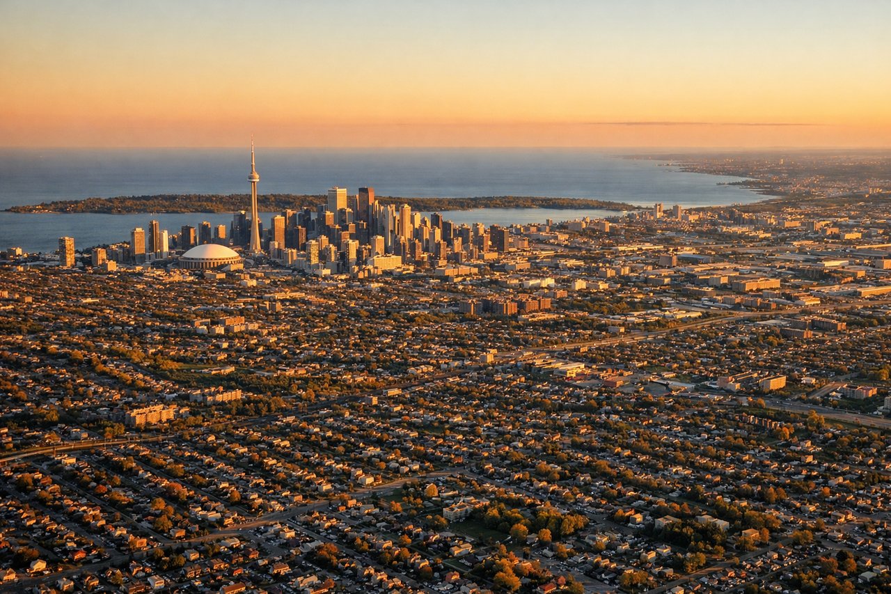
LEFTPearson's primary arrival runways for westbound traffic from Ottawa are typically 05/23 or 06L/24R, with aircraft often approaching from the northeast. A left-side seat on approach gives views over Lake Ontario's north shore, the Toronto downtown skyline including the CN Tower, and the lake itself. Right side faces north over suburban Mississauga and Brampton.
Will your flight be in sunlight?
Pick a date and time in the Sun Map to watch the sun move across your whole flight.
About This Route
Which side of the plane should I sit on flying from Ottawa Macdonald Cartier International (YOW) to Lester B Pearson International (YYZ)?
Sit on the Left side of the plane for the best views on flights from Ottawa to Toronto. Left side delivers the best views at both ends of this short flight — Ottawa's river and Parliament Hill on departure, and Lake Ontario with the Toronto skyline on approach. The flight is too brief and low-drama in the middle for the right side to compensate.
What can I see during takeoff from Ottawa Macdonald Cartier International in Ottawa?
During takeoff from Ottawa Macdonald Cartier International (YOW), sit on the Left side for the best views. Ottawa's dominant runway is 07/25, with westbound departures toward Toronto typically using runway 25 (heading roughly southwest). A left-side seat gives you a view back over the Ottawa River and downtown Ottawa as you climb out, including Parliament Hill and the Rideau Canal corridor. Right side faces south toward suburban sprawl. Notable sights include: Ottawa River, Parliament Hill and the Gothic Revival Centre Block, Rideau Canal, Gatineau across the river in Quebec.
What can I see when landing at Lester B Pearson International in Toronto?
When landing at Lester B Pearson International (YYZ), sit on the Left side for the best views. Pearson's primary arrival runways for westbound traffic from Ottawa are typically 05/23 or 06L/24R, with aircraft often approaching from the northeast. A left-side seat on approach gives views over Lake Ontario's north shore, the Toronto downtown skyline including the CN Tower, and the lake itself. Right side faces north over suburban Mississauga and Brampton. Notable sights include: Lake Ontario, Toronto downtown skyline and CN Tower, Humber Bay, Toronto Islands.
How long is the flight from Ottawa to Toronto?
The flight from Ottawa Macdonald Cartier International (YOW) to Lester B Pearson International (YYZ) takes about 1 hour. The shortest flight path between them is 226 miles (363 km); winds and air traffic control usually add a few percent.
What does the Ottawa to Toronto flight path pass over?
The flight tracks roughly southwest across the flat agricultural lowlands of eastern Ontario — the St. Lawrence Lowlands plain. You pass over or near Kingston and the northern end of Lake Ontario around the midpoint. The Thousand Islands region of the St. Lawrence River may be visible to the south on a clear day. The terrain is predominantly flat to gently rolling farmland with scattered small lakes and the occasional small city. No significant elevation changes — this is one of the flattest flight corridors in Canada.