The left side captures the most dramatic terrain on both ends of the flight — the Coast Mountains near Vancouver at departure and the Blue Ridge foothills near Dulles at arrival — while the right side offers mostly flat delta, prairie, and farmland throughout.
Flown YVR to IAD? Did we get it right?
Flight Path
Vancouver to Washington is 2,338 miles (3,763 km), a flight of about 4 hours 45 minutes.
The route crosses the Canadian Rockies near the Alberta border, then the wide plains of Saskatchewan and Manitoba, followed by the Great Lakes region around Lake Superior before descending over the Appalachian ridges into Virginia.
Great circle distance and headings ›


Phase by phase
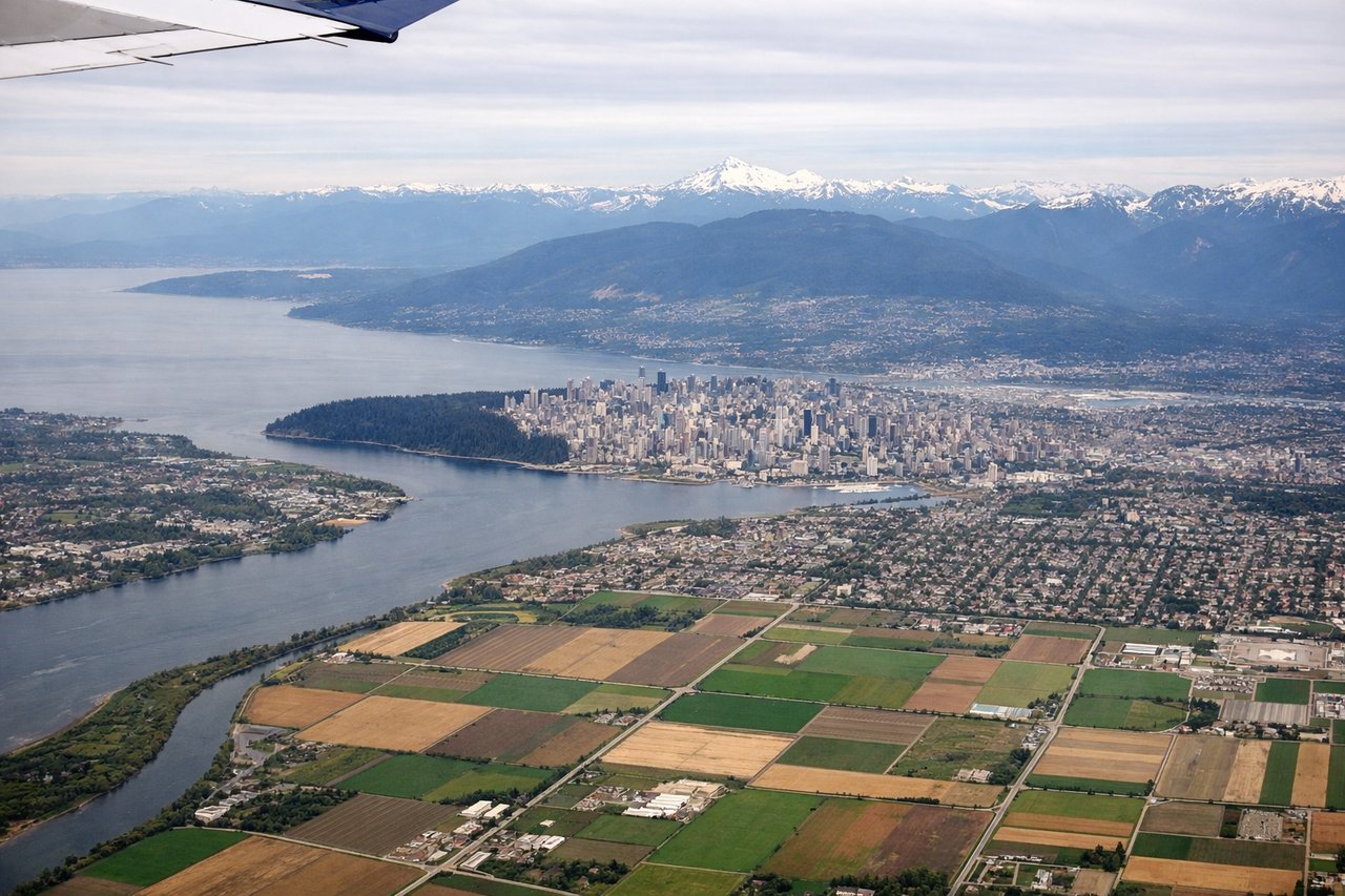
Takeoff from YVR
LEFTDeparting YVR to the west and banking toward the east, the initial climb gives left-side passengers a clear view of the North Shore mountains (Coast Mountains) and Burrard Inlet before the aircraft settles onto its easterly heading. The right side mostly shows the flat Fraser Delta and Strait of Georgia.
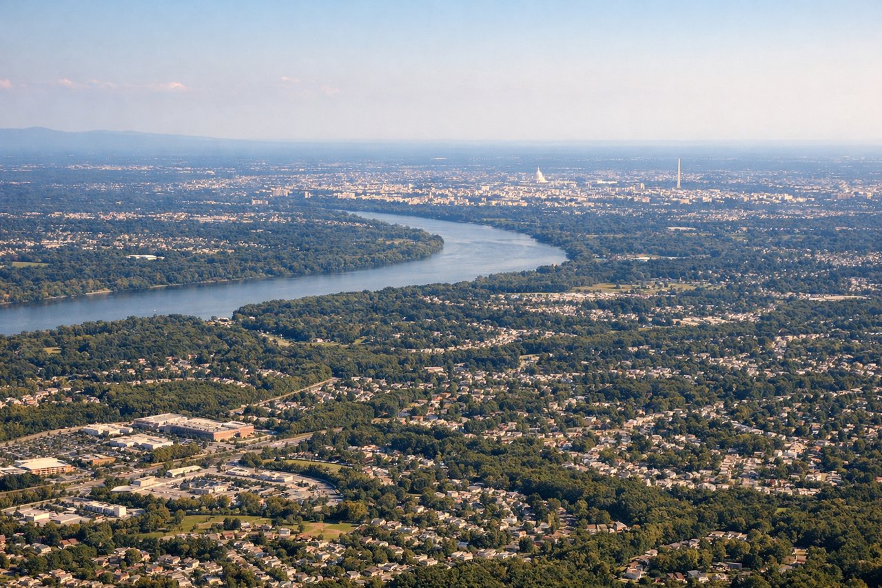
Landing at IAD
LEFTOn approach into Dulles from the north or south, the final descent crosses the rolling Piedmont with the Blue Ridge Mountains visible in the distance to the west, which sits on the left side of the aircraft during a typical northbound landing. The right side mainly shows flatter Virginia farmland with little relief.
Will your flight be in sunlight?
Pick a date and time in the Sun Map to watch the sun move across your whole flight.
About This Route
Which side of the plane should I sit on flying from Vancouver International (YVR) to Washington Dulles International (IAD)?
Sit on the Left side of the plane for the best views on flights from Vancouver to Washington. The left side captures the most dramatic terrain on both ends of the flight — the Coast Mountains near Vancouver at departure and the Blue Ridge foothills near Dulles at arrival — while the right side offers mostly flat delta, prairie, and farmland throughout.
What can I see during takeoff from Vancouver International in Vancouver?
During takeoff from Vancouver International (YVR), sit on the Left side for the best views. Departing YVR to the west and banking toward the east, the initial climb gives left-side passengers a clear view of the North Shore mountains (Coast Mountains) and Burrard Inlet before the aircraft settles onto its easterly heading. The right side mostly shows the flat Fraser Delta and Strait of Georgia. Notable sights include: North Shore Mountains, Burrard Inlet, Fraser River delta, Georgia Strait.
What can I see when landing at Washington Dulles International in Washington?
When landing at Washington Dulles International (IAD), sit on the Left side for the best views. On approach into Dulles from the north or south, the final descent crosses the rolling Piedmont with the Blue Ridge Mountains visible in the distance to the west, which sits on the left side of the aircraft during a typical northbound landing. The right side mainly shows flatter Virginia farmland with little relief. Notable sights include: Blue Ridge Mountains, Shenandoah Valley foothills, Piedmont farmland, Potomac River tributaries.
How long is the flight from Vancouver to Washington?
The flight from Vancouver International (YVR) to Washington Dulles International (IAD) takes about 4 hours 45 minutes. The shortest flight path between them is 2,338 miles (3,763 km); winds and air traffic control usually add a few percent.
What does the Vancouver to Washington flight path pass over?
The route crosses the Canadian Rockies near the Alberta border, then the wide plains of Saskatchewan and Manitoba, followed by the Great Lakes region around Lake Superior before descending over the Appalachian ridges into Virginia.