Left side wins at both ends of the flight. The Vancouver departure offers genuinely spectacular scenery — mountains, ocean inlets, and a photogenic city. The Houston arrival gives the better urban view of the two sides on approach. Through the cruise portion over the Rockies and Great Plains, left (south-facing) windows also get better light angles on southeasterly routing.
Flown YVR to IAH? Did we get it right?
Flight Path
Vancouver to Houston is 1,969 miles (3,169 km), a flight of about 4 hours.
The route tracks southeast from Vancouver across the Cascade Range and into the Columbia Plateau, then over the Snake River Plain in Idaho. It crosses the Rocky Mountains — likely over southern Idaho or northern Utah — where the Wasatch Range and high desert basin-and-range terrain are visible. Over New Mexico and Texas the terrain flattens dramatically into the Llano Estacado and the Texas Panhandle's featureless high plains, transitioning to the Gulf Coastal Plain as you descend toward Houston.
Great circle distance and headings ›

Phase by phase
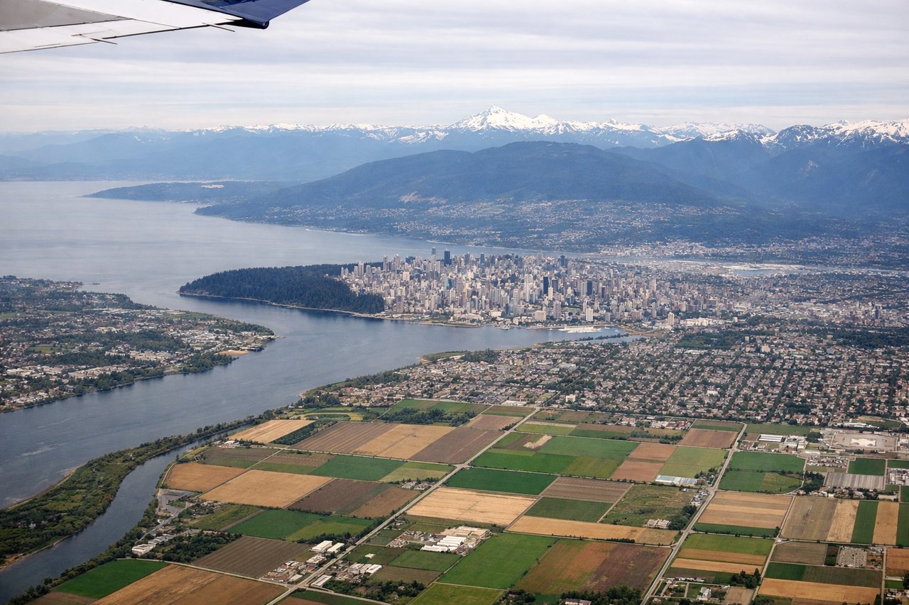
Takeoff from YVR
LEFTYVR typically departs eastbound on runway 08L/08R or southbound on 26L/26R. On an eastbound departure, the left (north) side gives you downtown Vancouver, Burrard Inlet, and the North Shore mountains including the Garibaldi massif. On a southbound departure climbing out over the Fraser River delta, the left side still captures the city core and mountains as the aircraft banks southeast toward the route.
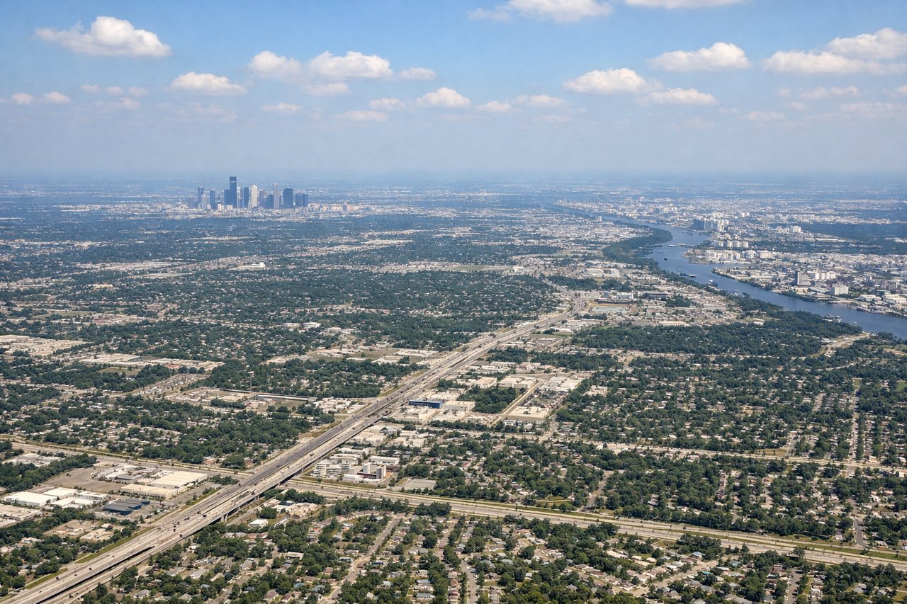
Landing at IAH
LEFTIAH typically lands westbound on runways 26L/26R or 27. On approach from the northeast, the left (south) side gives a clear view of the Houston urban sprawl, the downtown skyline, and the Ship Channel industrial corridor. The right side on this approach is mostly flat suburban development with less visual interest.
Will your flight be in sunlight?
Pick a date and time in the Sun Map to watch the sun move across your whole flight.
About This Route
Which side of the plane should I sit on flying from Vancouver International (YVR) to George Bush Intcntl Houston (IAH)?
Sit on the Left side of the plane for the best views on flights from Vancouver to Houston. Left side wins at both ends of the flight. The Vancouver departure offers genuinely spectacular scenery — mountains, ocean inlets, and a photogenic city. The Houston arrival gives the better urban view of the two sides on approach. Through the cruise portion over the Rockies and Great Plains, left (south-facing) windows also get better light angles on southeasterly routing.
What can I see during takeoff from Vancouver International in Vancouver?
During takeoff from Vancouver International (YVR), sit on the Left side for the best views. YVR typically departs eastbound on runway 08L/08R or southbound on 26L/26R. On an eastbound departure, the left (north) side gives you downtown Vancouver, Burrard Inlet, and the North Shore mountains including the Garibaldi massif. On a southbound departure climbing out over the Fraser River delta, the left side still captures the city core and mountains as the aircraft banks southeast toward the route. Notable sights include: Downtown Vancouver skyline, Burrard Inlet, North Shore Mountains (Grouse, Seymour, Cypress), Fraser River delta wetlands.
What can I see when landing at George Bush Intcntl Houston in Houston?
When landing at George Bush Intcntl Houston (IAH), sit on the Left side for the best views. IAH typically lands westbound on runways 26L/26R or 27. On approach from the northeast, the left (south) side gives a clear view of the Houston urban sprawl, the downtown skyline, and the Ship Channel industrial corridor. The right side on this approach is mostly flat suburban development with less visual interest. Notable sights include: Houston downtown skyline, Houston Ship Channel, Lake Houston, suburban Houston grid sprawl.
How long is the flight from Vancouver to Houston?
The flight from Vancouver International (YVR) to George Bush Intcntl Houston (IAH) takes about 4 hours. The shortest flight path between them is 1,969 miles (3,169 km); winds and air traffic control usually add a few percent.
What does the Vancouver to Houston flight path pass over?
The route tracks southeast from Vancouver across the Cascade Range and into the Columbia Plateau, then over the Snake River Plain in Idaho. It crosses the Rocky Mountains — likely over southern Idaho or northern Utah — where the Wasatch Range and high desert basin-and-range terrain are visible. Over New Mexico and Texas the terrain flattens dramatically into the Llano Estacado and the Texas Panhandle's featureless high plains, transitioning to the Gulf Coastal Plain as you descend toward Houston.