While landing favors the right, the takeoff experience from YVR is more visually rewarding with the immediate dramatic North Shore Mountains and Strait of Georgia. The left side captures the most distinctive geography at the flight's beginning, and the route eastbound across British Columbia and the Canadian Shield offers occasional left-side views of major valleys and water features.
Flown YVR to YHU? Did we get it right?
Flight Path
Vancouver to Montreal is 2,301 miles (3,703 km), a flight of about 5 hours 15 minutes.
The flight path crosses the Canadian Rockies (visible from both sides depending on exact routing—typically the route passes north of the Rockies proper), then over the interior plateau of British Columbia, across the prairies of Alberta and Saskatchewan, and into the Canadian Shield of Ontario and Quebec. The Great Lakes region (particularly Lake Superior and Lake Huron) may be visible on the northern horizon during the mid-flight segment if the routing permits. The Ottawa River valley becomes visible during descent into the Montreal region.
Great circle distance and headings ›Phase by phase
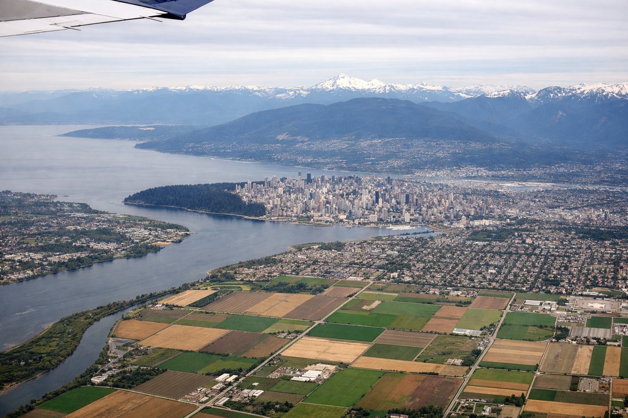
Takeoff from YVR
LEFTYVR typically departs eastbound (runways 26L/26R or 08L/08R depending on wind). Left-side seats offer immediate views of the North Shore Mountains and the Strait of Georgia. The climb-out trajectory takes you directly over water and mountainous terrain that's most dramatic from the left side.
Landing at YHU
RIGHTYHU (St-Hubert/Trudeau area) approaches typically use eastbound or westbound runways depending on wind. Right-side seats during descent into the Montreal region offer views of the St. Lawrence River, which is the dominant visual feature during final approach. The river's wide expanse and the surrounding urban sprawl of the Greater Montreal area are best appreciated from the right side on typical approach vectors.
Will your flight be in sunlight?
Pick a date and time in the Sun Map to watch the sun move across your whole flight.
About This Route
Which side of the plane should I sit on flying from Vancouver International (YVR) to St Hubert (YHU)?
Sit on the Left side of the plane for the best views on flights from Vancouver to Montreal. While landing favors the right, the takeoff experience from YVR is more visually rewarding with the immediate dramatic North Shore Mountains and Strait of Georgia. The left side captures the most distinctive geography at the flight's beginning, and the route eastbound across British Columbia and the Canadian Shield offers occasional left-side views of major valleys and water features.
What can I see during takeoff from Vancouver International in Vancouver?
During takeoff from Vancouver International (YVR), sit on the Left side for the best views. YVR typically departs eastbound (runways 26L/26R or 08L/08R depending on wind). Left-side seats offer immediate views of the North Shore Mountains and the Strait of Georgia. The climb-out trajectory takes you directly over water and mountainous terrain that's most dramatic from the left side. Notable sights include: North Shore Mountains (Grouse, Seymour, Cypress peaks), Strait of Georgia, Burrard Inlet, Vancouver downtown skyline receding behind.
What can I see when landing at St Hubert in Montreal?
When landing at St Hubert (YHU), sit on the Right side for the best views. YHU (St-Hubert/Trudeau area) approaches typically use eastbound or westbound runways depending on wind. Right-side seats during descent into the Montreal region offer views of the St. Lawrence River, which is the dominant visual feature during final approach. The river's wide expanse and the surrounding urban sprawl of the Greater Montreal area are best appreciated from the right side on typical approach vectors. Notable sights include: St. Lawrence River, Montreal urban area and suburbs, Laurentian Mountains (distant northern horizon), Île Perrot and river islands.
How long is the flight from Vancouver to Montreal?
The flight from Vancouver International (YVR) to St Hubert (YHU) takes about 5 hours 15 minutes. The shortest flight path between them is 2,301 miles (3,703 km); winds and air traffic control usually add a few percent.
What does the Vancouver to Montreal flight path pass over?
The flight path crosses the Canadian Rockies (visible from both sides depending on exact routing—typically the route passes north of the Rockies proper), then over the interior plateau of British Columbia, across the prairies of Alberta and Saskatchewan, and into the Canadian Shield of Ontario and Quebec. The Great Lakes region (particularly Lake Superior and Lake Huron) may be visible on the northern horizon during the mid-flight segment if the routing permits. The Ottawa River valley becomes visible during descent into the Montreal region.