Buffalo Narrows to New York is 1,879 miles (3,024 km), a flight of about 5 hours.
The right side captures the spectacular Buffalo Narrows lake system on departure, and while left wins at JFK, the takeoff view over Peter Pond Lake and Churchill Lake is the more unique and memorable sight of the journey. Right also tracks the Canadian Shield lakes and boreal terrain through much of the cruise.
Flight Path
Canadian Shield lake country of northern Saskatchewan and Manitoba, Lake Winnipeg (one of the world's largest lakes, clearly visible from altitude), the flat agricultural patchwork of the Manitoba and Ontario prairies transitioning to the Canadian Shield's rocky lake-dotted terrain, Lake Superior's vast blue expanse, then the Great Lakes corridor through southern Ontario, Lake Erie, and finally the Appalachian ridgelines of Pennsylvania and New York State before the Hudson Valley descent toward JFK
Great circle distance and headings ›
.jpeg?width=600)
.jpg?width=600)
Phase by phase
Takeoff from YVT
RIGHTBuffalo Narrows airport typically departs to the east or west along the narrows. On departure, the right side gives you a clear view of Buffalo Narrows lake system and the Churchill River drainage network — a striking boreal landscape of interconnected lakes and muskeg. The town of Buffalo Narrows sits on the isthmus between Peter Pond Lake and Churchill Lake, which is best seen from the right.
Landing at JFK
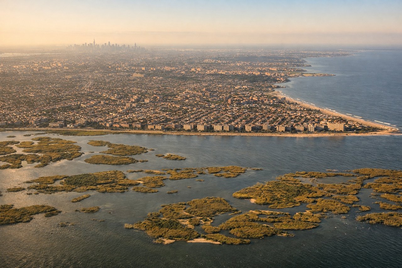
LEFTJFK approaches from the east or northeast over Jamaica Bay, and left-side seats get a clear view of Lower Manhattan's skyline, the Verrazano-Narrows Bridge, and the full sweep of New York Harbor as the aircraft descends over the Atlantic approaches. Right side looks mostly over suburban Queens and Long Island.
Landmarks on this routeAll landmarks →
Will your flight be in sunlight?
Pick a date and time in the Sun Map to watch the sun move across your whole flight.
About This Route
Which side of the plane should I sit on flying from Buffalo Narrows (YVT) to John F Kennedy International (JFK)?
Sit on the Right side of the plane for the best views on flights from Buffalo Narrows to New York. The right side captures the spectacular Buffalo Narrows lake system on departure, and while left wins at JFK, the takeoff view over Peter Pond Lake and Churchill Lake is the more unique and memorable sight of the journey. Right also tracks the Canadian Shield lakes and boreal terrain through much of the cruise.
What can I see during takeoff from Buffalo Narrows in Buffalo Narrows?
During takeoff from Buffalo Narrows (YVT), sit on the Right side for the best views. Buffalo Narrows airport typically departs to the east or west along the narrows. On departure, the right side gives you a clear view of Buffalo Narrows lake system and the Churchill River drainage network — a striking boreal landscape of interconnected lakes and muskeg. The town of Buffalo Narrows sits on the isthmus between Peter Pond Lake and Churchill Lake, which is best seen from the right. Notable sights include: Peter Pond Lake, Churchill Lake, Buffalo Narrows townsite on the isthmus, boreal muskeg lake network.
What can I see when landing at John F Kennedy International in New York?
When landing at John F Kennedy International (JFK), sit on the Left side for the best views. JFK approaches from the east or northeast over Jamaica Bay, and left-side seats get a clear view of Lower Manhattan's skyline, the Verrazano-Narrows Bridge, and the full sweep of New York Harbor as the aircraft descends over the Atlantic approaches. Right side looks mostly over suburban Queens and Long Island. Notable sights include: Lower Manhattan skyline, Jamaica Bay, Verrazano-Narrows Bridge, New York Harbor.
How long is the flight from Buffalo Narrows to New York?
The flight from Buffalo Narrows (YVT) to John F Kennedy International (JFK) takes about 5 hours. The shortest flight path between them is 1,879 miles (3,024 km); winds and air traffic control usually add a few percent.
What does the Buffalo Narrows to New York flight path pass over?
Canadian Shield lake country of northern Saskatchewan and Manitoba, Lake Winnipeg (one of the world's largest lakes, clearly visible from altitude), the flat agricultural patchwork of the Manitoba and Ontario prairies transitioning to the Canadian Shield's rocky lake-dotted terrain, Lake Superior's vast blue expanse, then the Great Lakes corridor through southern Ontario, Lake Erie, and finally the Appalachian ridgelines of Pennsylvania and New York State before the Hudson Valley descent toward JFK