Buffalo Narrows to Miami is 2,508 miles (4,036 km), a flight of about 6 hours.
The right side delivers the best views at both ends of the flight — the Saskatchewan lake district on departure and the Everglades-to-Miami panorama on arrival. Along the mid-flight path over the US interior, the right side also tends to face south and east, offering better angles on the Mississippi River valley and Gulf Coast as the route curves southeast.
Flight Path
The route tracks southeast over central Saskatchewan, then across the Canadian prairies into North Dakota and Minnesota, crossing the Upper Mississippi River valley, continuing over Illinois and Indiana, then Kentucky and Tennessee, crossing the Appalachian foothills in Georgia, and finally descending over the Florida peninsula with the Everglades visible before Miami. The Mississippi River near St. Louis and the broad agricultural plains of the Midwest are the most visually distinctive mid-flight features.
Great circle distance and headings ›
.jpeg?width=600)

Phase by phase
Takeoff from YVT
RIGHTBuffalo Narrows airport typically departs to the east or southeast. From the right side you get a clear view of Buffalo Narrows itself — the narrow water channel connecting Peter Pond Lake to the south and Churchill Lake to the north. The boreal lake district of northwestern Saskatchewan spreads out in all directions with dozens of interconnected lakes visible.
Landing at MIA
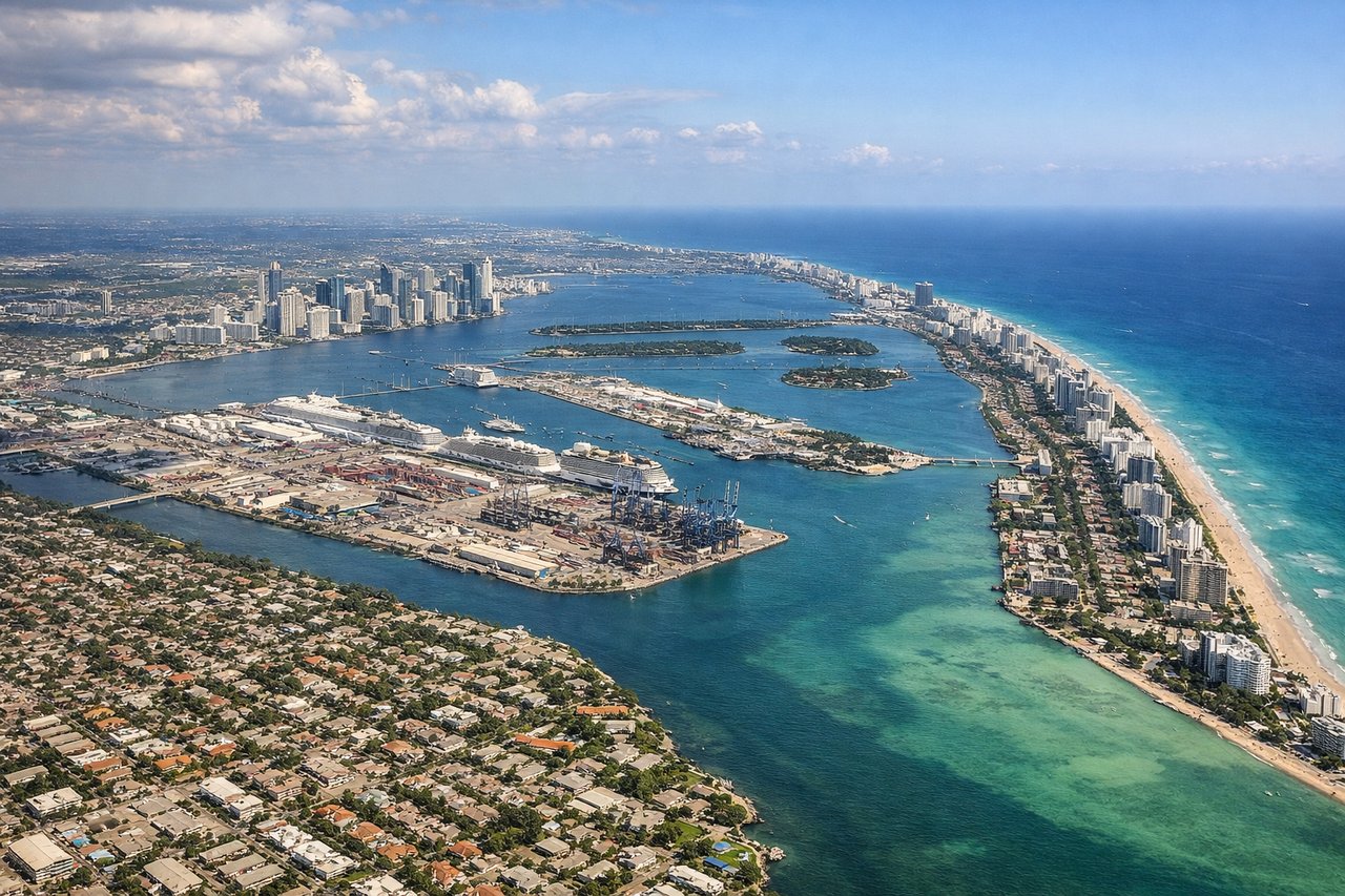
RIGHTMiami International's primary arrival runways from the north typically bring aircraft in from the northwest on approaches to runways 08L/08R or 09, tracking eastward over the Everglades and then over Miami's western suburbs. The right side gives you the Everglades wetlands on approach and then the downtown Miami skyline and Biscayne Bay as you cross the threshold.
Landmarks on this routeAll landmarks →
Will your flight be in sunlight?
Pick a date and time in the Sun Map to watch the sun move across your whole flight.
About This Route
Which side of the plane should I sit on flying from Buffalo Narrows (YVT) to Miami International (MIA)?
Sit on the Right side of the plane for the best views on flights from Buffalo Narrows to Miami. The right side delivers the best views at both ends of the flight — the Saskatchewan lake district on departure and the Everglades-to-Miami panorama on arrival. Along the mid-flight path over the US interior, the right side also tends to face south and east, offering better angles on the Mississippi River valley and Gulf Coast as the route curves southeast.
What can I see during takeoff from Buffalo Narrows in Buffalo Narrows?
During takeoff from Buffalo Narrows (YVT), sit on the Right side for the best views. Buffalo Narrows airport typically departs to the east or southeast. From the right side you get a clear view of Buffalo Narrows itself — the narrow water channel connecting Peter Pond Lake to the south and Churchill Lake to the north. The boreal lake district of northwestern Saskatchewan spreads out in all directions with dozens of interconnected lakes visible. Notable sights include: Buffalo Narrows channel, Peter Pond Lake, Churchill Lake, boreal muskeg and lake network of the Athabasca lowlands.
What can I see when landing at Miami International in Miami?
When landing at Miami International (MIA), sit on the Right side for the best views. Miami International's primary arrival runways from the north typically bring aircraft in from the northwest on approaches to runways 08L/08R or 09, tracking eastward over the Everglades and then over Miami's western suburbs. The right side gives you the Everglades wetlands on approach and then the downtown Miami skyline and Biscayne Bay as you cross the threshold. Notable sights include: Florida Everglades wetland mosaic, Miami downtown skyline, Biscayne Bay, Miami Beach barrier island.
How long is the flight from Buffalo Narrows to Miami?
The flight from Buffalo Narrows (YVT) to Miami International (MIA) takes about 6 hours. The shortest flight path between them is 2,508 miles (4,036 km); winds and air traffic control usually add a few percent.
What does the Buffalo Narrows to Miami flight path pass over?
The route tracks southeast over central Saskatchewan, then across the Canadian prairies into North Dakota and Minnesota, crossing the Upper Mississippi River valley, continuing over Illinois and Indiana, then Kentucky and Tennessee, crossing the Appalachian foothills in Georgia, and finally descending over the Florida peninsula with the Everglades visible before Miami. The Mississippi River near St. Louis and the broad agricultural plains of the Midwest are the most visually distinctive mid-flight features.