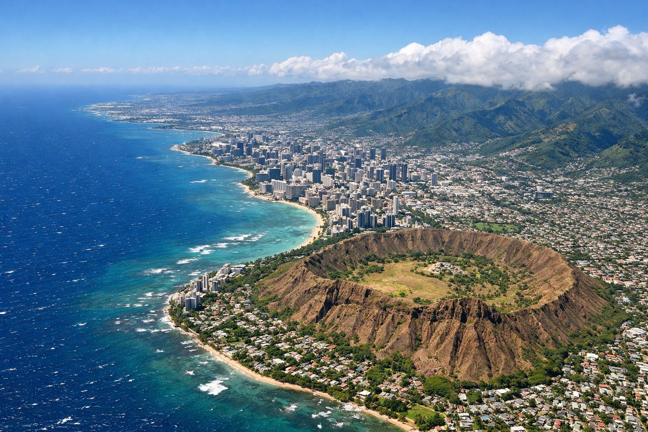
While the Prince George departure offers modest mountain views, the Honolulu arrival dominates this route. The right side captures the volcanic drama of Oahu's approach—Diamond Head, the Koolau cliffs, and the transition from open ocean to dramatic island topography—which is far more visually compelling than the interior British Columbia plateau. The landing experience alone elevates the right side significantly.
Flown YXS to HNL? Did we get it right?
Flight Path
Prince George to Honolulu is 2,908 miles (4,681 km), a flight of about 5 hours 15 minutes.
The flight crosses the northern Pacific Ocean for approximately 4 hours. Notable geographic features along the route include: the British Columbia coast and Queen Charlotte Sound (visible during initial climb if weather permits), the open North Pacific with no significant landmarks for the majority of cruise, and the approach to Hawaii includes the Big Island's volcanic profile (Mauna Kea and Mauna Loa) visible approximately 100 miles southeast of Oahu before final descent to Honolulu.
Great circle distance and headings ›Phase by phase
Takeoff from YXS
LEFTPrince George sits in the interior plateau of British Columbia with the Rocky Mountains visible to the west and southwest. Left-side departure routes typically climb out over the Nechako Plateau and offer views of the surrounding forested terrain and distant peaks.
Landing at HNL
RIGHTThe approach to Honolulu from the northeast brings the right side into view of the Hawaiian volcanic landscape. Diamond Head, the Koolau Range, and the windward cliffs dominate the approach, with Oahu's dramatic topography and the Pacific coastline providing exceptional visual drama during descent.
Will your flight be in sunlight?
Pick a date and time in the Sun Map to watch the sun move across your whole flight.
About This Route
Which side of the plane should I sit on flying from Prince George (YXS) to Honolulu International (HNL)?
Sit on the Right side of the plane for the best views on flights from Prince George to Honolulu. While the Prince George departure offers modest mountain views, the Honolulu arrival dominates this route. The right side captures the volcanic drama of Oahu's approach—Diamond Head, the Koolau cliffs, and the transition from open ocean to dramatic island topography—which is far more visually compelling than the interior British Columbia plateau. The landing experience alone elevates the right side significantly.
What can I see during takeoff from Prince George in Prince George?
During takeoff from Prince George (YXS), sit on the Left side for the best views. Prince George sits in the interior plateau of British Columbia with the Rocky Mountains visible to the west and southwest. Left-side departure routes typically climb out over the Nechako Plateau and offer views of the surrounding forested terrain and distant peaks. Notable sights include: Rocky Mountains (southwest horizon), Nechako Plateau (immediate terrain), Interior British Columbia forest canopy, Prince George urban area (receding below).
What can I see when landing at Honolulu International in Honolulu?
When landing at Honolulu International (HNL), sit on the Right side for the best views. The approach to Honolulu from the northeast brings the right side into view of the Hawaiian volcanic landscape. Diamond Head, the Koolau Range, and the windward cliffs dominate the approach, with Oahu's dramatic topography and the Pacific coastline providing exceptional visual drama during descent. Notable sights include: Diamond Head crater (iconic volcanic cone), Koolau Range (steep windward cliffs), Honolulu harbor and urban waterfront, Waikiki Beach and coastal development.
How long is the flight from Prince George to Honolulu?
The flight from Prince George (YXS) to Honolulu International (HNL) takes about 5 hours 15 minutes. The shortest flight path between them is 2,908 miles (4,681 km); winds and air traffic control usually add a few percent.
What does the Prince George to Honolulu flight path pass over?
The flight crosses the northern Pacific Ocean for approximately 4 hours. Notable geographic features along the route include: the British Columbia coast and Queen Charlotte Sound (visible during initial climb if weather permits), the open North Pacific with no significant landmarks for the majority of cruise, and the approach to Hawaii includes the Big Island's volcanic profile (Mauna Kea and Mauna Loa) visible approximately 100 miles southeast of Oahu before final descent to Honolulu.