The Rocky Mountains on departure from Calgary are more visually distinctive and dramatic than the Piedmont terrain on arrival at RDU. The mountains provide a clear, memorable geographic feature during the first significant portion of the flight, whereas the landing approach offers pleasant but less striking rolling forest and suburban views.
Flown YYC to RDU? Did we get it right?
Flight Path
Calgary to Raleigh-Durham is 2,027 miles (3,263 km), a flight of about 4 hours 15 minutes.
The flight crosses the Great Plains of eastern Colorado and western Kansas (relatively featureless from altitude), then transitions over the Missouri River valley and Mississippi River valley in the central US. The Flint Hills of Kansas may be visible as subtle rolling terrain. As you approach the eastern US, the Appalachian foothills become visible on the horizon roughly 200 miles before RDU. No major mountain ranges or dramatic landmarks dominate the midpoint; the route is primarily over agricultural plains and low-relief terrain.
Great circle distance and headings ›


Phase by phase
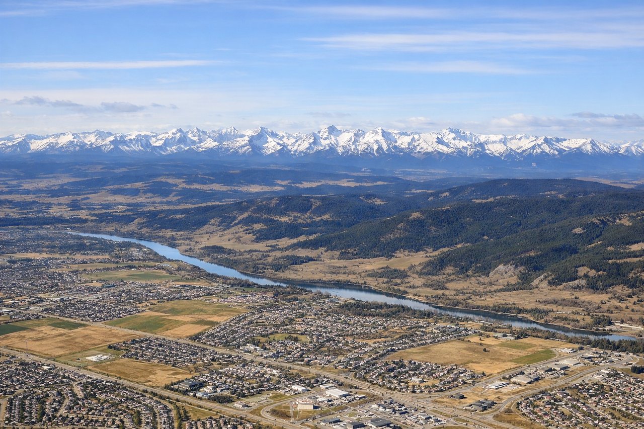
Takeoff from YYC
RIGHTCalgary typically departs eastbound (Runways 16L/R or 34L/R depending on wind). Right-side seats face south initially, offering views of the Canadian Rockies' front range as you climb. The mountains are most dramatic from this angle during the first 15-20 minutes of flight.
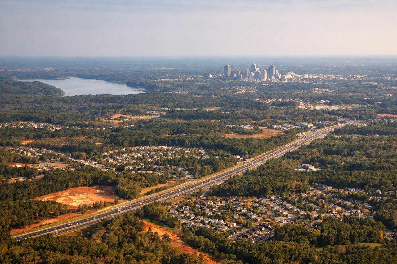
Landing at RDU
LEFTRDU typically lands westbound (Runways 05L/R or 23L/R). Left-side seats during descent from the west provide excellent views of the Piedmont terrain—rolling hills, forested areas, and the transition from the Appalachian foothills. You'll see the Research Triangle's urban sprawl and the Neuse River valley.
Will your flight be in sunlight?
Pick a date and time in the Sun Map to watch the sun move across your whole flight.
About This Route
Which side of the plane should I sit on flying from Calgary International (YYC) to Raleigh Durham International (RDU)?
Sit on the Right side of the plane for the best views on flights from Calgary to Raleigh-Durham. The Rocky Mountains on departure from Calgary are more visually distinctive and dramatic than the Piedmont terrain on arrival at RDU. The mountains provide a clear, memorable geographic feature during the first significant portion of the flight, whereas the landing approach offers pleasant but less striking rolling forest and suburban views.
What can I see during takeoff from Calgary International in Calgary?
During takeoff from Calgary International (YYC), sit on the Right side for the best views. Calgary typically departs eastbound (Runways 16L/R or 34L/R depending on wind). Right-side seats face south initially, offering views of the Canadian Rockies' front range as you climb. The mountains are most dramatic from this angle during the first 15-20 minutes of flight. Notable sights include: Canadian Rocky Mountains (front range, particularly Mount Royal and peaks west of the city), Bow River valley cutting through Calgary's southwest quadrant, Nose Hill and the city's downtown core to the left/north, Lake McGregor reservoir southeast of the airport.
What can I see when landing at Raleigh Durham International in Raleigh-Durham?
When landing at Raleigh Durham International (RDU), sit on the Left side for the best views. RDU typically lands westbound (Runways 05L/R or 23L/R). Left-side seats during descent from the west provide excellent views of the Piedmont terrain—rolling hills, forested areas, and the transition from the Appalachian foothills. You'll see the Research Triangle's urban sprawl and the Neuse River valley. Notable sights include: Neuse River and its floodplain (visible as a darker, tree-lined corridor), the Research Triangle urban development (Raleigh, Durham, Chapel Hill sprawl), Piedmont forest canopy with visible clearings and suburban development, Jordan Lake reservoir west-southwest of the airport.
How long is the flight from Calgary to Raleigh-Durham?
The flight from Calgary International (YYC) to Raleigh Durham International (RDU) takes about 4 hours 15 minutes. The shortest flight path between them is 2,027 miles (3,263 km); winds and air traffic control usually add a few percent.
What does the Calgary to Raleigh-Durham flight path pass over?
The flight crosses the Great Plains of eastern Colorado and western Kansas (relatively featureless from altitude), then transitions over the Missouri River valley and Mississippi River valley in the central US. The Flint Hills of Kansas may be visible as subtle rolling terrain. As you approach the eastern US, the Appalachian foothills become visible on the horizon roughly 200 miles before RDU. No major mountain ranges or dramatic landmarks dominate the midpoint; the route is primarily over agricultural plains and low-relief terrain.