The right side wins primarily on the strength of the Rocky Mountain crossing during cruise and descent — dramatic peaks, valleys, and the foothills transition into Calgary — which outweighs the more modest coastal views the left side offers at takeoff.
Flown YYJ to YYC? Did we get it right?
Flight Path
Victoria to Calgary is 452 miles (728 km), a flight of about 1 hour 55 minutes.
Columbia Mountains and Selkirk Range near Golden BC, the Rocky Mountain Trench, and the Continental Divide crossing near Kicking Horse Pass before descending into the Bow Valley toward Calgary
Great circle distance and headings ›


Phase by phase
Takeoff from YYJ
LEFTDeparting YYJ on runway 27, the aircraft climbs out over Saanich Inlet before turning northeast toward the mainland, putting the Gulf Islands, the Salish Sea, and the distant Vancouver skyline and Coast Mountains on the left. The right side mostly shows open water and the Olympic Mountains fading behind as the plane turns away from them.
Landing at YYC
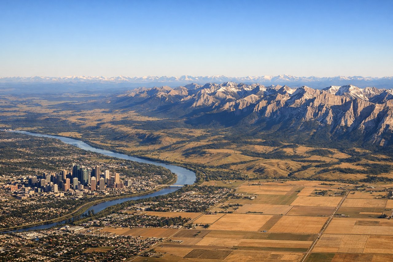
RIGHTOn the approach into Calgary from the west, the descent path crosses the Rocky Mountain front ranges and foothills, giving the right side sweeping views of the Bow Valley corridor, Kananaskis peaks, and the abrupt transition from mountains to prairie. The left side during this phase mostly faces the flat, featureless plains north of the city.
Will your flight be in sunlight?
Pick a date and time in the Sun Map to watch the sun move across your whole flight.
About This Route
Which side of the plane should I sit on flying from Victoria International (YYJ) to Calgary International (YYC)?
Sit on the Right side of the plane for the best views on flights from Victoria to Calgary. The right side wins primarily on the strength of the Rocky Mountain crossing during cruise and descent — dramatic peaks, valleys, and the foothills transition into Calgary — which outweighs the more modest coastal views the left side offers at takeoff.
What can I see during takeoff from Victoria International in Victoria?
During takeoff from Victoria International (YYJ), sit on the Left side for the best views. Departing YYJ on runway 27, the aircraft climbs out over Saanich Inlet before turning northeast toward the mainland, putting the Gulf Islands, the Salish Sea, and the distant Vancouver skyline and Coast Mountains on the left. The right side mostly shows open water and the Olympic Mountains fading behind as the plane turns away from them. Notable sights include: Saanich Inlet, Gulf Islands, Salish Sea, Vancouver skyline/Coast Mountains (distant).
What can I see when landing at Calgary International in Calgary?
When landing at Calgary International (YYC), sit on the Right side for the best views. On the approach into Calgary from the west, the descent path crosses the Rocky Mountain front ranges and foothills, giving the right side sweeping views of the Bow Valley corridor, Kananaskis peaks, and the abrupt transition from mountains to prairie. The left side during this phase mostly faces the flat, featureless plains north of the city. Notable sights include: Rocky Mountain front ranges, Kananaskis peaks, Bow River valley, foothills grasslands.
How long is the flight from Victoria to Calgary?
The flight from Victoria International (YYJ) to Calgary International (YYC) takes about 1 hour 55 minutes. The shortest flight path between them is 452 miles (728 km); winds and air traffic control usually add a few percent.
What does the Victoria to Calgary flight path pass over?
Columbia Mountains and Selkirk Range near Golden BC, the Rocky Mountain Trench, and the Continental Divide crossing near Kicking Horse Pass before descending into the Bow Valley toward Calgary