Armstrong to Reykjavik is 2,539 miles (4,087 km), a flight of about 5 hours 15 minutes.
While takeoff offers some Lake Superior views, the landing approach into Keflavik provides far more dramatic and distinctive scenery. Iceland's volcanic landscape is visually unique and unmistakable from the air, making left-side seats the better overall choice for this route.
Flight Path
The flight path crosses the North Atlantic at high latitude. Midpoint features include the open ocean with no visible landmarks, though at cruise altitude (typically 33,000-35,000 feet) the curvature of the Earth becomes subtly visible. The route passes north of Greenland's southern tip but at altitude, only open water and cloud formations are visible. The transition from North American continental air mass to Atlantic maritime conditions is marked by changing cloud patterns and ocean color, though no discrete landmarks exist in the midpoint region. Approaching Iceland, the first visible land is typically the southeastern coast, with glaciers and mountains becoming visible about 1.5 hours before landing.
Great circle distance and headings ›Phase by phase
Takeoff from YYW
RIGHTArmstrong typically departs to the east or northeast. Right-side seats offer views of Lake Superior's northern shoreline and the transition from boreal forest to open water, which is visually distinctive during climb-out.
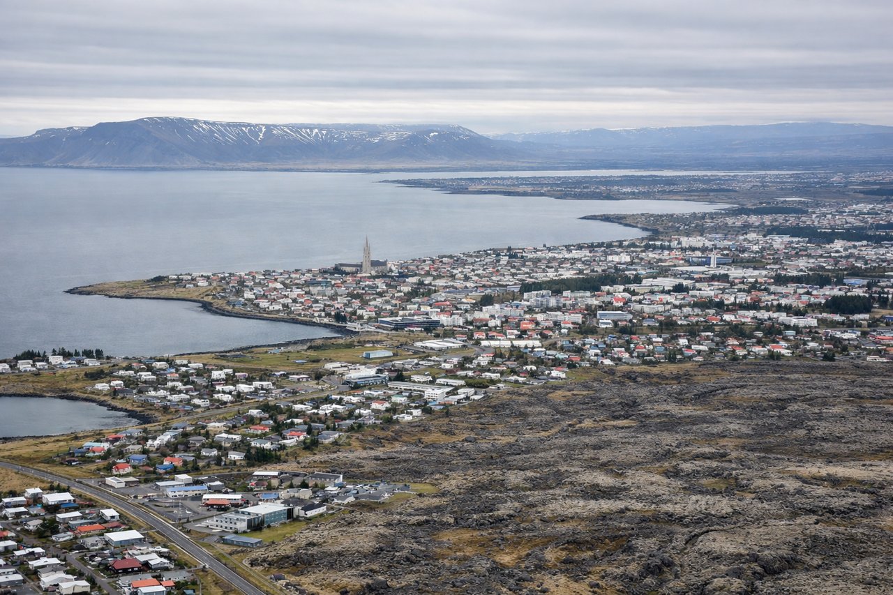
Landing at RKV
LEFTKeflavik International Airport (serving Reykjavik) typically uses runways aligned roughly east-west. Left-side seats during approach from the southeast offer views of Iceland's dramatic volcanic landscape, including the Reykjanes Peninsula's lava fields and geothermal features that are unmistakable from altitude.
Will your flight be in sunlight?
Pick a date and time in the Sun Map to watch the sun move across your whole flight.
About This Route
Which side of the plane should I sit on flying from Armstrong (YYW) to Reykjavik (RKV)?
Sit on the Left side of the plane for the best views on flights from Armstrong to Reykjavik. While takeoff offers some Lake Superior views, the landing approach into Keflavik provides far more dramatic and distinctive scenery. Iceland's volcanic landscape is visually unique and unmistakable from the air, making left-side seats the better overall choice for this route.
What can I see during takeoff from Armstrong in Armstrong?
During takeoff from Armstrong (YYW), sit on the Right side for the best views. Armstrong typically departs to the east or northeast. Right-side seats offer views of Lake Superior's northern shoreline and the transition from boreal forest to open water, which is visually distinctive during climb-out. Notable sights include: Lake Superior (northern shore), Nipissing District boreal forest, Schreiber Channel area, Canadian Shield terrain.
What can I see when landing at Reykjavik in Reykjavik?
When landing at Reykjavik (RKV), sit on the Left side for the best views. Keflavik International Airport (serving Reykjavik) typically uses runways aligned roughly east-west. Left-side seats during approach from the southeast offer views of Iceland's dramatic volcanic landscape, including the Reykjanes Peninsula's lava fields and geothermal features that are unmistakable from altitude. Notable sights include: Reykjanes Peninsula lava fields, Kleifarvatn lake, geothermal steam vents, Atlantic coastline.
How long is the flight from Armstrong to Reykjavik?
The flight from Armstrong (YYW) to Reykjavik (RKV) takes about 5 hours 15 minutes. The shortest flight path between them is 2,539 miles (4,087 km); winds and air traffic control usually add a few percent.
What does the Armstrong to Reykjavik flight path pass over?
The flight path crosses the North Atlantic at high latitude. Midpoint features include the open ocean with no visible landmarks, though at cruise altitude (typically 33,000-35,000 feet) the curvature of the Earth becomes subtly visible. The route passes north of Greenland's southern tip but at altitude, only open water and cloud formations are visible. The transition from North American continental air mass to Atlantic maritime conditions is marked by changing cloud patterns and ocean color, though no discrete landmarks exist in the midpoint region. Approaching Iceland, the first visible land is typically the southeastern coast, with glaciers and mountains becoming visible about 1.5 hours before landing.