While takeoff offers Lake Ontario views, the landing approach over Cartagena Bay and the Caribbean coastline is more visually dramatic and distinctive. The turquoise waters and historic city peninsula provide far more memorable scenery than Toronto's urban sprawl.
Flight Path
The flight path crosses the southeastern United States (Georgia, Florida panhandle visible on clear days), then the Gulf of Mexico, and approaches the Caribbean via Cuba's southern coast or the Windward Passage. Notable midpoint features include the Florida peninsula and Keys (if visible during daytime), the Gulf of Mexico's open waters, and Cuba's mountainous southern coast (Sierra Maestra range) visible on the approach to Caribbean waters.
Great circle distance and headings ›
.jpeg?width=600)

Phase by phase
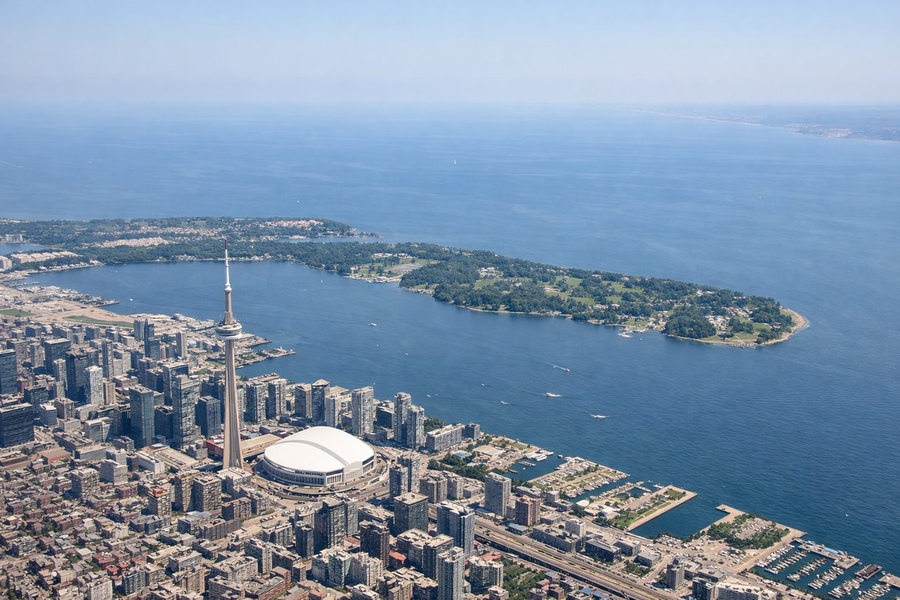
Takeoff from YYZ
LEFTLeft side offers views of Lake Ontario and the Greater Toronto Area shoreline during initial climb. You'll see the lake's expanse stretching east and the urban sprawl of Toronto receding beneath you.
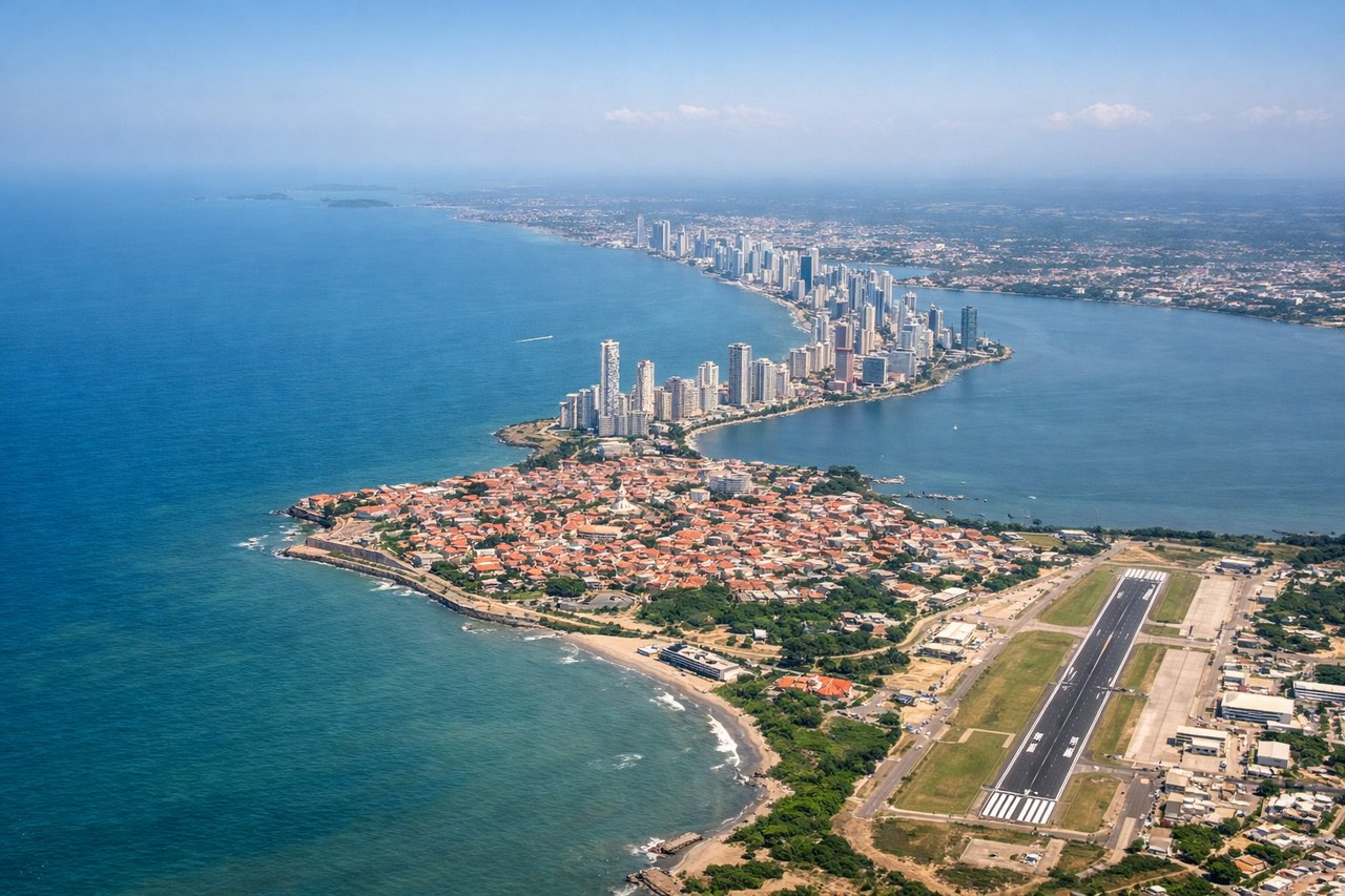
Landing at CTG
RIGHTRight side provides excellent views of the Caribbean coastline, Cartagena's historic walled city, and the surrounding bays during descent. You'll see the turquoise waters of Cartagena Bay and the distinctive peninsula where the old city sits.
Landmarks on this routeAll landmarks →
Will your flight be in sunlight?
See exactly which side of the plane gets sun and shade at your departure time.
About This Route
Which side of the plane should I sit on flying from Lester B Pearson International (YYZ) to Rafael Nunez (CTG)?
Sit on the Right side of the plane for the best views on flights from Toronto to Cartagena. While takeoff offers Lake Ontario views, the landing approach over Cartagena Bay and the Caribbean coastline is more visually dramatic and distinctive. The turquoise waters and historic city peninsula provide far more memorable scenery than Toronto's urban sprawl.
What can I see during takeoff from Lester B Pearson International in Toronto?
During takeoff from Lester B Pearson International (YYZ), sit on the Left side for the best views. Left side offers views of Lake Ontario and the Greater Toronto Area shoreline during initial climb. You'll see the lake's expanse stretching east and the urban sprawl of Toronto receding beneath you. Notable sights include: Lake Ontario, Toronto waterfront and downtown core, Scarborough Bluffs (eastern shoreline), Niagara Escarpment ridge (distant southwest).
What can I see when landing at Rafael Nunez in Cartagena?
When landing at Rafael Nunez (CTG), sit on the Right side for the best views. Right side provides excellent views of the Caribbean coastline, Cartagena's historic walled city, and the surrounding bays during descent. You'll see the turquoise waters of Cartagena Bay and the distinctive peninsula where the old city sits. Notable sights include: Caribbean Sea and Cartagena Bay (turquoise shallow waters), Cartagena's walled old city (Ciudad Vieja) on the peninsula, Rosario Islands archipelago (southeast of city), Magdalena River delta (south and inland).
How long is the flight from Toronto to Cartagena?
The flight from Lester B Pearson International (YYZ) to Rafael Nunez (CTG) takes 4h 15m.
What does the Toronto to Cartagena flight path pass over?
The flight path crosses the southeastern United States (Georgia, Florida panhandle visible on clear days), then the Gulf of Mexico, and approaches the Caribbean via Cuba's southern coast or the Windward Passage. Notable midpoint features include the Florida peninsula and Keys (if visible during daytime), the Gulf of Mexico's open waters, and Cuba's mountainous southern coast (Sierra Maestra range) visible on the approach to Caribbean waters.