The left side combines a scenic Toronto skyline and Lake Ontario departure with a striking Caribbean coastline arrival into Cancun, while the right side offers only flat inland terrain during both phases.
Flown YYZ to CUN? Did we get it right?
Flight Path
Toronto to Cancun is 1,618 miles (2,605 km), a flight of about 4 hours 15 minutes.
The route crosses the Appalachian foothills of eastern Kentucky and Tennessee before flattening out over Georgia and the Florida Panhandle, then continues over the open waters of the Gulf of Mexico toward the Yucatan coastline.
Great circle distance and headings ›

Phase by phase
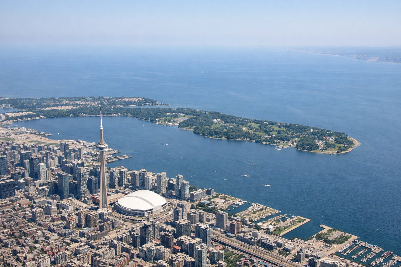
Takeoff from YYZ
LEFTDeparting YYZ to the south, the aircraft's turn brings downtown Toronto and Lake Ontario into view on the left side, with the CN Tower and the Toronto Islands briefly visible before the skyline fades behind the wing. The right side only shows suburban Mississauga and flat farmland.
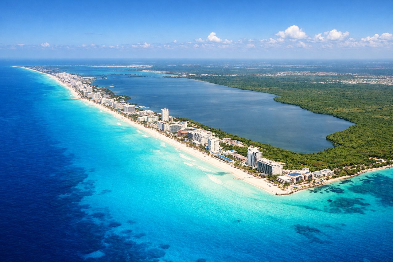
Landing at CUN
LEFTOn the runway 12 approach into Cancun, the final turn puts the turquoise Caribbean Sea, the Hotel Zone's beach strip, and Nichupte Lagoon on the left side of the aircraft just before touchdown. The right side instead faces the flat green jungle canopy of the inland Yucatan.
Will your flight be in sunlight?
Pick a date and time in the Sun Map to watch the sun move across your whole flight.
About This Route
Which side of the plane should I sit on flying from Lester B Pearson International (YYZ) to Cancun International (CUN)?
Sit on the Left side of the plane for the best views on flights from Toronto to Cancun. The left side combines a scenic Toronto skyline and Lake Ontario departure with a striking Caribbean coastline arrival into Cancun, while the right side offers only flat inland terrain during both phases.
What can I see during takeoff from Lester B Pearson International in Toronto?
During takeoff from Lester B Pearson International (YYZ), sit on the Left side for the best views. Departing YYZ to the south, the aircraft's turn brings downtown Toronto and Lake Ontario into view on the left side, with the CN Tower and the Toronto Islands briefly visible before the skyline fades behind the wing. The right side only shows suburban Mississauga and flat farmland. Notable sights include: CN Tower and downtown Toronto skyline, Lake Ontario shoreline, Toronto Islands, Billy Bishop Airport peninsula.
What can I see when landing at Cancun International in Cancun?
When landing at Cancun International (CUN), sit on the Left side for the best views. On the runway 12 approach into Cancun, the final turn puts the turquoise Caribbean Sea, the Hotel Zone's beach strip, and Nichupte Lagoon on the left side of the aircraft just before touchdown. The right side instead faces the flat green jungle canopy of the inland Yucatan. Notable sights include: Cancun Hotel Zone beaches, Nichupte Lagoon, turquoise Caribbean Sea, Isla Mujeres visible offshore.
How long is the flight from Toronto to Cancun?
The flight from Lester B Pearson International (YYZ) to Cancun International (CUN) takes about 4 hours 15 minutes. The shortest flight path between them is 1,618 miles (2,605 km); winds and air traffic control usually add a few percent.
What does the Toronto to Cancun flight path pass over?
The route crosses the Appalachian foothills of eastern Kentucky and Tennessee before flattening out over Georgia and the Florida Panhandle, then continues over the open waters of the Gulf of Mexico toward the Yucatan coastline.