The right side strings together the strongest individual moments of the flight: Toronto's skyline and lakefront at takeoff, the fjord-like coastline of Baffin Island and Davis Strait during the Arctic crossing, and a rare shot at Mount Fuji plus Tokyo Bay on final approach. The left side's Kamchatka volcanoes and Kuril Islands are impressive but more remote and less consistently visible than the right side's landmarks.
Flown YYZ to HND? Did we get it right?
Flight Path
Toronto to Tokyo is 6,429 miles (10,346 km), a flight of about 13 hours 35 minutes.
The route's midpoint falls over the Arctic, near the Beaufort Sea and Chukchi Sea between northern Canada and the Russian Far East, passing close to Banks Island and the Chukotka Peninsula before the flight path curves south toward Kamchatka and Japan.
Great circle distance and headings ›


Phase by phase
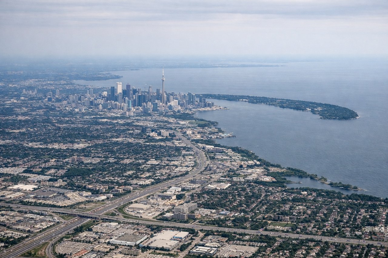
Takeoff from YYZ
RIGHTDeparting YYZ on a north-northwest heading toward the Arctic, a right-side turn during climb-out keeps Toronto's downtown skyline and the Lake Ontario shoreline in view longer before the aircraft crosses over the Ontario countryside toward James Bay. The left side mostly shows flat farmland with no lake or skyline reference.
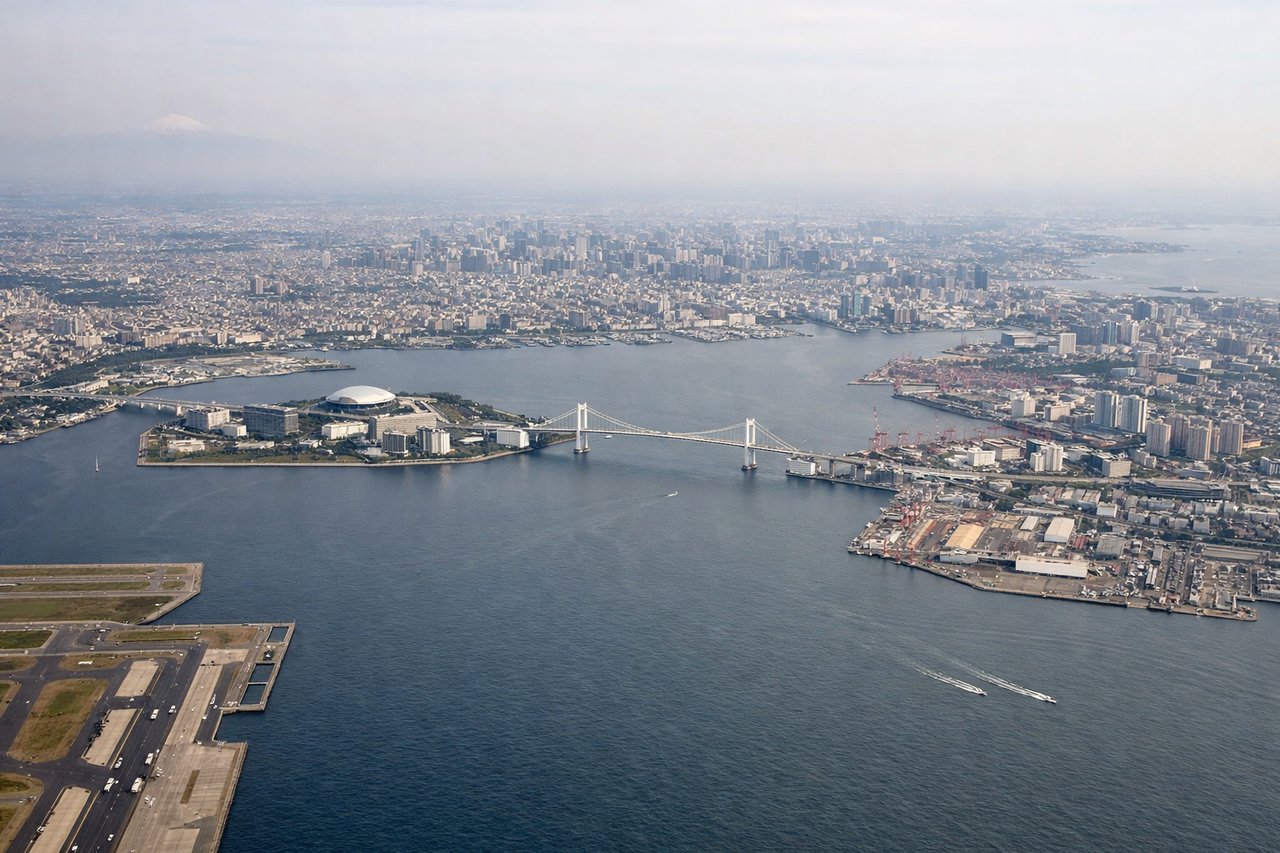
Landing at HND
RIGHTOn the descent into Haneda from the north, the approach path crosses Chiba and Tokyo Bay, and on a clear day Mount Fuji's snow-capped cone is visible off to the west on the right side, along with Yokohama's port and skyline. The left side mainly faces inland Chiba suburbs with no comparable landmark.
Will your flight be in sunlight?
Pick a date and time in the Sun Map to watch the sun move across your whole flight.
About This Route
Which side of the plane should I sit on flying from Lester B Pearson International (YYZ) to Tokyo International (HND)?
Sit on the Right side of the plane for the best views on flights from Toronto to Tokyo. The right side strings together the strongest individual moments of the flight: Toronto's skyline and lakefront at takeoff, the fjord-like coastline of Baffin Island and Davis Strait during the Arctic crossing, and a rare shot at Mount Fuji plus Tokyo Bay on final approach. The left side's Kamchatka volcanoes and Kuril Islands are impressive but more remote and less consistently visible than the right side's landmarks.
What can I see during takeoff from Lester B Pearson International in Toronto?
During takeoff from Lester B Pearson International (YYZ), sit on the Right side for the best views. Departing YYZ on a north-northwest heading toward the Arctic, a right-side turn during climb-out keeps Toronto's downtown skyline and the Lake Ontario shoreline in view longer before the aircraft crosses over the Ontario countryside toward James Bay. The left side mostly shows flat farmland with no lake or skyline reference. Notable sights include: Toronto downtown skyline (CN Tower), Lake Ontario shoreline, Toronto Islands, Ontario farmland.
What can I see when landing at Tokyo International in Tokyo?
When landing at Tokyo International (HND), sit on the Right side for the best views. On the descent into Haneda from the north, the approach path crosses Chiba and Tokyo Bay, and on a clear day Mount Fuji's snow-capped cone is visible off to the west on the right side, along with Yokohama's port and skyline. The left side mainly faces inland Chiba suburbs with no comparable landmark. Notable sights include: Mount Fuji, Tokyo Bay, Yokohama skyline and port cranes, Miura Peninsula.
How long is the flight from Toronto to Tokyo?
The flight from Lester B Pearson International (YYZ) to Tokyo International (HND) takes about 13 hours 35 minutes. The shortest flight path between them is 6,429 miles (10,346 km); winds and air traffic control usually add a few percent.
What does the Toronto to Tokyo flight path pass over?
The route's midpoint falls over the Arctic, near the Beaufort Sea and Chukchi Sea between northern Canada and the Russian Far East, passing close to Banks Island and the Chukotka Peninsula before the flight path curves south toward Kamchatka and Japan.