The left side bookends the flight with two genuinely dramatic, recognizable landmarks — Mount Fuji at departure and the Toronto lakefront skyline at arrival — while the right side offers comparatively featureless bay and suburban views at both ends.
Flown HND to YYZ? Did we get it right?
Flight Path
Tokyo to Toronto is 6,429 miles (10,346 km), a flight of about 12 hours 35 minutes.
The great-circle route arcs north over the Sea of Okhotsk and Kamchatka Peninsula's volcanic cones, then crosses the Bering Sea and southern Alaska near the Alaska Range, before tracking over the boreal forests and lakes of the Yukon, Northwest Territories, and the ice-rimmed shores of Hudson Bay on the way down into Ontario.
Great circle distance and headings ›


Phase by phase
Takeoff from HND
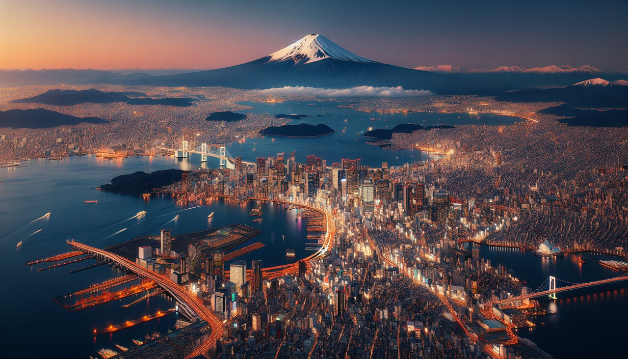
LEFTDeparting Haneda, the climb-out and initial turn typically give the left side a view of Mount Fuji's snow-capped cone rising above the haze to the southwest, along with Tokyo Bay and the Yokohama waterfront below. The right side mostly shows flat Chiba coastline and open bay water.
Landing at YYZ
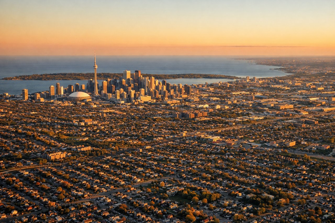
LEFTOn the common southwest-wind approach into Pearson (runway 24), aircraft fly a southwesterly final approach from the northeast, putting downtown Toronto and Lake Ontario off the left side of the cabin. Passengers get a good look at the CN Tower and the lakefront skyline before the runway threshold.
Will your flight be in sunlight?
Pick a date and time in the Sun Map to watch the sun move across your whole flight.
About This Route
Which side of the plane should I sit on flying from Tokyo International (HND) to Lester B Pearson International (YYZ)?
Sit on the Left side of the plane for the best views on flights from Tokyo to Toronto. The left side bookends the flight with two genuinely dramatic, recognizable landmarks — Mount Fuji at departure and the Toronto lakefront skyline at arrival — while the right side offers comparatively featureless bay and suburban views at both ends.
What can I see during takeoff from Tokyo International in Tokyo?
During takeoff from Tokyo International (HND), sit on the Left side for the best views. Departing Haneda, the climb-out and initial turn typically give the left side a view of Mount Fuji's snow-capped cone rising above the haze to the southwest, along with Tokyo Bay and the Yokohama waterfront below. The right side mostly shows flat Chiba coastline and open bay water. Notable sights include: Mount Fuji, Tokyo Bay, Yokohama skyline, Odaiba/Tokyo waterfront.
What can I see when landing at Lester B Pearson International in Toronto?
When landing at Lester B Pearson International (YYZ), sit on the Left side for the best views. On the common southwest-wind approach into Pearson (runway 24), aircraft fly a southwesterly final approach from the northeast, putting downtown Toronto and Lake Ontario off the left side of the cabin. Passengers get a good look at the CN Tower and the lakefront skyline before the runway threshold. Notable sights include: CN Tower, Toronto Islands, Lake Ontario shoreline, downtown Toronto skyline.
How long is the flight from Tokyo to Toronto?
The flight from Tokyo International (HND) to Lester B Pearson International (YYZ) takes about 12 hours 35 minutes. The shortest flight path between them is 6,429 miles (10,346 km); winds and air traffic control usually add a few percent.
What does the Tokyo to Toronto flight path pass over?
The great-circle route arcs north over the Sea of Okhotsk and Kamchatka Peninsula's volcanic cones, then crosses the Bering Sea and southern Alaska near the Alaska Range, before tracking over the boreal forests and lakes of the Yukon, Northwest Territories, and the ice-rimmed shores of Hudson Bay on the way down into Ontario.