The right side benefits from northern views of the Rocky Mountain foothills during cruise and the dramatic Las Vegas Strip and Lake Mead scenery on final approach, giving it more consistent visual interest than the largely flat, lake-only left side.
Flown YYZ to LAS? Did we get it right?
Flight Path
Toronto to Las Vegas is 1,939 miles (3,120 km), a flight of about 5 hours 5 minutes.
Great Lakes basin (Lake Huron/Lake Michigan), Great Plains of Nebraska and eastern Colorado, and the Front Range of the Rocky Mountains near the Colorado-Wyoming border before descending into the Great Basin desert of Utah and Nevada
Great circle distance and headings ›


Phase by phase
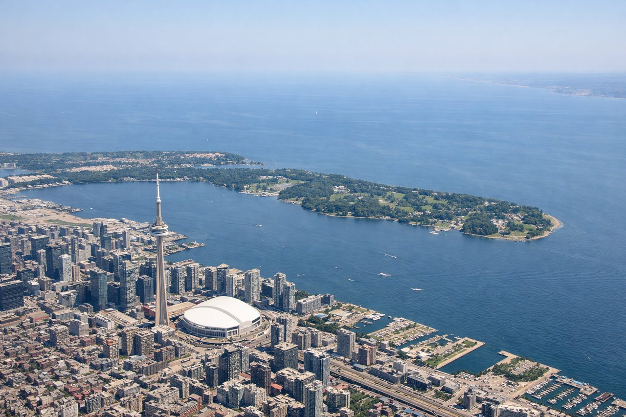
Takeoff from YYZ
LEFTDeparting YYZ to the southwest, the initial climb out puts Lake Ontario and the Toronto skyline (CN Tower, downtown waterfront) on the left side before the aircraft turns onto its westbound heading. The right side just shows suburban sprawl north of the airport.
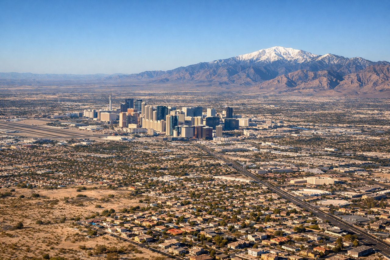
Landing at LAS
RIGHTOn approach to LAS runway 26, the flight path crosses the desert northeast of the city, and the final turn brings the Las Vegas Strip's towers into view on the right side of the aircraft before touchdown. Lake Mead and the reddish desert ridgelines are also visible earlier in the descent to the north.
Will your flight be in sunlight?
Pick a date and time in the Sun Map to watch the sun move across your whole flight.
About This Route
Which side of the plane should I sit on flying from Lester B Pearson International (YYZ) to Mc Carran International (LAS)?
Sit on the Right side of the plane for the best views on flights from Toronto to Las Vegas. The right side benefits from northern views of the Rocky Mountain foothills during cruise and the dramatic Las Vegas Strip and Lake Mead scenery on final approach, giving it more consistent visual interest than the largely flat, lake-only left side.
What can I see during takeoff from Lester B Pearson International in Toronto?
During takeoff from Lester B Pearson International (YYZ), sit on the Left side for the best views. Departing YYZ to the southwest, the initial climb out puts Lake Ontario and the Toronto skyline (CN Tower, downtown waterfront) on the left side before the aircraft turns onto its westbound heading. The right side just shows suburban sprawl north of the airport. Notable sights include: Lake Ontario shoreline, Toronto downtown skyline, CN Tower, Toronto Islands.
What can I see when landing at Mc Carran International in Las Vegas?
When landing at Mc Carran International (LAS), sit on the Right side for the best views. On approach to LAS runway 26, the flight path crosses the desert northeast of the city, and the final turn brings the Las Vegas Strip's towers into view on the right side of the aircraft before touchdown. Lake Mead and the reddish desert ridgelines are also visible earlier in the descent to the north. Notable sights include: Las Vegas Strip skyline, Lake Mead, Spring Mountains, Mojave Desert terrain.
How long is the flight from Toronto to Las Vegas?
The flight from Lester B Pearson International (YYZ) to Mc Carran International (LAS) takes about 5 hours 5 minutes. The shortest flight path between them is 1,939 miles (3,120 km); winds and air traffic control usually add a few percent.
What does the Toronto to Las Vegas flight path pass over?
Great Lakes basin (Lake Huron/Lake Michigan), Great Plains of Nebraska and eastern Colorado, and the Front Range of the Rocky Mountains near the Colorado-Wyoming border before descending into the Great Basin desert of Utah and Nevada