The left side combines a scenic urban departure over Toronto with a long cruise phase tracking near the Atlantic coastline and Bahamian islands, giving it more sustained visual interest than the right side, which sees mostly flat interior US terrain until the final approach.
Flown YYZ to MBJ? Did we get it right?
Flight Path
Toronto to Montego Bay is 1,742 miles (2,804 km), a flight of about 3 hours 45 minutes.
Appalachian ridgelines over Pennsylvania and Virginia, the Atlantic coastline near Cape Hatteras, and the shallow turquoise banks of the northern Bahamas (Andros and the Exuma chain) before the final leg toward Jamaica
Great circle distance and headings ›

Phase by phase
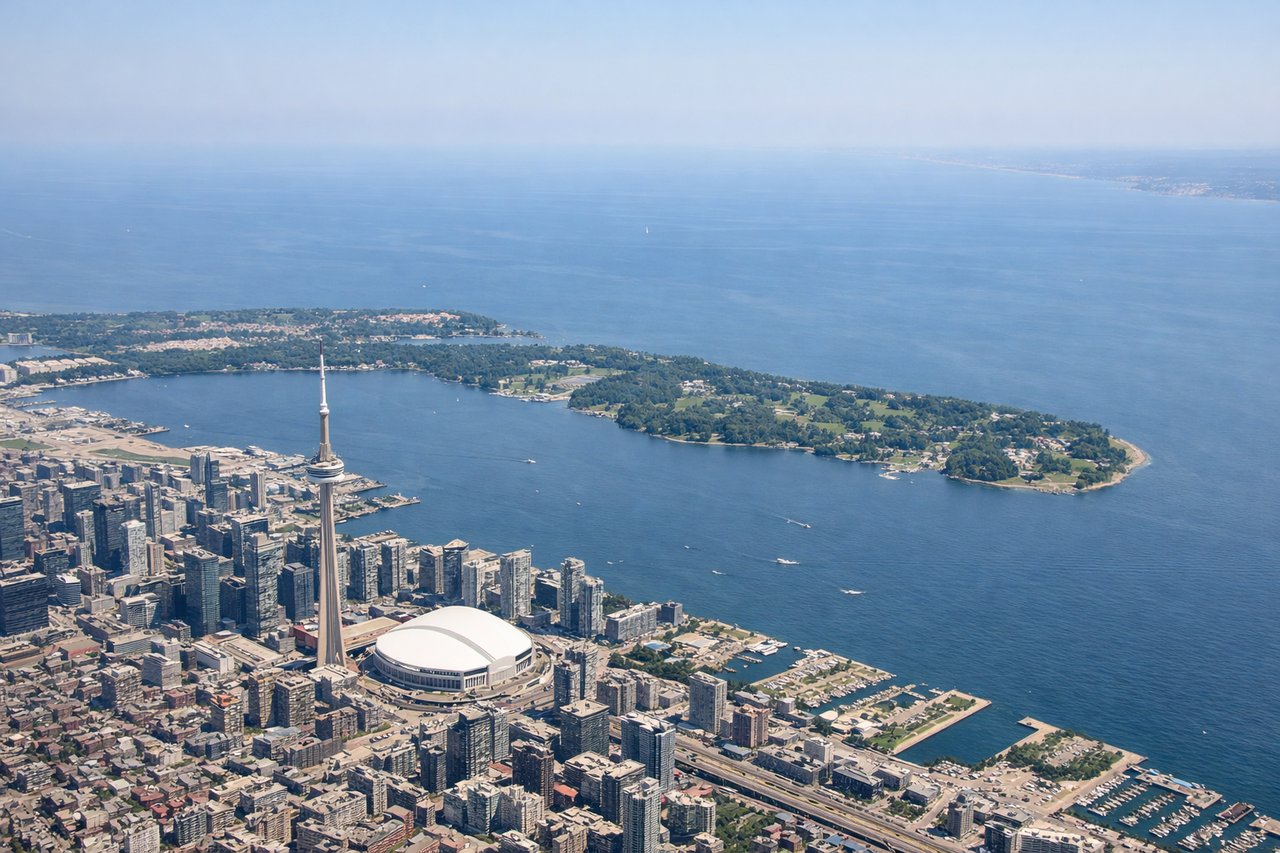
Takeoff from YYZ
LEFTDeparting YYZ toward the south, the initial climb and turn put downtown Toronto's skyline and the Lake Ontario shoreline on the left side of the aircraft, giving a brief but distinct urban view before the route heads out over farmland and the Appalachian foothills.
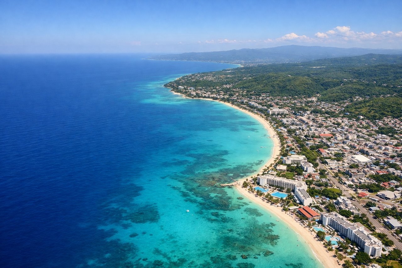
Landing at MBJ
RIGHTOn final approach into MBJ from the southwest, the aircraft aligns with runway 07 along Jamaica's north coast, putting the island's green interior hills and Cockpit Country foothills on the right side while the left mostly faces open Caribbean water.
Will your flight be in sunlight?
Pick a date and time in the Sun Map to watch the sun move across your whole flight.
About This Route
Which side of the plane should I sit on flying from Lester B Pearson International (YYZ) to Sangster International (MBJ)?
Sit on the Left side of the plane for the best views on flights from Toronto to Montego Bay. The left side combines a scenic urban departure over Toronto with a long cruise phase tracking near the Atlantic coastline and Bahamian islands, giving it more sustained visual interest than the right side, which sees mostly flat interior US terrain until the final approach.
What can I see during takeoff from Lester B Pearson International in Toronto?
During takeoff from Lester B Pearson International (YYZ), sit on the Left side for the best views. Departing YYZ toward the south, the initial climb and turn put downtown Toronto's skyline and the Lake Ontario shoreline on the left side of the aircraft, giving a brief but distinct urban view before the route heads out over farmland and the Appalachian foothills. Notable sights include: CN Tower and downtown Toronto skyline, Toronto Islands, Lake Ontario shoreline, Port Lands waterfront.
What can I see when landing at Sangster International in Montego Bay?
When landing at Sangster International (MBJ), sit on the Right side for the best views. On final approach into MBJ from the southwest, the aircraft aligns with runway 07 along Jamaica's north coast, putting the island's green interior hills and Cockpit Country foothills on the right side while the left mostly faces open Caribbean water. Notable sights include: Jamaica's interior hills near Cockpit Country, Montego Bay's coastal resort strip, turquoise coastal shallows, Great River valley.
How long is the flight from Toronto to Montego Bay?
The flight from Lester B Pearson International (YYZ) to Sangster International (MBJ) takes about 3 hours 45 minutes. The shortest flight path between them is 1,742 miles (2,804 km); winds and air traffic control usually add a few percent.
What does the Toronto to Montego Bay flight path pass over?
Appalachian ridgelines over Pennsylvania and Virginia, the Atlantic coastline near Cape Hatteras, and the shallow turquoise banks of the northern Bahamas (Andros and the Exuma chain) before the final leg toward Jamaica