The left side delivers the more dramatic and varied experience overall. The Toronto departure offers the iconic CN Tower and Lake Ontario waterfront, and as the flight tracks south-southwest, the left side also captures the Caribbean coastline of Cuba and the northern coast of Colombia as the route passes over the western Caribbean. The landing view on the right is excellent but shorter in duration.
Flown YYZ to PTY? Did we get it right?
Flight Path
Toronto to Panama City is 2,391 miles (3,848 km), a flight of about 5 hours 45 minutes.
The flight tracks south over Lake Erie and into the Appalachians briefly, then over the Atlantic coastal plain. It crosses Cuba's western end near Havana, passes over the Caribbean Sea, skims the northern coast of Colombia near Cartagena, and crosses into Panama over the Darien lowlands before descending into Tocumen. The Sierra Maestra mountains of eastern Cuba and the Colombian coastal range are faintly visible on clear days.
Great circle distance and headings ›


Phase by phase
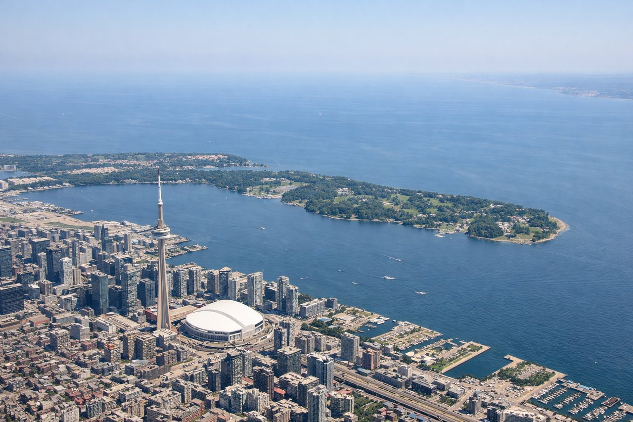
Takeoff from YYZ
LEFTYYZ typically departs south or east on runways 23/24L/24R, meaning a left-side seat gives you views over downtown Toronto, Lake Ontario, and the Toronto Islands. The city grid and waterfront are clearly visible during climb-out before turning south.
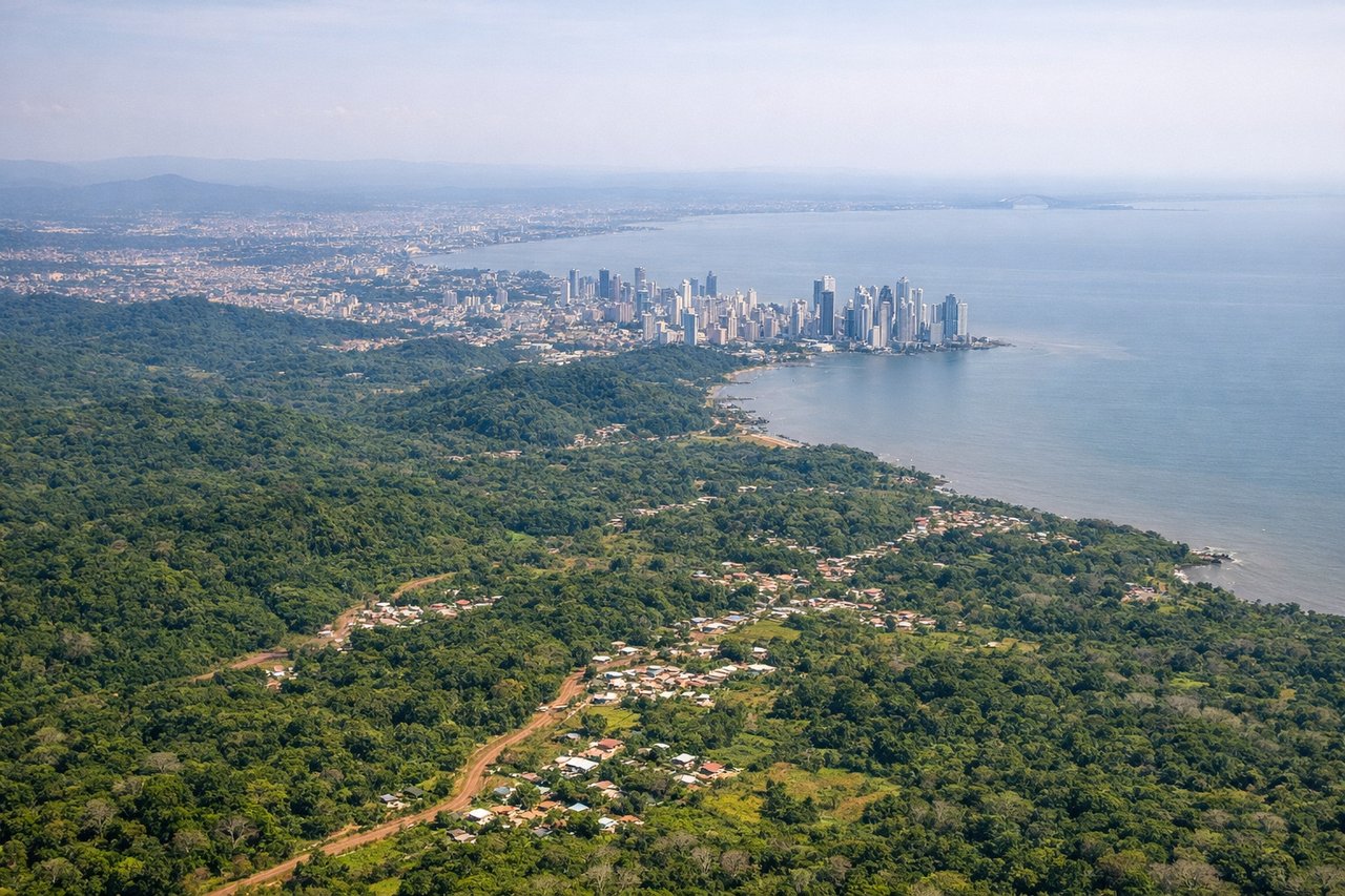
Landing at PTY
RIGHTTocumen typically lands on runway 03R/21L aligned roughly north-south. Approaching from the north on a southbound heading, the right side gives views over Panama Bay and the Pacific entrance to the Panama Canal. The Bridge of the Americas and the canal's Pacific locks are visible on approach.
Will your flight be in sunlight?
Pick a date and time in the Sun Map to watch the sun move across your whole flight.
About This Route
Which side of the plane should I sit on flying from Lester B Pearson International (YYZ) to Tocumen International (PTY)?
Sit on the Left side of the plane for the best views on flights from Toronto to Panama City. The left side delivers the more dramatic and varied experience overall. The Toronto departure offers the iconic CN Tower and Lake Ontario waterfront, and as the flight tracks south-southwest, the left side also captures the Caribbean coastline of Cuba and the northern coast of Colombia as the route passes over the western Caribbean. The landing view on the right is excellent but shorter in duration.
What can I see during takeoff from Lester B Pearson International in Toronto?
During takeoff from Lester B Pearson International (YYZ), sit on the Left side for the best views. YYZ typically departs south or east on runways 23/24L/24R, meaning a left-side seat gives you views over downtown Toronto, Lake Ontario, and the Toronto Islands. The city grid and waterfront are clearly visible during climb-out before turning south. Notable sights include: Downtown Toronto skyline with CN Tower, Toronto Islands and Island Airport, Lake Ontario shoreline, Humber Bay.
What can I see when landing at Tocumen International in Panama City?
When landing at Tocumen International (PTY), sit on the Right side for the best views. Tocumen typically lands on runway 03R/21L aligned roughly north-south. Approaching from the north on a southbound heading, the right side gives views over Panama Bay and the Pacific entrance to the Panama Canal. The Bridge of the Americas and the canal's Pacific locks are visible on approach. Notable sights include: Panama Bay, Bridge of the Americas, Pacific entrance to the Panama Canal (Miraflores/Pedro Miguel locks area), Panama City skyline.
How long is the flight from Toronto to Panama City?
The flight from Lester B Pearson International (YYZ) to Tocumen International (PTY) takes about 5 hours 45 minutes. The shortest flight path between them is 2,391 miles (3,848 km); winds and air traffic control usually add a few percent.
What does the Toronto to Panama City flight path pass over?
The flight tracks south over Lake Erie and into the Appalachians briefly, then over the Atlantic coastal plain. It crosses Cuba's western end near Havana, passes over the Caribbean Sea, skims the northern coast of Colombia near Cartagena, and crosses into Panama over the Darien lowlands before descending into Tocumen. The Sierra Maestra mountains of eastern Cuba and the Colombian coastal range are faintly visible on clear days.