While takeoff offers excellent Alpine views from the right, the landing sequence into Tampa Bay from the left provides more sustained and dramatic geography—a full view of one of Florida's major coastal features during descent. The left side captures the approach corridor and the bay's full extent.
Flown ZRH to TPA? Did we get it right?
Flight Path
Zurich to Tampa is 4,869 miles (7,836 km), a flight of about 10 hours 45 minutes.
The flight crosses the Atlantic Ocean for roughly 6-7 hours. Notable waypoints include the southern coast of Ireland and the UK (if visible during daylight), the open Atlantic with no landmarks, and the approach to North America via Newfoundland or the US East Coast. The Appalachian Mountains may be visible during descent into the southeastern US, though at cruise altitude (35,000+ feet) they appear as subtle terrain texture rather than distinct peaks. The flight path generally follows a great-circle route southwest across the Atlantic, with no major geographic features visible during the mid-ocean portion.
Great circle distance and headings ›


Phase by phase

Takeoff from ZRH
RIGHTRight-side seats capture the Alps immediately after departure. Zurich typically departs runway 28 or 34 (northwesterly headings), banking right over the Swiss plateau. The Alps dominate the right horizon within minutes of liftoff.
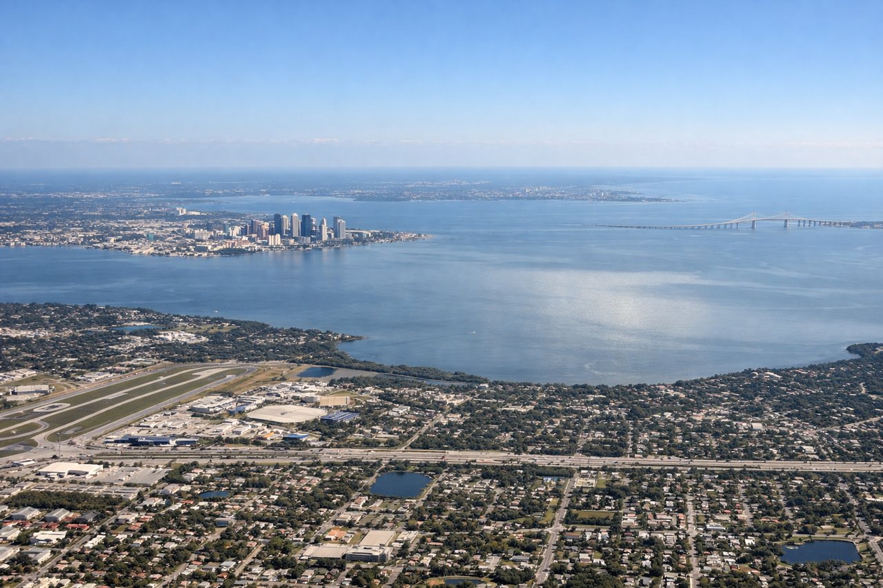
Landing at TPA
LEFTLeft-side seats offer views of the Florida Gulf Coast and Tampa Bay as you descend into TPA. Tampa typically lands runway 18L or 18R (southerly approaches), and the left side frames the bay, barrier islands, and coastal geography during final approach.
Will your flight be in sunlight?
Pick a date and time in the Sun Map to watch the sun move across your whole flight.
About This Route
Which side of the plane should I sit on flying from Zurich (ZRH) to Tampa International (TPA)?
Sit on the Left side of the plane for the best views on flights from Zurich to Tampa. While takeoff offers excellent Alpine views from the right, the landing sequence into Tampa Bay from the left provides more sustained and dramatic geography—a full view of one of Florida's major coastal features during descent. The left side captures the approach corridor and the bay's full extent.
What can I see during takeoff from Zurich in Zurich?
During takeoff from Zurich (ZRH), sit on the Right side for the best views. Right-side seats capture the Alps immediately after departure. Zurich typically departs runway 28 or 34 (northwesterly headings), banking right over the Swiss plateau. The Alps dominate the right horizon within minutes of liftoff. Notable sights include: Northern Alps (Säntis region), Lake Zurich (Zürichsee) below, Swiss plateau farmland, Rhine valley to the north.
What can I see when landing at Tampa International in Tampa?
When landing at Tampa International (TPA), sit on the Left side for the best views. Left-side seats offer views of the Florida Gulf Coast and Tampa Bay as you descend into TPA. Tampa typically lands runway 18L or 18R (southerly approaches), and the left side frames the bay, barrier islands, and coastal geography during final approach. Notable sights include: Tampa Bay (the bay itself), Hillsborough Bay, Clearwater Beach and barrier islands to the west, downtown Tampa skyline.
How long is the flight from Zurich to Tampa?
The flight from Zurich (ZRH) to Tampa International (TPA) takes about 10 hours 45 minutes. The shortest flight path between them is 4,869 miles (7,836 km); winds and air traffic control usually add a few percent.
What does the Zurich to Tampa flight path pass over?
The flight crosses the Atlantic Ocean for roughly 6-7 hours. Notable waypoints include the southern coast of Ireland and the UK (if visible during daylight), the open Atlantic with no landmarks, and the approach to North America via Newfoundland or the US East Coast. The Appalachian Mountains may be visible during descent into the southeastern US, though at cruise altitude (35,000+ feet) they appear as subtle terrain texture rather than distinct peaks. The flight path generally follows a great-circle route southwest across the Atlantic, with no major geographic features visible during the mid-ocean portion.