Left side captures the most dramatic scenery: the Trans-Ili Alatau mountains during departure are visually superior to the relatively flat coastal approach into Incheon. The mountain views outweigh the estuary views on landing.
Flown ALA to ICN? Did we get it right?
Flight Path
Almaty to Seoul is 2,592 miles (4,172 km), a flight of about 4 hours 15 minutes.
The flight path crosses the Tian Shan foothills east of Almaty, then traverses the Gobi Desert and Mongolian steppe (largely featureless at altitude), before approaching the Korean Peninsula. The Altai Mountains may be visible to the north on clear days during the central portion of the flight. As the aircraft descends toward Seoul, the transition from inland mountains to coastal plains becomes apparent, with the Yellow Sea appearing as a distinct blue-grey expanse.
Great circle distance and headings ›


Phase by phase
Takeoff from ALA
LEFTLeft side offers immediate views of the Trans-Ili Alatau mountains rising directly south of Almaty. The range dominates the southern horizon during climb-out and provides dramatic relief against the steppe.
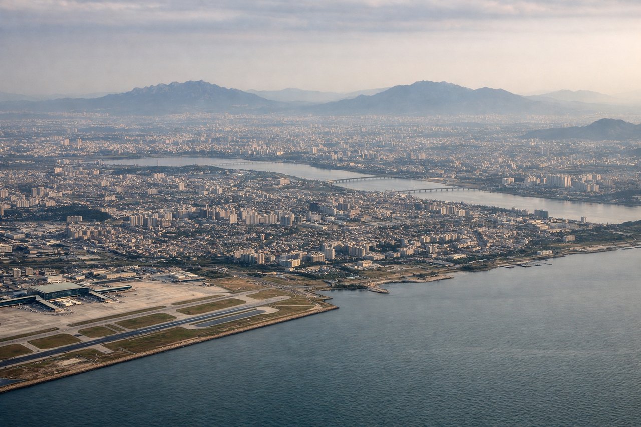
Landing at ICN
RIGHTRight side provides views of the Han River estuary and Incheon's coastal geography during descent. The river's distinctive meanders and the Yellow Sea coastline are clearly visible on approach to ICN.
Will your flight be in sunlight?
Pick a date and time in the Sun Map to watch the sun move across your whole flight.
About This Route
Which side of the plane should I sit on flying from Almaty (ALA) to Incheon International (ICN)?
Sit on the Left side of the plane for the best views on flights from Almaty to Seoul. Left side captures the most dramatic scenery: the Trans-Ili Alatau mountains during departure are visually superior to the relatively flat coastal approach into Incheon. The mountain views outweigh the estuary views on landing.
What can I see during takeoff from Almaty in Almaty?
During takeoff from Almaty (ALA), sit on the Left side for the best views. Left side offers immediate views of the Trans-Ili Alatau mountains rising directly south of Almaty. The range dominates the southern horizon during climb-out and provides dramatic relief against the steppe. Notable sights include: Trans-Ili Alatau (snow-capped peaks), Big Almaty Lake (turquoise alpine lake visible at ~2,400m), Almaty city grid spreading northward across the plain, Turgen River valley cutting through foothills.
What can I see when landing at Incheon International in Seoul?
When landing at Incheon International (ICN), sit on the Right side for the best views. Right side provides views of the Han River estuary and Incheon's coastal geography during descent. The river's distinctive meanders and the Yellow Sea coastline are clearly visible on approach to ICN. Notable sights include: Han River estuary and meanders, Incheon International Airport islands and reclaimed land, Yellow Sea coastline, Seoul metropolitan sprawl visible inland to the southeast.
How long is the flight from Almaty to Seoul?
The flight from Almaty (ALA) to Incheon International (ICN) takes about 4 hours 15 minutes. The shortest flight path between them is 2,592 miles (4,172 km); winds and air traffic control usually add a few percent.
What does the Almaty to Seoul flight path pass over?
The flight path crosses the Tian Shan foothills east of Almaty, then traverses the Gobi Desert and Mongolian steppe (largely featureless at altitude), before approaching the Korean Peninsula. The Altai Mountains may be visible to the north on clear days during the central portion of the flight. As the aircraft descends toward Seoul, the transition from inland mountains to coastal plains becomes apparent, with the Yellow Sea appearing as a distinct blue-grey expanse.