Anchorage to Dillingham is 328 miles (527 km), a flight of about 1 hour 10 minutes.
The westbound routing from ANC to DLG (approximately 260° magnetic) favors left-side views throughout. Departure offers the dramatic Chugach Mountains and Cook Inlet, while the cruise segment crosses the Alaska Range foothills and Lake Clark region. Arrival views of Nushagak Bay are good from either side, but the overall flight path and most dramatic scenery align with left-window preference.
Flight Path
Lake Clark (visible as a large alpine lake roughly 60 miles west of ANC), Talachulitna River valley, transition from mountainous terrain to coastal lowlands, scattered glaciated peaks of the Alaska Range foothills, extensive tundra and wetland complexes west of the range
Great circle distance and headings ›Phase by phase
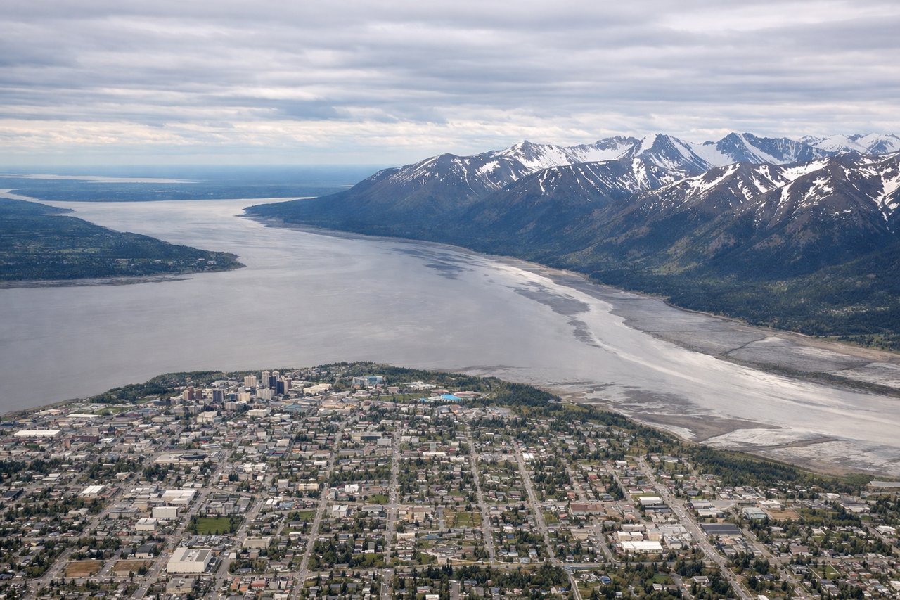
Takeoff from ANC
LEFTANC typically departs runways 01L/01R or 19L/19R. Westbound departures (runway 01) favor left seats for views of the Chugach Mountains immediately south and the Cook Inlet to the west. The left side captures the dramatic glaciated peaks and the broad water body that defines Anchorage's geography.
Landing at DLG
RIGHTApproaching DLG typically uses runway 09 or 27 depending on wind. Right seats on descent capture the Wood River and Nushagak Bay, the primary geographic features defining Dillingham's location. The right side also shows the Bristol Bay coastline and the transition from inland terrain to coastal flats.
Landmarks on this routeAll landmarks →
Will your flight be in sunlight?
Pick a date and time in the Sun Map to watch the sun move across your whole flight.
About This Route
Which side of the plane should I sit on flying from Ted Stevens Anchorage International (ANC) to Dillingham (DLG)?
Sit on the Left side of the plane for the best views on flights from Anchorage to Dillingham. The westbound routing from ANC to DLG (approximately 260° magnetic) favors left-side views throughout. Departure offers the dramatic Chugach Mountains and Cook Inlet, while the cruise segment crosses the Alaska Range foothills and Lake Clark region. Arrival views of Nushagak Bay are good from either side, but the overall flight path and most dramatic scenery align with left-window preference.
What can I see during takeoff from Ted Stevens Anchorage International in Anchorage?
During takeoff from Ted Stevens Anchorage International (ANC), sit on the Left side for the best views. ANC typically departs runways 01L/01R or 19L/19R. Westbound departures (runway 01) favor left seats for views of the Chugach Mountains immediately south and the Cook Inlet to the west. The left side captures the dramatic glaciated peaks and the broad water body that defines Anchorage's geography. Notable sights include: Chugach Mountains (south), Cook Inlet (west), Knik Arm (northwest), Turnagain Arm (southeast).
What can I see when landing at Dillingham in Dillingham?
When landing at Dillingham (DLG), sit on the Right side for the best views. Approaching DLG typically uses runway 09 or 27 depending on wind. Right seats on descent capture the Wood River and Nushagak Bay, the primary geographic features defining Dillingham's location. The right side also shows the Bristol Bay coastline and the transition from inland terrain to coastal flats. Notable sights include: Nushagak Bay (south), Wood River (north), Bristol Bay (south), Ahklun Mountains (northeast).
How long is the flight from Anchorage to Dillingham?
The flight from Ted Stevens Anchorage International (ANC) to Dillingham (DLG) takes about 1 hour 10 minutes. The shortest flight path between them is 328 miles (527 km); winds and air traffic control usually add a few percent.
What does the Anchorage to Dillingham flight path pass over?
Lake Clark (visible as a large alpine lake roughly 60 miles west of ANC), Talachulitna River valley, transition from mountainous terrain to coastal lowlands, scattered glaciated peaks of the Alaska Range foothills, extensive tundra and wetland complexes west of the range