Anchorage to Phoenix is 2,549 miles (4,102 km), a flight of about 5 hours 55 minutes.
The right side wins overall thanks to dramatic Alaska Range and Cook Inlet views on departure, and rugged Sonoran Desert mountain scenery on arrival into Phoenix, while the left side offers comparatively flatter, less distinctive terrain throughout the flight.
Flight Path
Coast Mountains of British Columbia, the Rocky Mountain foothills of Idaho and Utah, the Great Salt Lake basin, and the high desert plateaus of Nevada and northern Arizona
Great circle distance and headings ›

.jpeg?width=600)
Phase by phase
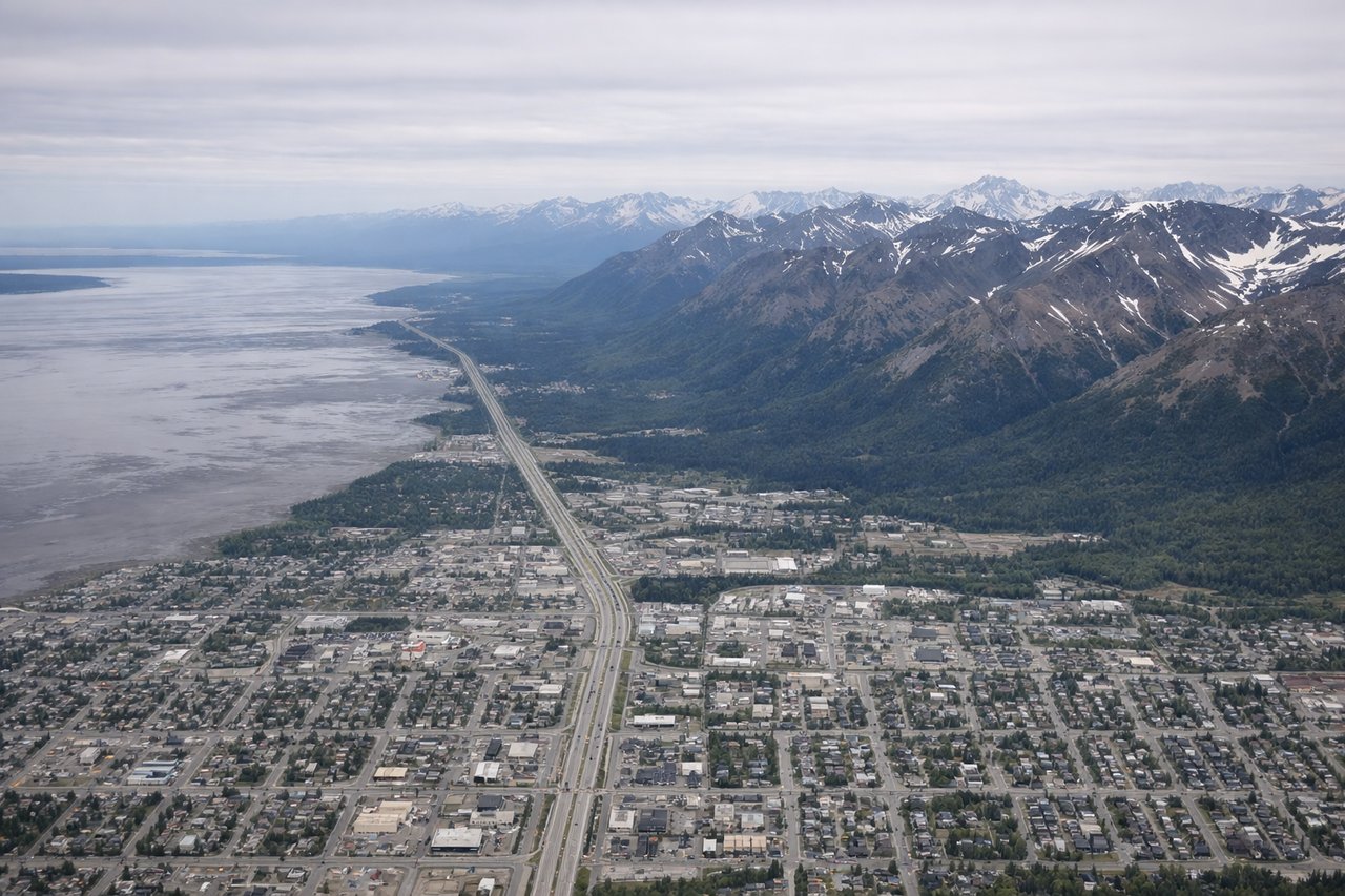
Takeoff from ANC
RIGHTDeparting ANC to the southeast, the right side faces west across Cook Inlet toward Mount Susitna and the jagged peaks of the Alaska Range, with Denali visible on the horizon on a clear day. The left side mostly shows the closer, less varied Chugach foothills.

Landing at PHX
RIGHTOn approach into PHX from the north, the right side offers views of the Superstition Mountains and the rugged desert terrain east of the city, contrasting sharply with the flat valley floor. The left side mainly shows suburban sprawl with fewer distinct geographic features.
Landmarks on this routeAll landmarks →
Will your flight be in sunlight?
Pick a date and time in the Sun Map to watch the sun move across your whole flight.
About This Route
Which side of the plane should I sit on flying from Ted Stevens Anchorage International (ANC) to Phoenix Sky Harbor International (PHX)?
Sit on the Right side of the plane for the best views on flights from Anchorage to Phoenix. The right side wins overall thanks to dramatic Alaska Range and Cook Inlet views on departure, and rugged Sonoran Desert mountain scenery on arrival into Phoenix, while the left side offers comparatively flatter, less distinctive terrain throughout the flight.
What can I see during takeoff from Ted Stevens Anchorage International in Anchorage?
During takeoff from Ted Stevens Anchorage International (ANC), sit on the Right side for the best views. Departing ANC to the southeast, the right side faces west across Cook Inlet toward Mount Susitna and the jagged peaks of the Alaska Range, with Denali visible on the horizon on a clear day. The left side mostly shows the closer, less varied Chugach foothills. Notable sights include: Cook Inlet, Mount Susitna, Alaska Range, Denali (distant).
What can I see when landing at Phoenix Sky Harbor International in Phoenix?
When landing at Phoenix Sky Harbor International (PHX), sit on the Right side for the best views. On approach into PHX from the north, the right side offers views of the Superstition Mountains and the rugged desert terrain east of the city, contrasting sharply with the flat valley floor. The left side mainly shows suburban sprawl with fewer distinct geographic features. Notable sights include: Superstition Mountains, Salt River Valley, Sonoran Desert terrain, Phoenix skyline.
How long is the flight from Anchorage to Phoenix?
The flight from Ted Stevens Anchorage International (ANC) to Phoenix Sky Harbor International (PHX) takes about 5 hours 55 minutes. The shortest flight path between them is 2,549 miles (4,102 km); winds and air traffic control usually add a few percent.
What does the Anchorage to Phoenix flight path pass over?
Coast Mountains of British Columbia, the Rocky Mountain foothills of Idaho and Utah, the Great Salt Lake basin, and the high desert plateaus of Nevada and northern Arizona