Phoenix to Anchorage is 2,549 miles (4,102 km), a flight of about 4 hours 45 minutes.
While takeoff and landing favor the right, the long cruise phase strongly favors the left, which faces west toward coastal British Columbia and the Alaska Panhandle - the Coast Mountains, Inside Passage fjords, and glaciated terrain near Wrangell-St Elias make for a far more varied and dramatic several hours of viewing than the right side's interior plateau and boreal forest.
Flight Path
Interior British Columbia plateau and Coast Mountains to the west, Fraser River valley, and the glaciated peaks of the Alaska Panhandle near Wrangell-St Elias as the route approaches Southcentral Alaska
Great circle distance and headings ›.jpeg?width=600)


Phase by phase
Takeoff from PHX
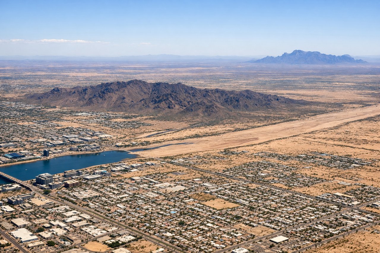
RIGHTDeparting PHX northbound, the right side faces east toward the Phoenix valley's signature desert peaks - Camelback Mountain, the Superstition Mountains, and Four Peaks stand out clearly against the flat valley floor during the climb.
Landing at ANC
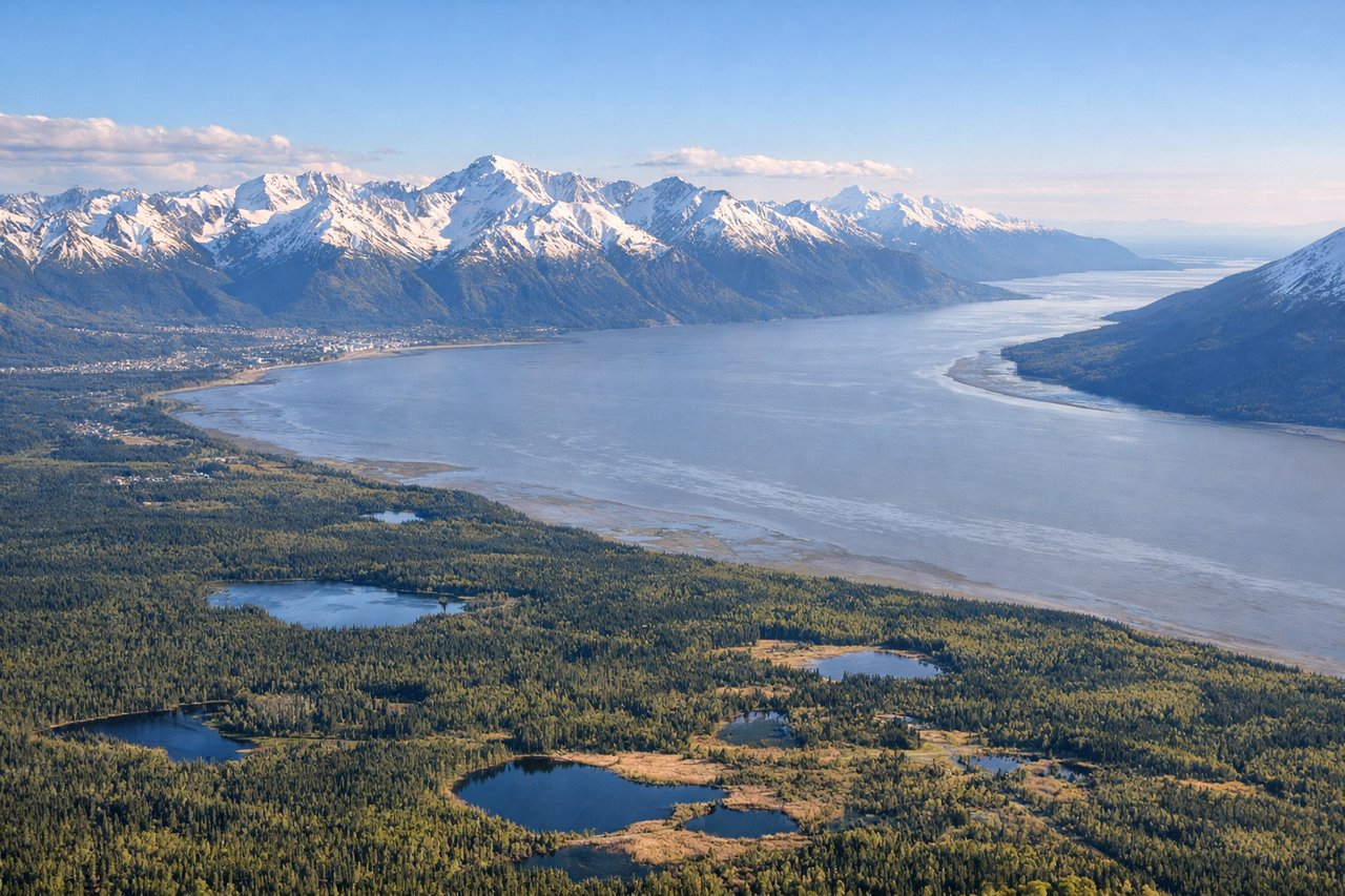
RIGHTOn approach into Anchorage, the final turn typically brings the Chugach Mountains into view on the right, their steep glaciated slopes rising abruptly just east of the city - a dramatic backdrop rarely seen this close on approach anywhere else in the US.
Landmarks on this routeAll landmarks →
Will your flight be in sunlight?
Pick a date and time in the Sun Map to watch the sun move across your whole flight.
About This Route
Which side of the plane should I sit on flying from Phoenix Sky Harbor International (PHX) to Ted Stevens Anchorage International (ANC)?
Sit on the Left side of the plane for the best views on flights from Phoenix to Anchorage. While takeoff and landing favor the right, the long cruise phase strongly favors the left, which faces west toward coastal British Columbia and the Alaska Panhandle - the Coast Mountains, Inside Passage fjords, and glaciated terrain near Wrangell-St Elias make for a far more varied and dramatic several hours of viewing than the right side's interior plateau and boreal forest.
What can I see during takeoff from Phoenix Sky Harbor International in Phoenix?
During takeoff from Phoenix Sky Harbor International (PHX), sit on the Right side for the best views. Departing PHX northbound, the right side faces east toward the Phoenix valley's signature desert peaks - Camelback Mountain, the Superstition Mountains, and Four Peaks stand out clearly against the flat valley floor during the climb. Notable sights include: Camelback Mountain, Superstition Mountains, Four Peaks, Phoenix urban grid.
What can I see when landing at Ted Stevens Anchorage International in Anchorage?
When landing at Ted Stevens Anchorage International (ANC), sit on the Right side for the best views. On approach into Anchorage, the final turn typically brings the Chugach Mountains into view on the right, their steep glaciated slopes rising abruptly just east of the city - a dramatic backdrop rarely seen this close on approach anywhere else in the US. Notable sights include: Chugach Mountains, Knik Arm, Anchorage skyline, Cook Inlet glimpses.
How long is the flight from Phoenix to Anchorage?
The flight from Phoenix Sky Harbor International (PHX) to Ted Stevens Anchorage International (ANC) takes about 4 hours 45 minutes. The shortest flight path between them is 2,549 miles (4,102 km); winds and air traffic control usually add a few percent.
What does the Phoenix to Anchorage flight path pass over?
Interior British Columbia plateau and Coast Mountains to the west, Fraser River valley, and the glaciated peaks of the Alaska Panhandle near Wrangell-St Elias as the route approaches Southcentral Alaska